

简要总结: Arc Hydro 是由 Esri 开发的一套综合性 GIS 框架,它整合了数据模型、工具集和工作流程,用于水资源管理。该框架基于 ArcGIS Pro 运行,能够帮助水资源管理者构建流域分析、水文建模的基础数据集,并通过专业的地理处理工具将其与水资源模型集成。.
水资源管理需要功能强大的地理空间工具,能够处理从地形分析到流域划分等各种任务。Arc Hydro 多年来一直是水文 GIS 工作的基石,但到了 2026 年,它的表现如何呢?
本文详细分析了Arc Hydro框架的功能、实际应用以及它如何融入现代水资源工作流程。无论是分析洪水风险、模拟水资源可用性,还是管理流域数据,了解Arc Hydro的优势都至关重要。.
什么是弧形水力发电?
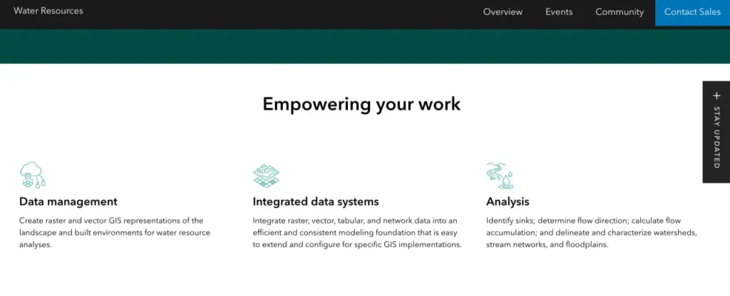
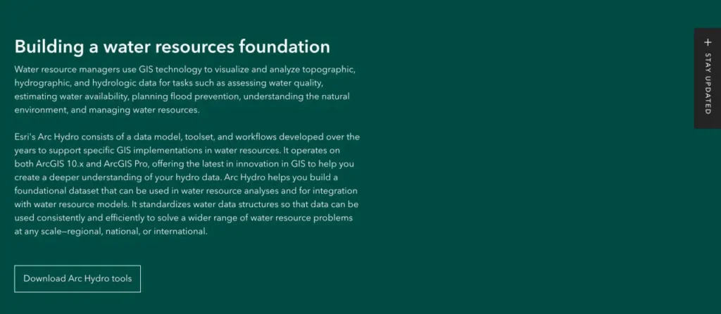
Arc Hydro 不仅仅是一套工具集,它还是一个完整的水资源 GIS 框架。根据 Esri 官方文档,它由三个核心组件构成:标准化的数据模型、全面的工具集以及专为水资源应用而开发的成熟工作流程。.
该框架基于 ArcGIS Pro 运行,使组织能够灵活地构建其 GIS 基础设施。水资源管理人员利用它在多个应用程序中可视化和分析地形、水文和水文数据。.
说实话,Arc Hydro 的数据模型组件才是它的独特之处。该框架并非处理分散的数据集,而是提供了一个结构化的模式,以支持分析和长期数据管理的方式组织水资源信息。.
核心组件分解
数据模型定义了水文特征的存储和关联方式——河流、流域、分水岭和监测点都通过标准化的关系相互连接。这种结构使得追踪水流路径、汇总上游数据和维护网络拓扑结构成为可能。.
该工具集包含用于地形处理、流域划分、网络生成和属性分配的地理处理功能。这些并非通用的空间分析工具,而是专为水文工作流程而设计的。.
工作流程将所有环节串联起来,并针对常见的水资源任务制定了规范的流程。从初始的数字高程模型(DEM)处理到最终的流域特征描述,这些工作流程提供了经过验证的方法,从而减少了试错过程。.
借助 FlyPix AI 从无人机和卫星图像中获得更多价值
地理空间项目通常依赖于大量图像,而人工审核这些图像难度很大。FlyPix AI 可帮助实现图像分析自动化,使团队能够更高效地检测目标、分类区域和监控变化。.
想要更快速的地理空间分析?
FlyPix AI 可以提供帮助:
- 卫星和无人机图像处理
- 目标检测与分类
- 土地利用分析
- 自定义人工智能模型训练
👉 试试 FlyPix AI 探索地理空间分析工作流程。.
主要特性和功能
Arc Hydro 的工具集涵盖了水文 GIS 工作的全部范围。地形处理工具可处理 DEM 参数化、填充汇区以及计算流向和汇流量——这些都是流域分析的基础步骤。.
流域划分功能允许用户为地表上的任意点定义集水区边界。这在分析监测站的排水区域、评估污染源的汇水区或将河流网络分割成易于管理的单元时至关重要。.
网络生成过程会创建具有正确拓扑结构的连通流网络。流向会被编码,支流会正确连接,生成的网络支持上下游追踪和基于网络的分析。.
属性管理工具
该框架包含用于计算和管理水文属性的专用工具。长度和面积计算、坡度统计、上游累积值——这些数据均根据数据模型模式进行计算和存储。.
时间序列数据管理处理诸如河流流量计读数或水质测量等时间信息。数据模型包含将时变数据与空间特征关联起来的结构,从而支持趋势分析和时间查询。.
集成功能可将 Arc Hydro 数据集与外部建模软件连接起来。该框架可以导出与降雨径流模型、地下水模型和水质模拟工具兼容的数据格式。.
与 ArcGIS Pro 集成
Arc Hydro 与 ArcGIS Pro 的兼容性为水资源工作带来了现代化的 GIS 功能。其 64 位架构能够处理更大的数据集,克服了旧系统常见的内存限制问题。.
根据 Esri 官方 ArcGIS Pro 文档,ArcGIS Pro 提供 2000 多种地理处理工具,并支持高级自动化和自定义功能。Arc Hydro 工具可集成到此生态系统中,充分利用 Pro 的性能提升和界面增强功能。.
功能区界面以逻辑方式组织 Arc Hydro 的功能,并且能够创建自定义工具箱,这意味着组织可以打包其特定的工作流程,以便在团队之间一致执行。.
性能考量
在处理大型流域的高分辨率数字高程模型 (DEM) 时,处理速度至关重要。与 10.x 版本相比,ArcGIS Pro 的并行处理和优化算法带来了显著的性能提升。.
但关键在于——您需要合适的硬件。专业增强版用户可以访问 ArcGIS Pro Advanced,其中包含完整的空间分析工具包。Esri 的 ArcGIS Pro 许可文档概述了包括基础版、标准版和高级版在内的许可级别,Arc Hydro 工作流程通常需要标准版或高级版的功能。.
| 许可证级别 | 典型的弧形水力发电应用案例 | 主要局限性 |
|---|---|---|
| 基本的 | 简单的流域景观查看,基本查询 | 有限的地理处理工具 |
| 标准 | 流域划分、网络构建、属性计算 | 一些高级空间分析受到限制 |
| 先进的 | 完整的水文模型构建、DEM处理、网络分析 | Arc Hydro 工作流程中没有相关内容。 |
实际应用
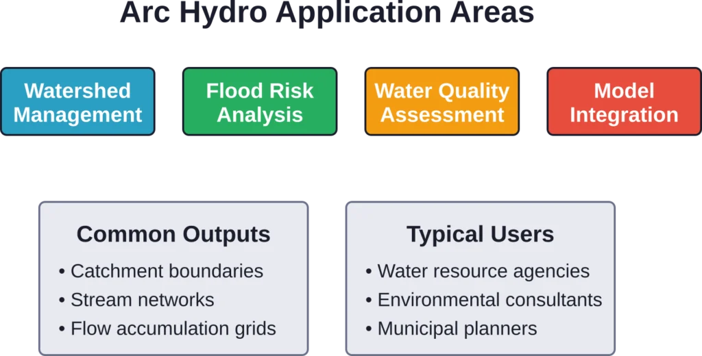
水资源管理者利用Arc Hydro进行流域评估和规划。划定排水边界、计算流域特征以及识别关键子流域,这些都源于该框架的核心功能。.
洪水风险分析利用Arc Hydro的地形处理和流量累积工具来识别易受洪水侵袭的区域。结合降水数据和水力模型,该框架支持洪水灾害地图绘制和减灾规划。.
美国地质调查局的研究表明,流域特征数据可用于水文模型,例如HSPF(水文模拟程序—FORTRAN)。Arc Hydro提供从GIS数据层生成模型参数所需的空间处理功能。.
水质应用
非点源污染评估需要了解污染源区域和水流路径。Arc Hydro 的网络追踪技术可以识别影响下游水质监测点的上游土地利用情况。.
国家水文数据集增强版高分辨率版(NHDPlus HR)采用类似的水文数据模型概念,实现无缝网络分析。这一国家级水文框架展示了标准化数据模型在不同区域的应用。.
社区讨论强调了Arc Hydro在多学科项目中的作用,在这些项目中,GIS专家为水文学家、工程师和环境科学家提供支持。标准化的数据结构促进了协作和数据共享。.
将 Arc Hydro 与替代方案进行比较
水文地理信息系统(GIS)领域包含多种选择。由德克萨斯农工大学开发的SWAT(土壤与水评估工具)被广泛用于流域尺度建模。根据SWAT官方网站的介绍,它可以模拟从小流域到河流流域尺度的水质和水量。.
但SWAT侧重于模拟建模,而非空间数据管理。Arc Hydro提供GIS框架,可以为SWAT和其他模型准备输入数据。.
TauDEM 和 Whitebox Geospatial 等开源工具无需支付许可费用即可提供地形分析功能。这些工具在特定任务上表现出色,但缺乏 Arc Hydro 的集成数据模型和工作流程文档。.
何时使用弧形水力发电比较合适
已投资于 Esri 生态系统的组织可受益于 Arc Hydro 的紧密集成。数据可在 Arc Hydro 工具和其他 ArcGIS 功能之间无缝流动,通用界面也缩短了培训时间。.
对于需要标准化数据结构以进行长期管理的项目而言,Arc Hydro 的数据模型极具价值。临时分析可以使用通用工具,但持续性项目需要一致的数据模式。.
多学科团队可受益于 Arc Hydro 的文档和成熟的工作流程。团队无需重新发明轮子,即可采用经过验证的方法并根据需要进行定制。.
| 工具 | 主要优势 | 最适合 |
|---|---|---|
| 弧水电 | 与数据模型集成的框架 | 企业水资源地理信息系统 |
| 扑打 | 流域模拟建模 | 水质/水量预测 |
| TauDEM | 开源地形分析 | 学术研究,定制工作流程 |
| WMS | 专业流域建模接口 | 工程设计项目 |
学习曲线和支持
Arc Hydro 要求用户具备扎实的 GIS 基础知识。在深入学习水文工作流程之前,理解坐标系统、栅格处理和地理数据库的概念至关重要。.
Esri 通过其学院和社区论坛提供培训资源。田纳西大学图书馆的研究指南收录了多种 GIS 学习资源,涵盖基础知识和 ArcGIS 应用。.
社区讨论表明,解决空间参考不匹配和处理错误需要耐心。Esri 社区论坛提供了宝贵的同行支持,经验丰富的用户和 Esri 工作人员都会解答问题。.
文档质量
Arc Hydro 的官方文档提供了标准工作流程的分步说明。数据模型规范详细解释了表结构、字段定义和关系类。.
教程数据集使用户无需费力寻找合适的测试数据即可练习核心工作流程。这些受控示例演示了工具的行为和预期结果。.
也就是说,复杂的项目通常需要进行实验。并非所有特殊情况都会在文档中列出,而根据具体需求调整工作流程需要时间和测试。.
共同挑战
DEM质量直接影响Arc Hydro的计算结果。高程数据中的瑕疵会贯穿整个处理过程,导致出现虚假的水流路径或错误的流域边界。因此,对DEM进行预处理至关重要。.
高分辨率处理大型流域数据对硬件提出了极高的要求。即使 ArcGIS Pro 进行了改进,大规模地形处理也可能需要数小时甚至数天,具体取决于数据量和计算机配置。.
数据模型的复杂性会构成一道初始障碍。组织需要投入时间理解模式关系,才能逐渐认识到这种结构的优势。简单的项目可能并不值得投入这么多时间。.
版本兼容性
Arc Hydro 的版本与 ArcGIS 的版本保持一致,但更新并非总是同步进行。用户有时会使用为早期 ArcGIS 版本开发的 Arc Hydro 工具,这可能会引发兼容性问题。.
某些情况下,工具在不同平台上的功能有所不同,需要进行测试和验证。.
在开始项目或计划升级之前,请先查看 Esri 官方网站,了解当前 Arc Hydro 版本与特定 ArcGIS 版本的兼容性。.
哪些人应该使用Arc Hydro?
管理长期监测项目的水资源机构可从 Arc Hydro 的数据模型中获益。一致的结构支持多年数据积累,并便于不同时间段的数据比较。.
从事流域评估的环境顾问可以利用Arc Hydro成熟的工作流程,高效地开展标准化分析。该框架还能缩短项目准备时间。.
学术研究人员和学生可以接触到专业的水文GIS实践。Arc Hydro的工作流程符合行业标准,使技能能够应用于专业领域。.
小型机构或个体从业者需要进行成本效益分析。ArcGIS 许可费用不菲,而 Arc Hydro 则增加了超出基本 GIS 操作的复杂性。因此,需要评估该框架的功能是否足以抵消其成本。.
常见问题
当然。Arc Hydro 可以处理任何栅格高程数据集,包括高分辨率 LiDAR DEM。该工具能够处理高分辨率数据,但处理时间会随着 DEM 尺寸的增大而增加。对于精细的高程数据,适当的 DEM 预处理对于消除小尺度伪影至关重要。.
Arc Hydro 主要关注地表水文,包括流域、水系和地表径流。虽然它可以为地下水模型提供一些输入数据,但专业的地下水分析工具和框架能够提供更专业的地下水分析功能。.
更新频率不固定。主要版本通常与 ArcGIS 的重要版本同步发布,而增量更新则用于修复错误和进行一些小的改进。请访问 Esri Arc Hydro 官方页面,查看当前版本信息和包含近期变更详情的发行说明。.
Arc Hydro 的标准工作流程假设水流由重力驱动,从高处流向低处。受潮汐影响的双向水流区域需要采用 Arc Hydro 基本工具无法处理的特殊方法。用户可以调整数据模型以适应沿海应用,但标准处理工具可能无法直接应用。.
Arc Hydro 使用 Esri 地理数据库格式——大多数应用场景使用文件地理数据库,多用户环境使用企业级地理数据库。输入数据可以来自各种来源(shapefile、栅格、coverage),但 Arc Hydro 会按照其自身的模式将结果存储在地理数据库结构中。.
Arc Hydro 的基本工作流程无需编程即可通过 ArcGIS 界面运行。高级自定义和自动化功能则需要 Python 脚本编写技能。大多数用户从标准工具入手,随着需求的增长逐步引入脚本编写。.
最终评估
Arc Hydro 提供了一个成熟、全面的水资源地理信息系统框架。其集成的数据模型、专用工具集和完善的工作流程文档,能够满足水文分析和流域管理方面的实际需求。.
已在使用 ArcGIS 的组织将从中获得最大价值——Arc Hydro 扩展了现有功能,而无需完全独立的平台。该框架充分利用了 ArcGIS Pro 的性能改进,同时保持了与现有 GIS 基础架构的兼容性。.
学习曲线确实陡峭。Arc Hydro 并非简单的插件,而是一套完整的系统方法,需要投入时间才能掌握。但对于可持续的水资源项目而言,这种投入会带来丰厚的回报,因为它能够实现流程标准化、数据结构统一和工作流程高效。.
当然还有其他选择——开源工具、专业建模软件、自定义脚本等等。每种工具都服务于特定的应用场景。Arc Hydro 的优势在于,它将全面的功能整合到一个有支持、有文档的框架中,并由 Esri 的生态系统提供支持。.
请访问 Esri Arc Hydro 官方网站查看最新版本信息、兼容性详情和许可要求。在决定采用之前,请评估该框架是否符合组织需求、现有基础设施和项目要求。.