

Location intelligence is rapidly becoming an indispensable tool for businesses looking to gain an edge in their industries. By integrating geographic and spatial data into decision-making processes, companies can uncover new opportunities, optimize operations, and enhance customer satisfaction. It’s not just about knowing “where” things happen – it’s about using that knowledge to improve outcomes across the board. In this article, we’ll explore some of the top location intelligence use cases, highlighting how businesses are leveraging spatial data to drive efficiency, growth, and innovation.
What is Location Intelligence?
Before diving into specific use cases, it’s essential to understand what location intelligence (LI) entails. Location intelligence is the process of using geographic and spatial data to make informed decisions. By analyzing maps, satellite imagery, GPS data, and other geospatial information, businesses can uncover patterns, trends, and insights that are invisible to traditional data sources.
Incorporating location intelligence into business operations allows companies to make better decisions regarding everything from marketing and supply chain management to real estate investments and disaster response.
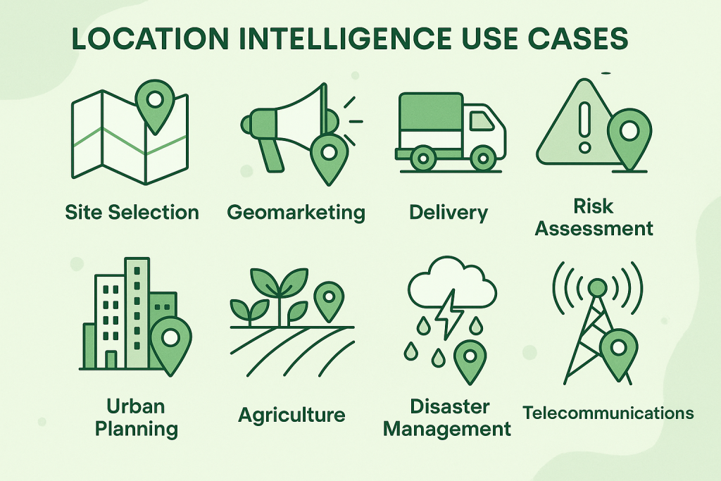
Top Location Intelligence Use Cases
1. Site Selection for Retail and Real Estate
One of the most common uses of location intelligence is in site selection. Whether you’re opening a new retail store, choosing a location for a restaurant, or investing in real estate, understanding the location’s potential is crucial.
- Retail: Retailers like Starbucks and McDonald’s are well-known for using location intelligence to choose optimal store locations. By analyzing foot traffic, demographics, and competitor proximity, businesses can select areas with the highest potential for success. This data-driven approach helps them make smarter decisions and reduce the risk of costly mistakes.
- Real Estate: Real estate professionals also use location data to assess property value and identify up-and-coming neighborhoods. By analyzing factors like local infrastructure, income levels, and crime rates, they can predict which areas will offer the highest returns on investment. This helps investors make better-informed decisions about where to buy or develop properties.
Benefits of Site Selection Using Location Intelligence:
- Increases profitability by selecting locations with high customer demand
- Reduces risks by relying on data-driven decisions instead of intuition
- Identifies hidden opportunities in underdeveloped areas
- Provides a competitive edge in saturated markets
2. Geomarketing and Customer Targeting
Location intelligence is also crucial in the field of geomarketing, where businesses use spatial data to reach customers more effectively. By leveraging geographic insights, companies can craft hyper-local marketing campaigns that are more relevant and impactful.
For example, retailers can use location data to:
- Target specific neighborhoods with tailored ads and promotions
- Track where customers are coming from and adjust marketing efforts accordingly
- Deliver time-sensitive offers based on real-time location (e.g., discounts when customers are near a store)
Benefits of Geomarketing:
- Increased engagement through personalized, relevant offers
- Better ROI on marketing spend by focusing on high-potential areas
- Improved customer experiences by reaching them with the right message at the right time
3. Optimizing Delivery Routes and Logistics
In the world of e-commerce and logistics, efficient delivery is a top priority. Location intelligence plays a key role in optimizing delivery routes, reducing fuel costs, and ensuring timely deliveries. By analyzing real-time traffic data, weather patterns, and geographic conditions, businesses can improve the efficiency of their logistics operations.
How it works:
- Delivery companies like FedEx and UPS use location intelligence to plot the fastest routes, considering variables such as traffic, road closures, and weather disruptions.
- Real-time tracking allows businesses to reroute drivers on the fly, ensuring they avoid delays and minimize fuel consumption.
- Companies can also predict high-demand areas based on historical location data, allowing them to allocate resources more efficiently.
Benefits of Route Optimization:
- Reduced delivery times and fuel consumption
- Improved customer satisfaction due to timely deliveries
- Lower operational costs with smarter route planning
4. Risk Assessment and Insurance
Insurance companies rely heavily on location intelligence to assess risk and set premiums. By analyzing geographic data such as flood zones, proximity to natural hazards, and local infrastructure, insurers can more accurately evaluate potential risks and adjust their policies accordingly.
How it works:
- Insurance companies use spatial data to create risk models for various types of coverage, such as home insurance, auto insurance, and business property insurance.
- By overlaying flood zone maps, fire risk data, and crime statistics, insurers can offer more accurate pricing and reduce their exposure to high-risk claims.
- Location data is also used in the claims process to verify the authenticity of damage claims by checking whether the event occurred in a high-risk area.
Benefits of Risk Assessment Using Location Intelligence:
- More accurate pricing based on real-world data
- Reduced fraud by cross-checking claims with geographic data
- Better risk mitigation strategies based on detailed spatial analysis
5. Urban Planning and Smart Cities
Location intelligence plays a pivotal role in urban planning and the development of smart cities. By analyzing population density, infrastructure, and environmental data, city planners can design more efficient, sustainable urban spaces.
How it works:
- Urban planners use location data to optimize traffic flow, determine the best locations for public facilities (like parks and hospitals), and identify areas in need of redevelopment.
- Cities like Barcelona have used location intelligence to reduce congestion and improve traffic management, cutting down on commute times and pollution.
- Smart cities use sensors and IoT devices to gather real-time location data, which is then used to optimize everything from waste collection to emergency response.
Benefits of Urban Planning with Location Intelligence:
- More sustainable and efficient cities
- Better allocation of resources based on real-time data
- Improved quality of life for residents through optimized services
6. Agriculture and Precision Farming
Location intelligence is revolutionizing agriculture by enabling precision farming, where farmers can optimize the use of resources like water, fertilizer, and pesticides based on detailed geographic data.
How it works:
- Farmers use GPS-equipped tractors and drones to gather data on soil conditions, crop health, and weather patterns.
- Location data helps farmers identify areas of their land that need more attention, whether it’s watering, fertilizing, or pest control.
- Satellite imagery and sensors track the health of crops, allowing farmers to act quickly to prevent diseases or infestations.
Benefits of Precision Farming:
- Increased crop yields through efficient use of resources
- Reduced environmental impact by minimizing water and chemical use
- Higher profitability due to better crop management and resource allocation
7. Disaster Management and Public Safety
Location intelligence is critical in disaster response and public safety. In the event of natural disasters like hurricanes, floods, or wildfires, location data can help emergency responders prioritize efforts and direct resources where they are most needed.
How it works:
- During a disaster, real-time geospatial data allows authorities to map affected areas and identify safe evacuation routes.
- Drones and satellite imagery provide up-to-date information on the extent of damage, helping emergency teams deploy resources quickly and efficiently.
- Location intelligence is also used in public safety, enabling cities to monitor crime patterns, optimize police patrol routes, and improve emergency response times.
Benefits of Disaster Management with Location Intelligence:
- Faster and more effective response during emergencies
- More efficient use of resources for disaster relief
- Reduced risk of damage and loss of life through better planning and real-time data
8. Telecommunications Network Optimization
Telecom companies use location intelligence to optimize network coverage and improve the quality of service for customers. By analyzing factors like population density, terrain, and existing infrastructure, telecom providers can determine the best locations for cell towers and antennas.
How it works:
- Telecom companies use location intelligence to map out areas with high customer demand, ensuring coverage is available where it’s most needed.
- In the rollout of 5G technology, location data is used to identify optimal sites for small cell towers and antennas to support high-frequency signals.
- Telecom providers also use spatial data to monitor network performance and detect areas with low signal strength or service interruptions.
Benefits of Network Optimization with Location Intelligence:
- Enhanced network reliability and coverage
- Better customer experience with fewer dropped calls and faster data speeds
- Reduced costs associated with overbuilding infrastructure in low-demand areas
FlyPix AI: Harnessing Location Intelligence with Cutting-Edge Technology
At FlyPix AI, we’re transforming how businesses interact with geospatial data. Our platform leverages AI-powered agents to automate the analysis of satellite, aerial, and drone imagery with remarkable precision. We help industries like construction, agriculture, and government save up to 99.7% of their time by rapidly processing complex geospatial images, turning what used to be a manual, time-consuming task into a fast, automated process.
Our AI models are designed to detect, monitor, and inspect at scale, offering solutions that are as diverse as the industries we serve. Whether you’re evaluating real estate properties, optimizing logistics routes, or planning urban development, FlyPix AI offers tailored location intelligence solutions to support your decision-making process.
Why FlyPix AI Fits the Location Intelligence Landscape
Location intelligence is more than just maps and geographic data; it’s about using that data to create real-time, actionable insights. FlyPix AI harnesses the power of advanced spatial analytics to enable faster and more accurate decision-making. For example, our platform can assist with site selection by providing a clear view of terrain, urban infrastructure, and potential risks. For agriculture, FlyPix AI can guide precision farming by analyzing crop health and soil conditions, ensuring smarter resource management.
With FlyPix, businesses are empowered to make strategic decisions without relying on time-consuming manual processes, ensuring they stay ahead of the curve in today’s fast-paced world. Our clients, ranging from small enterprises to global corporations, trust us to provide powerful geospatial insights with the ease of a few clicks.
Empowering Industries with Location Intelligence
FlyPix AI is at the forefront of AI-driven geospatial innovation. We understand that location intelligence is a catalyst for business growth. By combining machine learning with location data, FlyPix makes it easier than ever to detect patterns, automate processes, and gain deeper insights across industries, from construction to environmental monitoring. It’s about giving businesses the tools they need to act with confidence and precision.
Conclusion: The Power of Location Intelligence
Location intelligence is transforming the way businesses operate, offering powerful insights that drive smarter decision-making. From optimizing delivery routes to improving urban planning and enabling precision farming, the use cases are vast and impactful. As more industries recognize the value of geographic data, the potential for location intelligence to reshape business practices is boundless.
Incorporating location data into your decision-making process can help you identify opportunities, reduce risks, and enhance efficiency across your operations. Whether you’re in retail, real estate, agriculture, or telecommunications, understanding the power of “where” can unlock a wealth of possibilities for your business. Embrace the future of geospatial data and start making more informed, data-driven decisions today.
FAQ
Location intelligence refers to the process of using geospatial and geographic data to inform business decisions. By analyzing maps, satellite imagery, and GPS data, companies can gain insights into patterns, trends, and relationships that wouldn’t be obvious from traditional data sources. This helps businesses make smarter decisions in areas like site selection, marketing, logistics, risk assessment, and urban planning. It essentially answers the “where” of business questions, allowing companies to make more strategic moves based on real-world spatial data.
Absolutely. While retail and real estate are common sectors using location intelligence, the applications extend to many industries. For example, agriculture benefits from precision farming, where location data helps optimize resources like water and fertilizer. In logistics, businesses use location intelligence to optimize delivery routes and cut costs. Insurance companies apply it for more accurate risk assessments, and in urban planning, it helps build smarter, more sustainable cities. Essentially, if there’s any business that involves geography, location intelligence has a role to play.
Location intelligence can significantly enhance customer engagement by allowing businesses to craft hyper-targeted marketing campaigns. By analyzing customer location data, businesses can send tailored messages, promotions, or product recommendations based on where a customer is or where they’ve been. For instance, a customer near a store can receive a special discount when they’re nearby. This kind of real-time, location-based marketing improves relevance, boosts engagement, and increases the chances of converting prospects into loyal customers.
In disaster management, location intelligence can be a game-changer. During natural disasters like hurricanes or wildfires, real-time geospatial data allows emergency teams to map affected areas, track the extent of damage, and identify the best evacuation routes. Drones and satellite imagery provide on-the-ground visuals, helping responders quickly assess the situation. Location data also allows for more efficient resource distribution and ensures that help reaches the most critical areas first, ultimately saving time and lives.
While large companies often have the resources to fully integrate location intelligence into their operations, smaller businesses can also benefit. Retailers, even at a local level, can use location intelligence to optimize marketing, choose store locations, and understand customer behavior. Even small logistics companies can save time and fuel by using location data for route optimization. So, whether you’re running a small local shop or a global enterprise, location intelligence can be scaled to fit your needs.
In agriculture, location intelligence helps farmers improve crop yields and reduce waste through precision farming. By using GPS-equipped equipment, drones, and satellite imagery, farmers can track soil conditions, monitor crop health, and adjust their resource usage accordingly. For example, by mapping areas that require more or less water, farmers can optimize irrigation systems. This use of data helps conserve water, reduce fertilizer use, and increase efficiency, ultimately leading to better crop production with lower environmental impact.