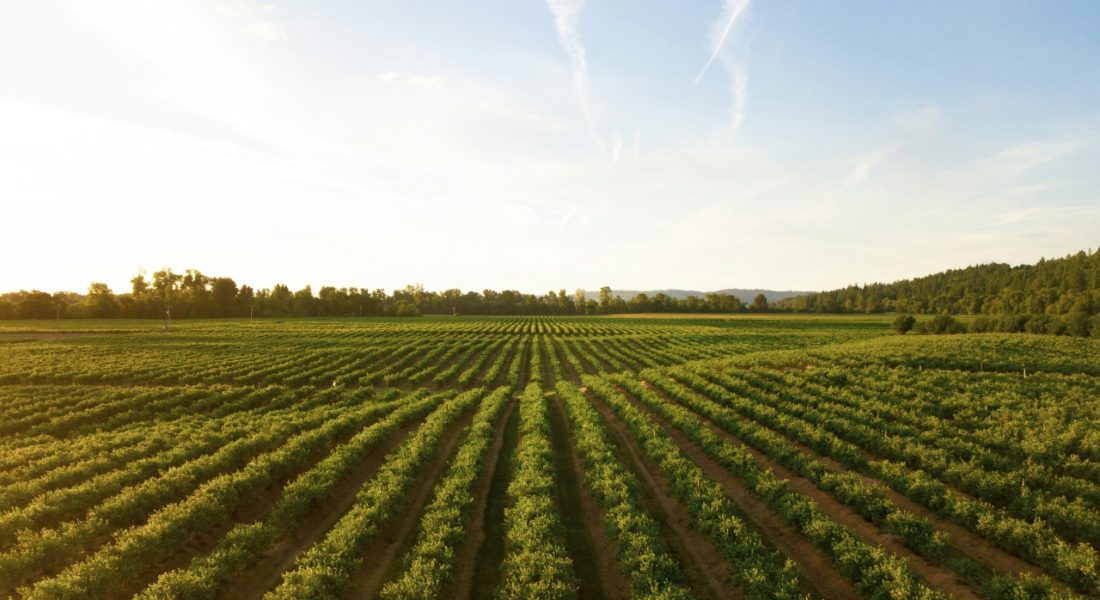
Sustainable agriculture tools might sound complex, but they’re simply technologies designed to make farming smarter, cleaner, and more efficient. From sensors and satellite monitoring to carbon calculators and regenerative farming software, these solutions help producers grow more with less-less water, less energy, and less environmental impact.
Across the world, farmers are adopting digital platforms, renewable energy systems, and precision agriculture tools to optimize resource use and build climate resilience. In this article, we’ll look at some of the key tools driving sustainable agriculture today, how they work, and how they’re helping shape the future of food production.

1. FlyPix AI
At FlyPix AI, we automate the interpretation of satellite, aerial, and drone imagery to make geospatial analysis faster and more resource-efficient. Our platform allows teams to train custom AI models for object detection and land classification without any programming background. In agriculture, this means the ability to monitor crop health, irrigation efficiency, and land use changes in real time – reducing manual scouting and minimizing unnecessary inputs.
This approach directly aligns with the goals of sustainable agriculture. By providing early detection of crop stress, more precise irrigation planning, and visibility into soil and vegetation conditions, our technology helps farmers use water, fertilizers, and land more responsibly. Automation makes these insights scalable, allowing sustainable practices to be implemented consistently, even across large or diverse fields. In this way, FlyPix AI functions not just as an analytical tool, but as a practical driver of climate-conscious, data-driven farming.
Key Highlights:
- AI-driven detection and classification in agricultural and environmental imagery
- Custom model training for crop, soil, and water analysis
- Compatible with drone, aerial, and satellite data
- Cloud-based processing for scalability and team collaboration
- Adaptable for various industries – agriculture, forestry, infrastructure, and beyond
Services:
- Automated geospatial analysis for agriculture and land management
- Custom AI model development for crop and resource monitoring
- Environmental and sustainability reporting using Earth observation data
- Integration with existing farm management or GIS systems
- Support for precision and regenerative agriculture projects
Contact Information:
- Website: flypix.ai
- LinkedIn: www.linkedin.com/company/flypix-ai
- Address: Robert-Bosch-Str. 7, 64293 Darmstadt, Germany
- Phone Number: +49 6151 2776497
- Email: info@flypix.ai
2. Farmonaut
Farmonaut provides satellite-powered monitoring for agriculture. The platform delivers field visibility through crop health, soil moisture, and vegetation index mapping. Insights update continuously so agribusiness teams can spot issues early, plan inputs with more precision, and reduce guesswork across large or distributed fields.
Beyond crop monitoring, Farmonaut includes advisory and operations tools that connect daily decisions with longer term sustainability goals. Capabilities span AI-based farm guidance, plantation management with tree counts and growth tracking, supply chain traceability, carbon footprint reports, and fleet tracking. APIs and an admin workspace help integrate these insights into existing workflows.
Key Highlights:
- Satellite-based crop and soil monitoring with practical, field-level views
- AI farm advisory covering actions from seed to harvest
- Plantation management with tree inventory and growth tracking
- Product traceability and blockchain-backed record keeping
- Carbon and nature metrics to support climate-smart practices
- Tools for credit and insurance assessment using geospatial evidence
- Fleet and asset tracking for equipment and vehicles
- APIs and a central admin hub for team-wide adoption
Services:
- Crop health, soil moisture, and vegetation index analysis
- Season-long advisory recommendations and alerts
- Plantation analytics with growth and carbon tracking
- Supply chain traceability setup and QR-based transparency
- Carbon footprinting and sustainability reporting support
- Banking and insurance risk insights tied to farm monitoring
- Fleet monitoring for fuel, routing, and utilization
- API access and onboarding for agribusiness systems
Contact Information:
- Website: farmonaut.com
- App Store: apps.apple.com/ua/app/farmonaut
- Google Play: play.google.com/store/apps/farmonaut.android&pcampaignid
- LinkedIn: www.linkedin.com/company/farmonaut
- Address: 2810 N Church St PMB 87609, Wilmington Delaware, USA,
- Phone Number: +1 (669)666-6882
- Facebook: www.facebook.com/farmonaut
- Twitter: x.com/farmonaut
- Instagram: www.instagram.com/farmonaut
- Email: support@farmonaut.com

3. AGRIVI
AGRIVI offers a suite of farm management and food traceability products designed to standardize planning, field operations, and compliance. The core platform centralizes activities, inputs, costs, and results so farms and agri-companies can coordinate work, compare outcomes, and document practices without juggling separate tools.
The product family extends into AI engagement, supply chain programs, and data integrations. Messaging-based agronomic advisors help brands and input manufacturers support growers at scale. Traceability modules document each production step from field to shelf. Connect services integrate weather stations, soil sensors, machinery, and ERP data, making on-farm and business metrics available in one place.
Key Highlights:
- Farm management software for operational and financial control
- AI-powered farmer engagement via familiar messaging apps
- End-to-end food traceability for crop and processed products
- Integrations for weather, soil, machinery, and enterprise systems
- Industry-specific setups for farms, cooperatives, food and retail, and more
- Library of resources to support digitalization and ROI tracking
Services:
- Field activity planning, scouting, input tracking, and cost analytics
- AI advisory programs for farmer education and support
- Supply chain and contract farming management
- Traceability configuration with consumer-facing transparency
- Data integrations for sensors, equipment, and ERP platforms
- Implementation, training, and ongoing customer support
Contact Information:
- Website: www.agrivi.com
- App Store: apps.apple.com/ua/app/agrivi/
- Google Play: play.google.com/store/apps/agrivi.agrivi&pcampaignid
- LinkedIn: www.linkedin.com/company/agrivi
- Facebook: www.facebook.com/AgriviCorp
- Twitter: x.com/AgriviCorp

4. SignalFire Wireless Telemetry
SignalFire provides wireless telemetry for remote monitoring across industrial and agricultural sites. In agriculture, the system connects sensors and controllers to watch water sources, chemical additives, pumps, and pressure points across a property. Gateways and cloud access bring those readings together so teams can keep irrigation plans on track without constant site visits.
Hardware options cover long-range radios and cellular units, with battery or solar power for off-grid installs. Nodes pair with common sensors for level, flow, pressure, and environmental signals. The result is a practical way to instrument fields and infrastructure where wiring is costly or terrain is challenging.
Key Highlights:
- Wireless sensor networks suited to large or remote farm areas
- Cloud dashboards for real-time status and alerts
- Support for level, flow, pressure, and environmental monitoring
- Long-range and cellular options for varied coverage needs
- Battery and solar-friendly designs for off-grid deployment
- Proven in harsh environments and mixed-asset sites
Services:
- Design and deployment of wireless monitoring networks
- Tank, pipeline, and pump monitoring for irrigation and inputs
- Pressure, flow, and level measurement across water systems
- Cloud setup with alerting and historical views
- Integration support for existing sensors and controllers
- Field guidance for antenna placement and power planning
Contact Information:
- Website: www.signal-fire.com
- LinkedIn: www.linkedin.com/company/2429613
- Address: 140 Locke Dr., Suite B Marlborough, MA 01752 USA
- Phone Number: 978-212-2868
- Facebook: www.facebook.com/SignalFireWirelessTelemetry
- Twitter: x.com/SignalFireTelem
- Email: info@signal-fire.com
5. COMET-Farm
COMET-Farm is a web tool for estimating whole-farm and ranch greenhouse gas outcomes in the United States. The workflow collects land and management details, then produces inventory results for major sources and sinks within the farm gate. Outputs cover carbon dioxide, methane, and nitrous oxide, as well as carbon stored in biomass and soils.
The tool supports side-by-side comparisons between a current baseline and one or more conservation scenarios. Methods align with USDA guidance for entity-scale inventories. Use is limited to most regions of the contiguous United States, and the tool is not intended for urban agriculture or areas with highly rocky or cobbly soils.
Key Highlights:
- Full-farm accounting across crop, livestock, and land systems
- Baseline versus conservation scenario comparisons
- Focus on CO2, CH4, N2O sources and carbon removals
- Methods aligned with USDA entity-scale inventory guidance
- Built-in help, documentation, and user guide
- Data entry structure designed for practical management records
Services:
- Greenhouse gas inventory setup and scenario modeling
- Soil and biomass carbon estimation within farm boundaries
- Emission source coverage for common on-farm activities
- Report generation for interpretation and planning
- Documentation access for methods and assumptions
Contact Information:
- Website: comet-farm.com
- Facebook: www.facebook.com/COMETFarmTool
- Twitter: x.com/cometfarm
- Instagram: www.instagram.com/comet_farm
6. Regrow
Regrow is a climate action platform for agricultural supply chains. The system maps practice adoption in sourcing regions, estimates emissions using remote sensing and AI, and highlights where regenerative practices can reduce risk and improve outcomes. Planning tools help teams coordinate programs with finance and procurement, rather than treating sustainability as a separate track.
Measurement, reporting, and verification support is built in for corporate targets and program claims. Data outputs are prepared to align with common reporting frameworks and major carbon registries. Enrollment and integrations aim to reduce friction for program participants while keeping audit needs in view.
Key Highlights:
- Supply shed visibility for practices and emissions drivers
- Planning tools to identify high value regenerative actions
- MRV workflows suitable for program scale and audits
- Reporting aligned with SBTi, CSRD, CDP and related needs
- Integrations with farm systems and remote sensing data
- Program design support for brands, traders, and developers
Services:
- Baseline assessment across crops and regions
- Strategy planning with scenario and investment views
- Program execution with enrollment and data capture
- Emissions reduction and removal accounting
- Audit-ready reporting and registry preparation
- Partner enablement for agribusiness and public sector users
Contact Information:
- Website: www.regrow.ag
7. Agroforestry Design Tool
The Agroforestry Design Tool is a digital platform that helps users create multistory agroforest layouts based on ecological layers and time-based crop succession. It assists with species selection, spatial arrangement, and visual simulation of long-term growth. Rather than offering fixed templates, the tool guides the user in developing site-specific plans suited to climate, soil, and project goals. The resulting designs can support food and timber production, biodiversity restoration, and soil regeneration while maintaining ecological structure similar to a natural forest.
Working from environmental input data, the tool organizes species by height class and light requirements, producing a geometric pattern that mimics natural canopy layers. Color-coded visualization helps interpret the structure, while export options allow saving a project layout for further refinement. The developers emphasize that it functions as a planning aid, not a substitute for local expertise or indigenous agroforestry knowledge. Limitations include regional species data focused on U.S.-affiliated Pacific Islands, predefined 100×100 ft patterns, and the absence of livestock integration or metric visualization.
Key Highlights:
- Assists with species selection, spacing, and spatial arrangement
- Visualizes agroforest growth over time with color-coded layers
- Supports regenerative and mixed agroforestry standards
- Integrates environmental inputs for localized design guidance
- Offers PDF export for project documentation and review
- Focuses on structure and function similar to natural forest systems
- Developed through collaboration between Permanent Agriculture Resources and FARM Center
Services:
- Agroforest design generation using environmental data
- Interactive species and layer selection
- Visualization of multistory forest structure and growth
- PDF export of site-specific design plans
- Guidance aligned with regenerative agroforestry standards
- Educational support through webinars and user documentation
Contact Information:
- Website: www.agroforestryx.com
- Email: webmaster@agroforestryx.com
8. Cropin Cloud
Cropin provides a cloud-based platform built to digitize and connect agriculture operations across the food value chain. The system combines AI, satellite data, and historical records to deliver insights on crop performance, sourcing, and environmental risk. By integrating data from farms, suppliers, and climate sources, it supports predictive decision-making for productivity, sustainability, and traceability.
Cropin Cloud is structured as a multi-tenant system that can be tailored for agribusinesses, food companies, or public-sector programs. Its applications cover digital farm management, supply chain monitoring, compliance, and sustainable agriculture initiatives. The platform focuses on improving transparency and resilience in food production by linking localized data with global context.
Key Highlights:
- AI-driven agriculture cloud for end-to-end visibility
- Predictive insights using regional and plot-level intelligence
- Multi-tenant architecture for scalability across organizations
- Integration of farm, supply, and climate data
- Support for sustainable sourcing and regenerative practices
- Tools for compliance, reporting, and performance monitoring
Services:
- Crop and yield prediction analytics
- Supply chain and sourcing traceability
- Sustainability and climate-risk assessment
- Data integration across farms, agencies, and partners
- Digital transformation consulting for agri-food systems
- Reporting tools for ESG and regulatory frameworks
Contact Information:
- Website: www.cropin.com
- Google Play: play.google.com/store/apps/details?id=com.cropin.smartfarm&pcampaignid
- LinkedIn: www.linkedin.com/company/cropin-technology
- Address: 16192, Coastal Highway, Lewes, Delaware 19958, County of Sussex
- Facebook: www.facebook.com/CropinTech
- Twitter: x.com/CropInTech

9. AGCO PTx
AGCO’s PTx portfolio provides precision agriculture technology designed to work across multiple brands and equipment types. The system brings together retrofit, OEM, and factory-fit options that turn existing machinery into connected, data-driven tools for smarter field management. By combining hardware and software solutions, it enables continuous monitoring and control throughout the crop cycle, helping streamline planning, execution, and analysis.
PTx functions as an integrated technology layer for both AGCO and partner-brand equipment. The platform connects field data with operational insights, allowing users to simplify complex workflows and reduce inefficiencies. From pre-season setup to post-harvest evaluation, it provides clear visibility of agronomic performance, machine activity, and resource use across mixed fleets.
Key Highlights:
- Precision agriculture platform for multi-brand equipment fleets
- Retrofit, OEM, and factory-fit technology for new or existing machines
- Data-driven tools for real-time monitoring and analysis
- Centralized workflows for pre-, in-, and post-season operations
- Connectivity between machinery, agronomic data, and office systems
- Supported by a global dealer and service network
Services:
- Precision planting, crop care, and nutrient management tools
- In-season field monitoring and performance tracking
- Equipment integration for automated and data-informed control
- Digital record keeping and operational analytics
- Connectivity support and training through certified dealers
Contact Information:
- Website: www.agcocorp.com
- App Store: apps.apple.com/us/app/fendtone-go
- Google Play: play.google.com/store/apps/agco.fendtonego
- LinkedIn: www.linkedin.com/company/agco-corporation
- Address: Precision Planting, LLC 23207 Townline Road Tremont, IL 61568 USA
- Phone Number: +1 309.925.5050
- Facebook: www.facebook.com/AGCOcorp
- Twitter: x.com/agcocorp
- Instagram: www.instagram.com/agcocorp

10. John Deere Operations Center
John Deere Operations Center is a digital farm management platform that connects equipment, field data, and operational insights in one place. The system collects information from machines, sensors, and connected apps, allowing users to view current field activity, track performance, and make adjustments in real time. Through its web and mobile versions, it provides a clear overview of what’s happening across the entire operation, from planting to harvest.
The platform simplifies record keeping and decision-making by combining machine data with agronomic information. Equipment status, field progress, and completed jobs can be reviewed remotely, supporting better planning for future work. Designed for flexibility, the Operations Center integrates with a wide range of machinery and software, giving users control over their data and how it’s shared across teams or partners.
Key Highlights:
- Centralized dashboard for connected machines and field operations
- Real-time visibility into work progress, equipment, and conditions
- Web and mobile access for managing tasks on the go
- Integration with a wide range of farm equipment and apps
- Tools for planning, analysis, and long-term record keeping
- Data privacy and sharing settings controlled by the user
Services:
- Equipment monitoring and performance tracking
- Field operations management and activity records
- Task planning and data analysis tools
- Integration with precision agriculture systems
- Mobile access through dedicated apps for operations and equipment
Contact Information:
- Website: operationscenter.deere.com
- Facebook: www.facebook.com/JohnDeereRussia
11. CropX Platform
CropX is a digital agronomy platform that merges soil sensors, satellite data, and cloud analytics to provide a complete view of field conditions. It aggregates data from multiple sources-both above and below ground-and turns it into actionable insights for irrigation, nutrient, and disease management. The system is built to connect different IoT devices, farm machines, and data services into a single environment for precision monitoring and control.
CropX focuses on improving efficiency through timely recommendations and automation. The platform generates reports on resource use, crop performance, and environmental impact to support transparency across the supply chain. Its hardware integrates with existing farm setups, making it adaptable for a variety of operations and crop types. By translating complex agronomic data into clear, practical guidance, it helps optimize inputs while maintaining productivity.
Key Highlights:
- Unified platform for soil, weather, and satellite data
- Precision irrigation, disease, and nutrient management insights
- IoT and sensor connectivity across multiple devices and systems
- Easy-to-read dashboards and performance tracking tools
- Cloud-based analytics for field-to-supply-chain transparency
- Hardware options for data collection and integration
Services:
- Field monitoring and soil moisture analysis
- Automated irrigation and nutrient management recommendations
- Disease prediction and prevention tools
- Effluent and water use optimization
- Environmental reporting and compliance support
- Integration of sensors, farm equipment, and connected devices
Contact Information:
- Website: cropx.com
- LinkedIn: www.linkedin.com/company/cropx-ltd
- Address: 201 E Center St Ste 112 PMB 237,Anaheim, CA 92805,USA
- Phone Number: 1 (888) 832 2767
- Facebook: www.facebook.com/CropXGlobal
- Twitter: x.com/crop_x
- Instagram: www.instagram.com/cropx_global

12. Taranis
Taranis provides an AI-powered crop intelligence platform designed to give agronomic advisors and growers precise, leaf-level visibility across their fields. The system captures ultra-high-resolution imagery using drones and other sensors, then analyzes it through machine learning models trained on an extensive agricultural dataset. This process translates millions of data points into clear insights on crop health, weed presence, insect damage, nutrient deficiencies, and disease pressure-long before issues become visible to the eye.
The platform focuses on helping advisors manage more acres with less time in the field, while maintaining a strong connection with growers. By automating scouting and analysis, it allows users to prioritize problem areas, validate recommendations, and create actionable plans for every field. Taranis combines its technology with full-service support, offering continuous coverage before, during, and after each growing season.
Key Highlights:
- AI-powered crop intelligence with submillimeter image resolution
- Drone-based imagery capturing detailed, leaf-level crop data
- Analysis of weeds, insects, diseases, and nutrient issues
- Season-long coverage supported by agronomy expertise
- Tools for advisors to communicate and plan with growers
- Continuous learning models trained on extensive global datasets
Services:
- Leaf-level crop scouting and field imagery collection
- AI analysis of plant health, disease, and pest indicators
- Field prioritization and decision-support tools for advisors
- Conservation-focused programs and resource efficiency insights
- In-season and post-season reporting with actionable visuals
- Advisory communication tools for customized grower engagement
Contact Information:
- Website: www.taranis.com
- LinkedIn: www.linkedin.com/company/taranis-visual
- Address: 725 E. Main St. Westfield, IN 46074
- Phone Number: +1 (317) 804-2031
- Facebook: www.facebook.com/taranisvisual
- Twitter: x.com/TaranisAg
- Instagram: www.instagram.com/taranis_ag
- Email: info@taranis.ag
Conclusion
Sustainable agriculture increasingly relies on technology that blends traditional field knowledge with digital precision. Modern tools now combine data, modeling, and visualization to make farming more efficient, climate-resilient, and environmentally responsible. They support different stages of the agricultural process – from land planning and resource monitoring to emissions tracking and precision equipment control.
While these technologies vary in scale and purpose, they share the same vision: helping agriculture shift from reactive management to proactive, data-driven design. Instead of following uniform practices, farmers can now base decisions on site-specific conditions, long-term sustainability goals, and measurable results. Together, these innovations represent a connected ecosystem reshaping how food is produced in a resource-conscious world.
