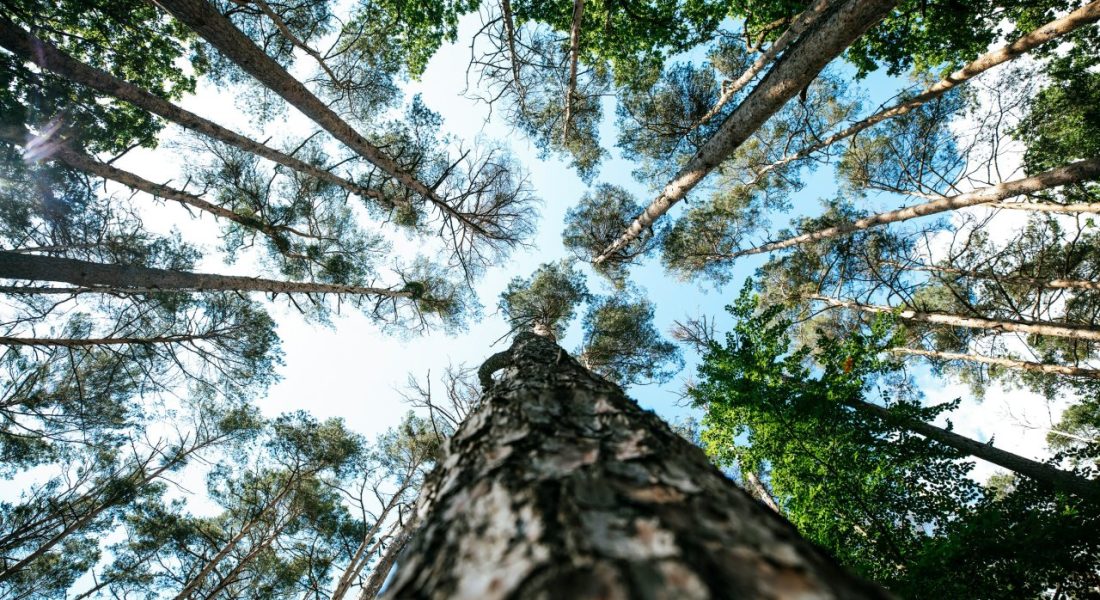
Sustainable forestry tools may sound highly specialized, but at their core, they’re technologies that make forest management smarter, cleaner, and more efficient. From drones and GIS platforms to carbon monitoring software and traceability systems, these tools help forest managers and organizations use resources wisely-reducing environmental impact while ensuring long-term forest health.
Across the globe, foresters are adopting digital solutions, precision equipment, and data-driven systems to monitor ecosystems, track carbon storage, and plan reforestation projects more effectively. In this article, we’ll explore some of the leading tools shaping the future of sustainable forestry-how they work, and how they’re helping protect forests while supporting the people who depend on them.

1. FlyPix AI
At FlyPix AI, we automate the interpretation of satellite, aerial, and drone imagery to support sustainable forest management. We enable organizations to train custom AI models for object detection, land classification, and vegetation monitoring without needing programming experience. In forestry, we use these capabilities to track deforestation, assess biomass, and observe land-use trends in a consistent, scalable way.
As part of the sustainable forestry toolkit, we focus on providing reliable data that supports responsible planning and long-term forest resilience. We detect early indicators of forest degradation, evaluate canopy changes, and identify areas suitable for conservation or reforestation. By reducing manual fieldwork and improving monitoring accuracy, we help forestry teams respond proactively and align their work with ecological and climate objectives.
Key Highlights:
- AI-powered detection and classification in forestry and environmental imagery
- Custom model training for forest cover, biomass, and ecosystem monitoring
- Integration with satellite, drone, and aerial data sources
- Cloud-based processing for scalability and collaboration
- Adaptable for forestry, agriculture, and environmental management projects
Services:
- Automated geospatial analysis for forest health and land-use monitoring
- Custom AI model development for deforestation tracking and vegetation mapping
- Environmental and sustainability reporting using Earth observation data
- Integration with existing GIS and forest management systems
- Support for carbon accounting, conservation, and reforestation initiatives
Contact Information:
- Website: flypix.ai
- LinkedIn: www.linkedin.com/company/flypix-ai
- Address: Robert-Bosch-Str. 7, 64293 Darmstadt, Germany
- Phone Number: +49 6151 2776497
- Email: info@flypix.ai

2. EOS Data Analytics (EOSDA)
EOSDA provides satellite powered tools that help track forest cover, detect change, and monitor risks at scale. The platform uses multisource imagery and geospatial analytics to flag deforestation, wildfire activity, and vegetation stress, and can classify land cover or tree species for planning and compliance use cases. Outputs can come as raster or vector layers along with concise reports that fit into existing GIS workflows.
Alongside forestry specific tasks, EOSDA offers a viewer to search and process imagery, an API for integrating analytics, and products built for routine monitoring. Typical inputs include an area of interest in common GIS formats. Typical use spans compliance checks, operational planning, and long term forest condition tracking across remote areas.
Key Highlights:
- Forest cover change and reforestation detection
- Deforestation and burned area alerts
- Forest health analysis with vegetation indices
- Tree species and land cover classification
- EUDR related analysis and reporting
- API access for custom integration
- Imagery discovery and processing in a single viewer
Services:
- Satellite based forestry monitoring
- Deforestation and wildfire detection
- Analytics layers and compliance ready reports
- Land cover and boundaries detection
- Soil moisture and crop or yield modeling where relevant to mixed landscapes
- High resolution imagery sourcing and delivery
- API connect and white label options
Contact Information:
- Website: eos.com
- LinkedIn: www.linkedin.com/company/eos-data-analytics
- Address: 800 W. El Camino Real,Suite 180,Mountain View, CA 94040 USA
- Facebook: www.facebook.com/eosda
- Twitter: x.com/eos_da
- Instagram: www.instagram.com/eosdataanalytics
- Email: sales@eosda.com

3. SCS Global Services
SCS Global Services delivers independent certification and verification for sustainable forestry and forest products. Programs cover responsible forest management, chain of custody, timber legality, and biomass standards, helping organizations show conformance with recognized frameworks and market requirements.
Support also extends to EUDR readiness and validation for deforestation free commodities, carbon offset verification, and specialty claims such as salvaged wood and fiber. Services are structured, audit based, and aligned to regional and international schemes.
Key Highlights:
- Third party audits for forest management and supply chains
- EUDR support for deforestation free claims
- Carbon offset project verification
- Timber legality and salvaged wood verification
- Coverage across multiple schemes and regions
- Clear documentation for market and regulatory needs
Services:
- FSC forest management and chain of custody certification
- PEFC and SFI certification programs
- American Tree Farm System certification
- Timber legality and SVLK verification
- Roundtable on Sustainable Biomaterials and SBP certification
- EUDR verification and validation services
- Salvaged wood and fiber verification
Contact Information:
- Website: www.scsglobalservices.com
- LinkedIn: www.linkedin.com/company/scsglobalservices
- Address: 2000 Powell Street, Suite 600 Emeryville, CA 94608 US
- Phone Number: +1.510.452.8000
- Email: info@scsglobalservices.com

4. Trimble Forestry – CONNECTED FOREST
Trimble Forestry offers an integrated software suite for managing the forest supply chain from land to mill. The platform connects planning, planting, harvesting, transport, and processing in one environment, enabling shared data and real time updates across teams and contractors.
Modules cover land and forest management, wood procurement, mixed fleet harvesting, logistics, and load ticket exchange. Add-ons include EUDR compliance tools, map services, hosting, and best practices consulting, creating a single system of record for operational decisions and traceable fiber flows.
Key Highlights:
- End to end forestry operations in one suite
- ERP for forest owners and land management
- Mixed fleet harvesting management
- Logistics planning with load ticket exchange
- Real time data capture and communication
- EUDR compliance solutions and professional services
Services:
- CFForest for land and forest management
- CFBusiness for wood procurement and contracting
- CFHarvest for harvesting operations and fleet oversight
- CFLogistics for wood transport and delivery
- CFXchange for digital load ticket exchange and data sharing
- Map services, implementation, hosting, and consulting
Contact Information:
- Website: forestry.trimble.com
- LinkedIn: www.linkedin.com/showcase/trimble-forestry
- Facebook: www.facebook.com/trimble.forestry
- Twitter: x.com/TRMBForestry

5. AFRY Smart Forestry
AFRY Smart Forestry provides software, analytics, and consulting to plan and run sustainable forest operations. The offering brings together remote sensing, inventory, modeling, and optimization so forest assets can be mapped, monitored, and scheduled with clear constraints. Planning tools support both tactical and long term strategies, with options to align objectives such as economic performance, carbon sequestration, and biodiversity.
The suite covers management software for planning and fleet monitoring, scalable inventory from drones to satellites processed with AI, and modeling that links supply chain visibility with day to day decisions. AFRY also offers carbon services and valuation work, plus methods and training to embed adaptive forest management across organizations.
Key Highlights:
- Integrated planning tools for tactical and strategic forestry
- Remote sensing inventory from drone to satellite with AI processing
- Forest asset modeling, simulation, and optimization
- Mixed machinery monitoring and harvest scheduling support
- Supply chain visibility with continuous performance tracking
- Carbon balance assessment and forecasting
- Information systems to support stakeholders and data governance
Services:
- Forest management planning software and fleet monitoring
- Remote sensing inventory and ground reference integration
- Forest valuation and carbon services
- Modeling, simulation, and optimization of forest assets
- Consulting on adaptive management, KPIs, and dashboards
- Tree mapping and management information system setup
Contact Information:
- Website: afry.com
- LinkedIn: www.linkedin.com/company/afry
- Address: 295 Madison Avenue Suite 300 New York, NY 10017 United States
- Phone Number: +1 914 643 2767
- Facebook: www.facebook.com/afryofficial
- Instagram: www.instagram.com/afry.official
- Email: soile.kilpi@afry.com

6. Remsoft
Remsoft delivers optimization software for forest, land, and asset management. The platform turns operational and planning data into scenarios, helping connect activities from forest to mill while balancing constraints such as cost, supply, and timing. Lifecycle planning tools surface trade offs, identify bottlenecks, and build plans that can be explained and defended.
Capabilities also include land valuation and asset management for timberland, plus analytics for infrastructure and related supply chains where forestry intersects with transport or maintenance. Remsoft provides support and services around model design, implementation, and governance to keep plans consistent as conditions change.
Key Highlights:
- Decision optimization across the forestry value chain
- Multi level planning from long horizon to operational schedules
- Scenario analysis with transparent, defensible plans
- Integration of constraints for cost, supply, and timing
- Land valuation and asset management insights
- Support for data quality, model setup, and governance
Services:
- Forestry planning and optimization software
- Lifecycle planning from forest to mill
- Land valuation and timberland asset management
- Implementation, model design, and training
- Analytics for infrastructure linked to forestry logistics
- Ongoing support for data, reporting, and review
Contact Information:
- Website: remsoft.com
- LinkedIn: www.linkedin.com/company/remsoft-inc.
- Address: 500-77 Westmorland St. Fredericton, New Brunswick E3B 6Z3 Canada
- Phone Number: 1-506-450-1511
- Facebook: www.facebook.com/REMSOFT
- Twitter: x.com/RemsoftInc
- Email: info@remsoft.com

7. Form International
Form International operates as a management, investment, and consulting firm focused on sustainable forestry, agroforestry, and landscape restoration. Work spans project design, implementation, and oversight in tropical regions, with a focus on nature based solutions, supply chain improvements, and results that balance environmental and economic outcomes.
Engagements range from forest landscape design and reforestation to carbon project development and certification support. Form International also advises on forestry and agriculture investments, risk analysis, and market access, working with clients such as project developers, investors, public bodies, and community partners.
Key Highlights:
- End to end support for reforestation and restoration projects
- Focus on tropical forestry and agroforestry landscapes
- Carbon project development and certification guidance
- Supply chain advisory for timber and agricultural products
- Investment strategy and risk assessment for forestry assets
- Practical management services from design to monitoring
Services:
- Forest landscape design and management
- Forestry and agriculture investment advisory
- Timber and agricultural supply chain support
- Forest and climate services, including carbon project work
- Technical and financial consulting for projects and portfolios
- Project oversight, monitoring, and reporting
Contact Information:
- Website: forminternational.nl
- LinkedIn: www.linkedin.com/company/form-international
- Address: Hanzeplein 11 8017 JD Zwolle The Netherlands
- Phone Number: +31 (0)38 444 89 90
- Email: info@forminternational.nl

8. LAND+ Agroforestry Toolbox
Forestry Service Group applies a stepwise LAND+ approach to improve land use in a balanced way. The method aligns sustainability, responsibility, profitability, and customizability so decisions account for economics, social needs, and the environment at the same time. Tools include a practical card game for choosing site specific options and an economic model that estimates costs and benefits for agroforestry setups.
Work centers on agroforestry as a unifying framework that connects local interests with broader policy trends and market requirements. The toolbox is used to design tailored systems for different land types and climates, aiming to reduce drivers of deforestation while building viable commodity chains and skills for long term management.
Key Highlights:
- LAND+ method linking economic, social, and environmental goals
- Card game for structured, site specific decision making
- Economic model for costs and benefits of agroforestry
- Custom solutions for diverse land, soils, and climates
- Focus on responsible markets and policy alignment
- Experience across many countries and project types
Services:
- Agroforestry system design and planning
- Land use diagnostics and option selection using LAND+
- Financial modeling for agroforestry investments
- Supply chain and commodity chain advisory
- Capacity building on sustainable practices and tools
- Project support for implementation and monitoring
Contact Information:
- Website: www.forestryservicegroup.com
- Address: Postbsus 17 3886 ZG Garderen.
- Phone Number: +31 6 5351 3917
- Email: marco@nvforest.com

9. Global Forest Watch
Global Forest Watch is a digital monitoring platform that tracks forest change, deforestation, and restoration activities worldwide. It brings together satellite data, analytics, and visualization tools that allow users to explore more than 60 datasets related to forest cover, conservation, land use, and communities. The platform enables near real-time detection of deforestation, providing weekly alerts through the GLAD system and interactive dashboards for analyzing forest trends across countries and regions.
The system also supports practical applications through its suite of tools such as GFW Pro and Forest Watcher. These extensions help companies assess deforestation risk in supply chains, ensure compliance with regulations, and support on-the-ground monitoring even in offline conditions. Global Forest Watch serves as both a technical tool and a shared information hub connecting policymakers, organizations, and journalists around actionable forest data.
Key Highlights:
- Global satellite-based forest monitoring and analytics
- Weekly GLAD alerts for tropical deforestation detection
- Over 60 datasets covering land use, conservation, and carbon fluxes
- Dashboards and reports for national and regional analysis
- GFW Pro for supply chain risk and EUDR compliance
- Forest Watcher mobile app for offline monitoring and field data collection
Services:
- Global and country-level forest monitoring dashboards
- Deforestation and fire alerts in near real time
- Custom analysis and data downloads
- Supply chain risk assessment through GFW Pro
- Mobile field verification with Forest Watcher
- Forest carbon and land use trend visualization
Contact Information:
- Website: www.globalforestwatch.org
- LinkedIn: www.linkedin.com/showcase/globalforestwatch
- Facebook: www.facebook.com/globalforests
- Twitter: x.com/globalforests
- Instagram: www.instagram.com/globalforests
- Email: Kaitlyn.Thayer@wri.org

10. Planet Insights Platform
Planet Labs operates one of the world’s largest Earth observation satellite constellations, offering high-frequency imagery and derived analytics for environmental monitoring. The platform provides users with daily, high-resolution images that make it possible to observe changes across forests, farmlands, and other ecosystems. Its monitoring system enables users to look backward through historical archives, look broader across landscapes, and look deeper into environmental indicators such as soil moisture or vegetation health.
In forestry, Planet’s tools are often used for deforestation detection, reforestation tracking, and carbon accounting. The Planet Insights Platform integrates its datasets, analytic feeds, and visualization capabilities into a single interface, allowing users to identify changes, measure forest cover dynamics, and act quickly on new findings.
Key Highlights:
- Daily satellite imagery and historical archives
- High-resolution monitoring for detailed analysis
- PlanetScope and SkySat imagery for local and regional use
- Analytics on land cover, biomass, and environmental indicators
- Integrated tools for forestry, agriculture, and sustainability sectors
- Data access through the Planet Insights Platform
Services:
- Forest and land use monitoring with daily updates
- Deforestation detection and verification
- Carbon and biomass tracking using Planetary Variables
- Custom tasking and analytics through Planet Tasking and Feeds
- Integration with Esri and third-party systems
- Data delivery and visualization via Planet Basemaps and Insights Platform
Contact Information:
- Website: www.planet.com
- LinkedIn: www.linkedin.com/company/planet-labs
- Address: 645 Harrison Street 4th Floor San Francisco, CA 94107
- Facebook: www.facebook.com/PlanetLabs
- Twitter: x.com/planet
- Instagram: www.instagram.com/planetlabs

11. NCX
NCX provides decision-support tools for landowners to evaluate and manage forest assets through economic and conservation programs. The platform analyzes property conditions and connects landowners with opportunities such as timber harvest, carbon credits, and conservation payments. Its model compares market options, growth rates, and timing scenarios, presenting personalized strategies for maximizing both ecological and financial outcomes.
Beyond assessment, NCX offers implementation services that handle contracting, buyer connections, and documentation. The approach is designed to simplify access to forestry markets and sustainable management options, giving landowners the insight needed to balance short-term returns with long-term forest value.
Key Highlights:
- Property-level analysis for forest management decisions
- Economic modeling for timber, carbon, and conservation options
- Expert recommendations tailored to landowner goals
- Simple, stepwise process from assessment to implementation
- Focus on accessible, transparent information for non-specialists
- Coverage across multiple U.S. forest regions
Services:
- Free property assessment and forest forecast reports
- Market analysis for timber and conservation programs
- Carbon credit project guidance
- Implementation support for sales and contracts
- Educational outreach on forest and land management options
Contact Information:
- Website: ncx.com
- Phone Number: (415) 223-0022
- Email: landowners@ncx.com

12. Treemetrics – ForestHQ
ForestHQ is a climate-smart forest management platform that unifies measurement, monitoring, harvesting, certification, and reporting in one system. The platform centers on traceable inventory and valuation, linking field data with satellite or drone imagery to tighten estimates and reduce uncertainty. Forest measurement relies on species-specific equations and supports custom growth models, while mobile data capture and structured databases keep information consistent across teams and sites.
Operational tools address harvest planning and control, log stock tracking, and mixed fleet machine data via HarvestSync. Certification workflows are built in, using configurable forms, offline field apps, and imagery-backed checks to streamline audits for common standards. Additional modules cover carbon MRV, IoT sensor inputs for canopy and soil monitoring, API-based integration with legacy systems, and report generation for routine oversight.
Key Highlights:
- Ground-truthed measurement and valuation with imagery support
- Carbon MRV linked to traceable field inventories
- Harvest planning, machine data analysis, and roadside log tracking
- Certification manager with form builder and offline field apps
- Alerts for canopy and vegetation change using satellite EO
- API-based integration to replace fragmented data silos
Services:
- Forest inventory, valuation, and modeling setup
- Carbon estimation workflows and audit-ready reporting
- Harvest data collection, machine data harmonization, and analytics
- Certification process management for PEFC and FSC programs
- Forest monitoring via satellite, drones, and IoT sensors
- Database design, data migration, and API integration
Contact Information:
- Website: treemetrics.com
- Address: Munster Technological University, Bishopstown, Cork, T12 Y275
- Facebook: www.facebook.com/Treemetrics
- Twitter: x.com/treemetrics

13. Open Forest Protocol
Open Forest Protocol provides a digital standard for afforestation and reforestation projects, combining registration, monitoring, validation, and credit issuance in a transparent workflow. Project data, validator decisions, and methodologies are presented in a way that supports independent checking and consistent reviews. The approach is designed to scale across regions and project sizes while keeping verification visible to the wider community.
Tools address key roles in the voluntary carbon market. Project developers register and manage projects through a structured interface, validators participate in data verification, buyers access nature-based removal credits with clear provenance, and builders use open infrastructure to create new environmental assets. An atlas view offers a unified look at projects and monitoring status for ongoing tracking.
Key Highlights:
- End-to-end tooling for project registration, monitoring, and issuance
- Transparent validation process with public-facing decisions
- Role-specific portals for developers, validators, buyers, and builders
- Methodology support for afforestation and reforestation projects
- Open infrastructure designed for scale and inclusion
Services:
- Project onboarding, portfolio management, and monitoring setup
- Validation workflows and reviewer participation tools
- Credit issuance support with clear documentation trails
- Buyer access to nature-based removal credits
- Public atlas for project visibility and status tracking
- Technical resources for building on the platform
Contact Information:
- Website: www.openforestprotocol.org
- LinkedIn: www.linkedin.com/company/theopenforestprotocol
- Twitter: x.com/OpenForest_
14. Forest Stewardship Council (FSC)
Forest Stewardship Council sets widely used standards for responsible forest management and provides a labeling system recognized across markets. The framework brings together social, environmental, and economic interests to define requirements for forest operations and supply chains. Certification links forest practices with product claims through chain-of-custody controls, supported by guidance, documents, and integrity programs.
Beyond certification, FSC offers procedures that verify ecosystem service outcomes and resources that align with evolving regulatory needs. Online portals supply tools, standards, and case materials, while regional teams support implementation. The result is a consistent pathway for forest managers, companies, governments, and civil society to reference and apply responsible forestry practices.
Key Highlights:
- Standards for forest management and chain-of-custody
- Labeling system that signals responsible sourcing
- Procedures for documenting ecosystem service benefits
- Tools and portals for guidance, documents, and integrity cases
- Resources that support alignment with regulatory requirements
Services:
- Forest management certification and audits
- Chain-of-custody certification for product tracking
- Ecosystem service verification procedures
- Guidance on labeling, logo use, and claims
- Standards documentation, consultations, and support via regional teams
Contact Information:
- Website: fsc.org
- LinkedIn: www.linkedin.com/company/fsc-international-bonn
- Facebook: www.facebook.com/pages/Forest-Stewardship-Council-FSC
- Twitter: x.com/FSC_IC
- Instagram: www.instagram.com/fsc_international

15. Terrascope
Terrascope is a software platform for measuring and managing emissions across land, nature, and broader value chains. The system ingests dispersed activity data, fills gaps with transparent methods, and standardizes everything into a single view. Emissions factor matching includes forestry, land, and agriculture categories, helping teams keep audits clean while staying consistent from corporate to product level footprints.
Planning tools then turn data into action. Scenario features test what-if reductions, compare options, and map a practical path to decarbonization. Reporting outputs align with major frameworks to keep disclosures organized. The result is a workflow that moves from raw inputs to decisions with less friction, especially for FLAG linked supply chains and land intensive portfolios.
Key Highlights:
- Centralized data ingestion with validation and transformation
- AI assisted matching of emissions factors, including FLAG categories
- Corporate and product footprinting in one system
- Scenario tools to evaluate decarbonization pathways
- Audit ready outputs and disclosure support
- Designed for complex supplier networks and land linked operations
Services:
- Data onboarding, cleansing, and consolidation
- Emissions calculation for corporate and product scopes
- FLAG and land sector guidance implementation
- What-if modeling and portfolio reduction planning
- Reporting pack generation for major standards
- Workflow support for supplier engagement and follow up
Contact Information:
- Website: www.terrascope.com
- LinkedIn: www.linkedin.com/company/terrascope-climatetech
- Address: PLQ 3, 2 Tanjong Katong Rd, Level 4 Singapore 437161

16. Pachama
Pachama provides a nature intelligence platform to find, evaluate, and monitor forest carbon projects. The workflow covers sourcing comparable project information, running diligence with satellite informed analytics, and tracking outcomes over time on a single dashboard. The approach is built to help organizations make consistent, defensible choices without months of scattered reviews.
Different user paths support companies, investors, and project partners. Companies can screen options and keep progress visible, investors can assess risk with structured evidence, and developers can prepare projects for market. The platform’s focus on standardized inputs and ongoing monitoring helps turn one off checks into a repeatable process.
Key Highlights:
- Unified sourcing to compare forest carbon projects
- Streamlined diligence with satellite data and AI
- Ongoing tracking of project status and performance signals
- Views tailored for companies, investors, and project partners
- Tools that reduce manual review and scattered documents
Services:
- Project screening and shortlisting workflows
- Analytical diligence with mapped evidence
- Portfolio monitoring and periodic updates
- Guidance to prepare projects for investment
- Reporting and shareable packs for internal reviews
Contact Information:
- Website: pachama.com
- LinkedIn: www.linkedin.com/company/pachama
- Twitter: x.com/pachamainc
Conclusion
Sustainable forestry tools combine technology, planning, and certification to make forest management both practical and responsible. Different types of systems contribute to this goal: digital platforms focus on data-driven optimization and scenario modeling, while project-based frameworks emphasize the balance between social, environmental, and financial outcomes. On-the-ground management practices further demonstrate how sustainable approaches can be scaled and implemented effectively in real operations.
Together, these tools illustrate that sustainability in forestry is not a single system or software but a coordinated network of analytics, management, and accountability. By connecting local land users, planners, and certification bodies, they help transition forestry from extractive models toward long-term stewardship-where data supports informed decision-making and forest value extends beyond timber to include biodiversity, climate stability, and community well-being.
