اكتشف اللاعبين الرئيسيين في قطاع الجغرافيا المكانية في الدنمارك حيث نسلط الضوء على أفضل الشركات التي تقود الابتكار في أنظمة المعلومات الجغرافية (GIS) وتقنيات رسم الخرائط. من عمالقة الصناعة الراسخين إلى الشركات الناشئة الديناميكية، تعرف على كيفية قيام هذه الشركات بتحويل مشهد الحلول الجغرافية المكانية في الدنمارك وخارجها.
1. فلاي بيكس AI
في FlyPix AI، نقوم بتسخير قدرات الذكاء الاصطناعي لتحويل البيانات الجغرافية المكانية إلى رؤى قابلة للتنفيذ. منصتنا بارعة في اكتشاف الأشياء وتتبع التغيير وتحديد الشذوذ عبر مجموعة واسعة من الصور الجغرافية المكانية. يتيح لنا ذلك تقديم تحليل شامل يدعم التطبيقات المهمة في صناعات مثل الزراعة والتخطيط الحضري والمراقبة البيئية.
ويرتكز نهجنا على إمكانية الوصول والكفاءة. نحن نقدم منصة سهلة الاستخدام بدون تعليمات برمجية تمكن المستخدمين من جميع مستويات المهارة من التعامل مع أدوات الذكاء الاصطناعي وإجراء تحليلات جغرافية مكانية معقدة. سواء كان دمج البيانات من الطائرات بدون طيار أو الأقمار الصناعية أو أجهزة الليدار أو SAR، فإن منصتنا تتعامل مع مصادر بيانات متعددة، مما يضمن تعدد الاستخدامات والقدرة على التكيف مع متطلبات المشروع المختلفة.
يمتد التزامنا إلى توفير حلول قابلة للتطوير تلبي احتياجات كل من المشاريع الصغيرة والعمليات واسعة النطاق. باستخدام FlyPix AI، يمكن للشركات معالجة وتحليل بياناتها الجغرافية المكانية بكفاءة، والحفاظ على الأداء العالي والدقة، وهو أمر بالغ الأهمية لاتخاذ القرار في الوقت المناسب والتخطيط الاستراتيجي.
النقاط الرئيسية:
- منصة التحليل الجغرافي المكاني المعتمدة على الذكاء الاصطناعي.
- واجهة سهلة الاستخدام بدون تعليمات برمجية للمستخدمين على جميع مستويات المهارة.
- يعمل توافق مصدر البيانات المتعددة على تحسين تعدد استخدامات النظام الأساسي.
خدمات:
- كشف الأشياء وتحديد الشذوذ في الصور الجغرافية المكانية.
- أدوات بدون تعليمات برمجية لإنشاء نماذج ذكاء اصطناعي مخصصة لتحليل البيانات.
- حلول قابلة للتطوير لمعالجة البيانات الجغرافية المكانية وتحليلها.
معلومات الاتصال:
- موقع إلكتروني: flypix.ai
- العنوان: شارع روبرت بوش. 7، 64293 دارمشتات، ألمانيا
- تواصل بالبريد الاكتروني: info@flypix.ai
- رقم الهاتف: +49 6151 2776497
- ينكدين: www.linkedin.com/company/flypix-ai
2. منظر شرقي جغرافي مكاني
لقد أثبتت شركة East View Geospatial نفسها كمزود بارز للبيانات الجغرافية المكانية والخدمات التحليلية، مستفيدة من شبكة عالمية لتقديم حلول ومنتجات شاملة لرسم الخرائط. على مدى السنوات الـ 25 الماضية، أصبحت مصدرًا مركزيًا للاحتياجات المتنوعة التي تتراوح من البحث الأكاديمي إلى التطبيقات التجارية المعقدة. إن تعاونهم مع مختلف سلطات رسم الخرائط الوطنية والدولية يعزز قدرتهم على تقديم بيانات جغرافية مكانية موثوقة.
تمتد خبرة الشركة إلى إنشاء مجموعات بيانات جغرافية مكانية مخصصة مصممة خصيصًا لتلبية احتياجات الصناعة المحددة، وذلك بفضل فريقها ذو الخبرة من المتخصصين في نظم المعلومات الجغرافية ورسم الخرائط والاستشعار عن بعد. باستخدام أحدث البرامج وتقنيات الإنتاج، تضمن East View Geospatial تسليم بيانات عالية الجودة تلبي معايير الدقة والتفاصيل الصارمة، اللازمة لصناعات مثل الجيش والدفاع والاتصالات.
استجابة للطلب المتزايد على تحليل البيانات المتقدمة، قامت شركة East View Geospatial بتطوير مجموعة من الخدمات التحليلية التي تستخدم التقنيات المتطورة مثل رادار الفتحة الاصطناعية (SAR) ومعالجة LiDAR. تم تصميم هذه الخدمات لتوفير رؤى ومعلومات في الوقت الفعلي، ودعم العملاء في اتخاذ قرارات مستنيرة بسرعة وكفاءة.
النقاط الرئيسية:
- شبكة واسعة من موفري البيانات والمحتوى الرسمي.
- إنتاج بيانات جغرافية مكانية مخصصة مصممة خصيصًا لتلبية احتياجات الصناعة المحددة.
- خدمات تحليلية متقدمة باستخدام أحدث التقنيات.
خدمات:
- إنتاج مجموعات البيانات الجغرافية المكانية المخصصة.
- التحليل الطيفي والفائق الطيفي.
- معالجة بيانات SAR وLiDAR.
- توفير بيانات التدريب على التعلم الآلي.
- مراقبة الموقع وتحليل الكشف عن التغيير.
معلومات الاتصال:
- موقع الكتروني: www.geospatial.com
- العنوان: 10601 Wayzata Blvd، مينيابوليس، MN 55305-1515
- الهاتف: +1 (952) 252-1205
- الفيسبوك: facebook.com/EVGeospatial
- تويتر: twitter.com/EVGeospatial
- لينكد إن: www.linkedin.com/company/east-view-geospatial

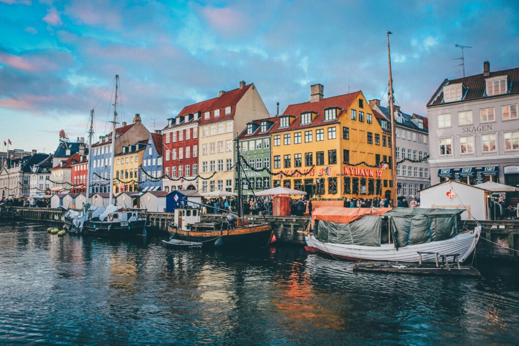
3. وكالة البيانات الجغرافية الدنماركية
تلعب وكالة البيانات الجغرافية الدنماركية دورًا محوريًا في إدارة وتوفير البيانات الجغرافية المكانية حول الأراضي البرية والبحرية في الدنمارك. وتضمن الوكالة سهولة الوصول إلى البيانات الجغرافية المكانية الأساسية وموثوقيتها، ودعم عمليات القطاعين العام والخاص. وهي تلعب دورًا أساسيًا في تسجيل التغييرات في بيانات الملكية، وهو أمر بالغ الأهمية بالنسبة لمعاملات الأراضي والضرائب والإدارة العامة. ويمتد عملهم إلى المجال البحري، حيث ينتجون خرائط بحرية ومنتجات أخرى لضمان الملاحة الآمنة في المياه الدنماركية وغرينلاند.
يتم دعم عملياتهم بأساس قوي في جمع البيانات وضمان الجودة. وتشرف الوكالة على أكثر من 520.000 كيلومتر مربع من الحدود المساحية، مما يوفر موردًا حيويًا لإدارة الممتلكات في الدنمارك. وتشمل خبرتهم أيضًا إنتاج البيانات الجغرافية المكانية للبحر، مما يسهل مجموعة واسعة من الأنشطة البحرية. تضمن هذه المعالجة الشاملة للبيانات دقة وموثوقية المعلومات المهمة للعديد من الوظائف المجتمعية.
تلتزم الوكالة بالابتكار واعتماد التقنيات الجديدة. إنهم يستخدمون أدوات متقدمة مثل أجهزة صدى الصوت متعددة الحزم ومعالجة البيانات الرقمية لتعزيز دقة تحليلاتهم الجغرافية المكانية. لا يحافظ هذا النهج على جودة خدماتها فحسب، بل يعمل على تحسينها، مما يضمن تلبية الاحتياجات المعاصرة لمستخدميها. تؤكد جهودهم المستمرة لدمج المنهجيات الجديدة على تفانيهم في توفير بيانات جغرافية مكانية حديثة وسهلة الوصول وعالية الجودة.
النقاط الرئيسية:
- يدير أكثر من 520.000 كم من الحدود المساحية.
- تنتج الملكية الرسمية والبيانات الهيدروغرافية.
- يستخدم التقنيات المتقدمة لجمع البيانات ومعالجتها.
خدمات:
- تسجيل وإدارة بيانات الممتلكات.
- إنتاج الخرائط الملاحية والمنتجات البحرية.
- الابتكار في معالجة البيانات الجغرافية المكانية وتطبيق التكنولوجيا.
معلومات الاتصال:
- موقع الكتروني: eng.gst.dk
- العنوان: Lindholm Brygge 31، 9400 Nørresundby
- الهاتف: 72545000
- البريد الإلكتروني: gst@gst.dk
- لينكد إن: dk.linkedin.com/company/geodatastyrelsen-aalborg

4. هيئة المسح الجيولوجي للدنمارك وجرينلاند
تعد هيئة المسح الجيولوجي للدنمارك وجرينلاند (GEUS) مؤسسة متكاملة ضمن وزارة المناخ والطاقة والمرافق الدنماركية، مع التركيز على الدراسات والأبحاث والاستشارات الجيولوجية العلمية، ولا سيما تغطية منطقتي الدنمارك وجرينلاند. تشارك GEUS بعمق في رسم الخرائط الجيولوجية وتنتج مجموعة متنوعة من البيانات الجغرافية المكانية التي تعتبر ضرورية للتخطيط البيئي وإدارة الموارد. وتشمل أنشطتها في المقام الأول جمع ومعالجة ونشر البيانات الجيولوجية والهيدروغرافية التي تعمل كموارد أساسية لمشاريع التنمية الوطنية والإقليمية.
تشارك GEUS أيضًا في أبحاث مكثفة وتقدم خدمات استشارية تساعد في الإدارة المستدامة للموارد الطبيعية وحماية البيئة. ويدعم عملهم مختلف القطاعات بما في ذلك إدارة المياه وإنتاج الطاقة والتنقيب عن المعادن. ومن خلال دمج البيانات العلمية الجيولوجية مع التكنولوجيا، فإنها توفر رؤى تساعد في صنع السياسات والبحث الأكاديمي، مما يساهم بشكل كبير في مجالات علوم المناخ والجيولوجيا.
المؤسسة ليست مجرد مستودع لمجموعات البيانات الجغرافية المكانية الضخمة ولكنها أيضًا ميسر للابتكار في علوم الأرض. يستخدمون التقنيات الحديثة مثل الاستشعار عن بعد ونظم المعلومات الجغرافية (GIS) لتعزيز دقة البيانات الجيولوجية وإمكانية الوصول إليها. إن التزام GEUS بتطوير المعرفة العلمية الجيولوجية من خلال البحث والتطوير المستمر يضعها كلاعب رئيسي في القطاع الجغرافي المكاني في الدنمارك.
النقاط الرئيسية:
- متخصص في الدراسات الجيولوجية ورسم الخرائط الجيولوجية.
- تقديم الخدمات الاستشارية والأبحاث في مجال المياه والطاقة والموارد المعدنية.
- يستخدم تقنيات نظم المعلومات الجغرافية والاستشعار عن بعد لتحسين البيانات.
خدمات:
- رسم الخرائط الجيولوجية والمسوحات الهيدروغرافية.
- جمع ومعالجة البيانات الجغرافية المكانية.
- البحوث والاستشارات في مجال إدارة الموارد الطبيعية.
معلومات الاتصال:
- موقع الكتروني: eng.geus.dk
- العنوان: Oester Voldgade 10، 1350 Copenhagen K، الدنمارك
- الهاتف: +45 38 14 20 00
- البريد الإلكتروني: geus@geus.dk
- لينكد إن: www.linkedin.com/company/geus

5. فوجرو
تقوم شركة Fugro، وهي شركة رائدة بارزة في الحصول على البيانات الجغرافية المكانية وتحليلها، بتسخير قوة البيانات الجغرافية لتقديم رؤى تسهل تطوير عمليات أكثر أمانًا واستدامة وكفاءة. تمتد خبرتهم الواسعة عبر مختلف الصناعات، مع التركيز على كشف أسرار الأرض لدعم البناء واسع النطاق، والحفاظ على البيئة، والتنمية الحضرية. مع الالتزام بالتكنولوجيا المبتكرة والاستدامة، تلعب فوجرو دورًا حاسمًا في المشاريع التي تطمح إلى خلق عالم آمن وقابل للعيش.
يكمن جوهر خدمات Fugro في أسلوبها المتقدم في جمع البيانات الجغرافية وتفسيرها. ويشمل ذلك المسوحات الجوية والأرضية وتحت الماء التي توفر رؤى تفصيلية حول الظروف المادية لمواقع المشروع. سواء كان الأمر يتعلق ببناء البنية التحتية أو استكشاف مصادر الطاقة الجديدة، فإن استراتيجياتهم المبنية على البيانات تضمن بناء المشاريع على أسس متينة. إن وجودهم العالمي يمكّنهم من تقديم حلول محلية تلبي متطلبات إقليمية محددة، مما يدل على مرونتهم وقدراتهم واسعة النطاق.
يمتد تأثير فوجرو إلى ما هو أبعد من المسح القياسي. وهي تلعب دورا محوريا في مساعدة قطاع الطاقة، وخاصة في التحول إلى مصادر الطاقة المستدامة. تساعد دراساتهم البيئية في حماية المحيطات والمساعدة في تنمية المناطق الساحلية. من خلال دمج الذكاء الاصطناعي والتقنيات المتطورة الأخرى في سير العمل، لا تعمل شركة Fugro على زيادة كفاءة ودقة تحليلات البيانات فحسب، بل تعمل أيضًا على تعزيز قدرتها على إدارة وتنفيذ المشاريع المعقدة على نطاق عالمي.
النقاط الرئيسية:
- رائد في دمج الذكاء الاصطناعي مع التحليلات الجغرافية المكانية.
- الخبرة في إدارة المشاريع المعقدة ومتعددة الطبقات.
- وصول عالمي مع حلول محلية مخصصة.
خدمات:
- جمع البيانات الجغرافية المتقدمة (الجوية، الأرضية، تحت المائية).
- تحليل مفصل لمشاريع البنية التحتية والبيئة.
- الخدمات الاستشارية للتنمية المستدامة.
معلومات الاتصال:
- موقع الكتروني: www.fugro.com
- العنوان: أجيرن ألي 3،. مدينة، هورشلوم 2790، الدنمارك
- الفيسبوك: www.facebook.com/fugro
- تويتر: twitter.com/fugro
- انستقرام: www.instagram.com/fugro
- لينكد إن: www.linkedin.com/company/fugro

6. سويكو
Sweco هي شركة استشارات هندسية ومعمارية بارزة مقرها في أوروبا، وتشارك بعمق في تخطيط وتصميم المجتمعات والمدن المستدامة للمستقبل. مع قوة عاملة تضم أكثر من 22000 مهندس معماري ومهندس ومتخصص، تتعاون Sweco بشكل وثيق مع العملاء لتطوير حلول تعالج بشكل فعال التحضر، وتسخير الرقمنة، وتعزيز الاستدامة المجتمعية. وقد وضع هذا النهج شركة Sweco في طليعة الصناعة، لا سيما في المجال الجغرافي المكاني، حيث تؤثر خبرتها بشكل كبير على التنمية الحضرية المستدامة.
تركز Sweco في عملياتها على دمج الخبرة العالمية مع الفهم المحلي، مما يضمن أن حلولها ليست مبتكرة فحسب، بل أيضًا ذات صلة بالسياق للاحتياجات المحددة لعملائها. تتيح لهم هذه المنهجية معالجة مجموعة واسعة من التحديات المتعلقة بالمباني والمناطق الحضرية وأنظمة المياه والطاقة والبنية التحتية للنقل. يتجلى التزام Sweco بالاستدامة في هدفها المتمثل في أن تصبح محايدة مناخيًا بحلول عام 2040 على الأقل، مما يعكس تفانيها في الإشراف البيئي والممارسات المستدامة ضمن مشاريعها وعملياتها المؤسسية.
تعتبر عروض خدمات Sweco واسعة النطاق، وتشمل العديد من المجالات الرئيسية التي تستخدم البيانات والتقنيات الجغرافية المكانية. غالبًا ما تشتمل مشاريعهم على حلول رقمية متطورة ونظم المعلومات الجغرافية، مما يوفر دعمًا حاسمًا في تخطيط وتنفيذ المشاريع الحضرية والبنية التحتية المعقدة. تُظهر هذه القدرات دور Sweco في تطوير كيفية تخطيط المجتمعات الحديثة لبيئاتها وبنائها واستدامتها، مع التركيز على الحلول الفعالة والذكية والمستدامة.
النقاط الرئيسية:
- رائدة في مجال الاستشارات الهندسية والمعمارية الأوروبية.
- التركيز القوي على التنمية الحضرية المستدامة والرقمنة.
- الالتزام بأن تصبح محايدة مناخيا بحلول عام 2040.
خدمات:
- الاستشارات الهندسية والمعمارية.
- تخطيط وتصميم المباني والمناطق الحضرية والبنية التحتية للنقل.
- حلول رقمية متقدمة ونظم المعلومات الجغرافية لإدارة المشاريع الشاملة.
معلومات الاتصال:
- موقع الكتروني: www.swecogroup.com
- العنوان: Sweco Danmark، Ørestads Boulevard 41، 2300 København S.
- الهاتف: +45 7220 7207
- البريد الإلكتروني: info@sweco.dk
- فيسبوك: www.facebook.com/SwecoDanmark
- انستقرام: www.instagram.com/swecodenmark
- تويتر: twitter.com/swecodk
- لينكد إن: www.linkedin.com/company/sweco
استنتاج
تحتل أفضل الشركات الجغرافية المكانية في الدنمارك طليعة دمج التقنيات والحلول الجغرافية المكانية المتقدمة التي تعزز بشكل كبير التخطيط الحضري والإدارة البيئية وتطوير البنية التحتية. تلعب هذه الشركات دورًا محوريًا في مواجهة التحديات المعقدة للتوسع الحضري، وذلك باستخدام أنظمة المعلومات الجغرافية (GIS) لإنشاء حلول تخطيط مكاني مستدامة وفعالة. ويتجلى التزامهم بالابتكار في عروض خدماتهم المتنوعة، بدءًا من رسم الخرائط الجوية وخدمات LiDAR إلى تطبيقات نظم المعلومات الجغرافية الشاملة، والتي تلعب دورًا أساسيًا في اتخاذ قرارات مستنيرة وتعزيز التنمية المستدامة عبر مختلف القطاعات.
ويمتد تأثير هذه الشركات الرائدة إلى ما هو أبعد من الحدود الوطنية، حيث يشارك العديد منها في مشاريع في جميع أنحاء الدول الاسكندنافية وأوروبا. يعكس تركيزهم على الاستدامة ودمج الحلول الرقمية في خدماتهم الجغرافية المكانية توافقًا قويًا مع الاتجاهات العالمية نحو الحفاظ على البيئة وتخطيط المدن الأكثر ذكاءً. ومع استمرار الدنمارك في تطوير قدراتها التكنولوجية، من المقرر أن يلعب هؤلاء القادة في مجال الجغرافيا المكانية دورًا حاسمًا في تشكيل المناظر الطبيعية المستقبلية ليس فقط للدنمارك ولكن أيضًا للمجتمع الدولي الأوسع، مما يدفع الابتكارات التي تدمج الاستدامة والكفاءة في جوهرها إلى الأمام.


