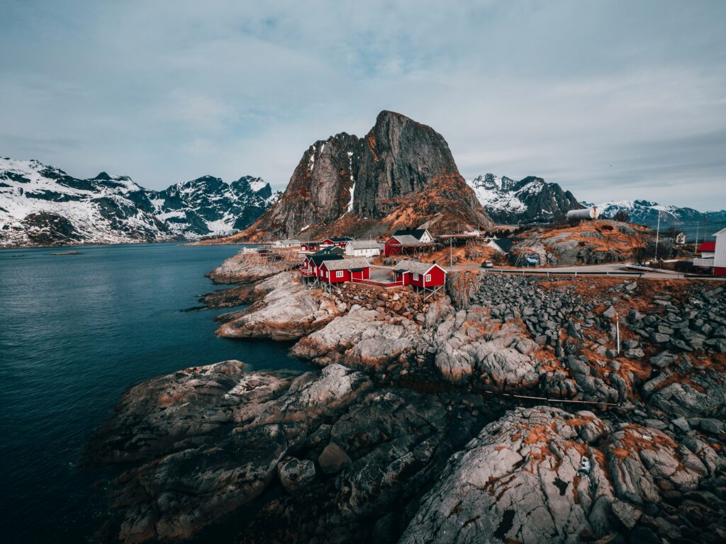
تعد النرويج، المعروفة بمناظرها الطبيعية الوعرة وقطاع التكنولوجيا المتطور، موطنًا لبعض الشركات الجغرافية المكانية الأكثر ابتكارًا في العالم. تتخصص هذه المؤسسات في إنشاء حلول متطورة لرسم الخرائط والتحليل المكاني، والتي تلبي احتياجات مجموعة واسعة من الصناعات بدءًا من المراقبة البيئية وحتى التخطيط الحضري. يتعمق هذا المقال في اللاعبين البارزين في المجال الجغرافي المكاني في النرويج، ويسلط الضوء على مساهماتهم وقدراتهم الفريدة.

1. فلاي بيكس AI
في FlyPix AI، نقوم بتسخير قوة الذكاء الاصطناعي لإحداث ثورة في الحلول الجغرافية المكانية عبر مختلف الصناعات. تقف منصة GEO AI الخاصة بنا في طليعة الابتكار، حيث تحول الصور المعقدة إلى رؤى قابلة للتنفيذ ومرجعية جغرافية. تتيح خدماتنا للمستخدمين تتبع التغيرات البيئية، وتحسين التخطيط الحضري، وتحسين عمليات صنع القرار من خلال الدقة والكفاءة المعتمدة على الذكاء الاصطناعي.
يوفر FlyPix AI واجهة قوية وسهلة الاستخدام تسهل التصور السهل وإدارة البيانات الجغرافية المكانية، مما يساهم في تحسينات كبيرة في الكفاءة وتوفير التكاليف لعملائنا. سواء كنا نساعد الهيئات الحكومية في مراقبة البنية التحتية أو دعم فرق الاستجابة للكوارث، تضمن منصتنا المعتمدة على الذكاء الاصطناعي أن يتمكن عملاؤنا من الاستفادة من التكنولوجيا المتطورة لتلبية احتياجاتهم الجغرافية المكانية بفعالية.
النقاط الرئيسية:
- اكتشاف الكائنات وتحديد موقعها باستخدام الذكاء الاصطناعي من أجل المراقبة والتحليل الدقيق.
- التتبع الديناميكي والتحليل التفصيلي للكائنات لفهم التغييرات بمرور الوقت والمكان.
- حلول قابلة للتخصيص مصممة خصيصًا لتلبية احتياجات الصناعة المحددة، مما يعزز تجربة المستخدم والكفاءة التشغيلية.
خدمات:
- اكتشاف الكائنات وتعريبها: استخدم نماذج الذكاء الاصطناعي لاكتشاف الميزات أو التغييرات الجغرافية وتقسيمها وتعريبها.
- اكتشاف التغيير والشذوذ: مراقبة وتحديد الأنماط أو التغييرات غير العادية في الصور الجوية وصور الأقمار الصناعية.
- التتبع الديناميكي: تتبع خصائص الكائن أو تغييرات الموقع باستخدام خوارزميات الذكاء الاصطناعي المتقدمة.
- حالات الاستخدام المخصص: تطوير حلول مخصصة للتحديات الفريدة عبر قطاعات مختلفة مثل الزراعة والتخطيط الحضري والمراقبة البيئية.
معلومات الاتصال:
- موقع إلكتروني: flypix.ai
- العنوان: شارع روبرت بوش. 7، 64293 دارمشتات، ألمانيا
- تواصل بالبريد الاكتروني: info@flypix.ai
- رقم الهاتف: +49 6151 2776497
- ينكدين: www.linkedin.com/company/flypix-ai

2. إي إنسايتس AS
تتخصص شركة EDInsights AS، ومقرها النرويج، في تحويل بيانات الأقمار الصناعية إلى رؤى قابلة للتنفيذ لمختلف الصناعات، مع التركيز على إنتاج الطاقة الكهرومائية وتحليل السوق. تستفيد الشركة من التقنيات المتقدمة بما في ذلك رادار الفتحة الاصطناعية (SAR) والتعلم الآلي لرصد وتحليل البيانات الجغرافية المكانية. ويساعد هذا النهج في إجراء تقييم دقيق للمياه والثلوج وتخزين الطاقة، وهو أمر بالغ الأهمية لإنتاج الطاقة وتسعير السلع الأساسية. ويهدف التزامهم بتقديم حلول قوية ودقيقة إلى دعم عمليات صنع القرار الحاسمة.
تعطي EDInsights الأولوية للحلول الخاصة بالعميل، وتوظف فريقًا من الخبراء في الاستشعار عن بعد، وتحليل البيانات، والهيدرولوجيا، لدفع الحدود التكنولوجية داخل الصناعة. بهدف تعزيز كفاءة وذكاء سوق الطاقة الكهرومائية، تتميز EDInsights بنهجها المبتكر في مجال تنافسي، حيث تجمع بين الخبرة العلمية والتطبيقات العملية لتلبية الاحتياجات المتنوعة لعملائها العالميين.
النقاط الرئيسية:
- متخصص في تحويل بيانات الأقمار الصناعية للحصول على رؤى قابلة للتنفيذ.
- يركز على الطاقة الكهرومائية وتحليل السوق باستخدام SAR والتعلم الآلي.
- يوفر المراقبة والتحليلات الجغرافية المكانية الحاسمة لقطاعات الطاقة والسلع.
خدمات:
- HydroEdge Nordics وGlobal: رصد ورسم خرائط للموارد المائية المصممة خصيصًا لتلبية احتياجات منتجي الطاقة المائية ومحللي السوق والتجار.
- مراقبة تشوه السطح: مراقبة التغييرات في البنية التحتية الحيوية لتوقع المخاطر وتخفيفها.
- الحلول الجغرافية المكانية المخصصة: تطوير تطبيقات مخصصة لمختلف الاحتياجات الصناعية التي تتضمن تحليل البيانات الجغرافية المكانية.
معلومات الاتصال:
- موقع الكتروني: edinsights.no
- العنوان: أوسلو، النرويج
- البريد الإلكتروني للاتصال: contact@edinsights.no
- لينكد إن: www.linkedin.com/company/edinsightsas
3. جيونورد أس
لقد أثبتت GeoNord AS، التي تقع في ألتا بالنرويج، نفسها كلاعب مهم في الصناعة الجغرافية المكانية منذ بدايتها. تتخصص الشركة في مجموعة من الخدمات بدءًا من رسم الخرائط والمسح وحتى الهندسة الجيوتقنية، وتستفيد من التكنولوجيا المتقدمة لتوفير حلول مستدامة تعزز القدرة التنافسية لعملائها. ويتم التأكيد على التزامهم من خلال السعي المستمر للتقدم التكنولوجي وتقديم خدمات عالية الجودة في القطاع الجغرافي المكاني.
تفتخر GeoNord AS بقدرتها على مواجهة التحديات الجيوتقنية المعقدة. وقد لعبت الشركة دورًا فعالًا في إجراء التحقيقات الجيوتقنية الضرورية للتقييمات التأسيسية في مشاريع البناء. باستخدام أحدث المعدات مثل جهاز الحفر الجديد Geotech 605 FM، تضمن GeoNord إجراء تقييمات جيوتقنية دقيقة وشاملة. تعتبر هذه الأنشطة حاسمة في المناطق المعرضة للمخاطر الجيولوجية مثل الانهيارات الأرضية والهبوط الأرضي، حيث توفر بيانات مهمة تساعد في تطوير البنية التحتية وتضمن الامتثال التنظيمي.
ويمتد تفاني الشركة إلى ما هو أبعد من مجرد تقديم الخدمات إلى الالتزام العميق بالرعاية البيئية. تسعى GeoNord AS جاهدة لتقليل التأثير البيئي من خلال الممارسات المستدامة، مما يضمن أن عملياتها تساهم بشكل إيجابي في الحفاظ على البيئة. تعد هذه الفلسفة جزءًا لا يتجزأ من روحهم التشغيلية، مما يعكس رؤيتهم للجمع بين الخبرة الرائدة في الصناعة وممارسة الأعمال المسؤولة.
النقاط الرئيسية:
- متخصص في رسم الخرائط والمساحة والهندسة الجيوتقنية.
- يستخدم التقنيات المتقدمة لإجراء تحقيقات جيوتقنية دقيقة.
- ملتزمون بالممارسات المستدامة وتقليل التأثير البيئي.
خدمات:
- التحقيقات والتقييمات الجيوتقنية التفصيلية.
- رسم خرائط التضاريس وتحليلها باستخدام تكنولوجيا الطائرات بدون طيار.
- استشارات الامتثال البيئي والتنظيمي.
- تقييم مخاطر الانهيارات الأرضية والهبوط.
- التحليل المختبري الجيوتقني وإعداد التقارير.
معلومات الاتصال:
- موقع الويب: http://www.geonord.xyz
- العنوان: Betongveien 4, 3.etasje 9515 Alta
- الهاتف: 78 43 58 48
- البريد الإلكتروني للاتصال:firmapost@geonord.no
- الفيسبوك: www.facebook.com/GeoNord

4. هوك AS
لقد حققت شركة Hawkeye AS مكانة متميزة في قطاع علم الجيوماتكس، مع التركيز على تقنيات المسح المتقدمة التي تشمل رسم خرائط الطائرات بدون طيار، والمسح الضوئي بالليزر ثلاثي الأبعاد، وعمليات التفتيش المتخصصة. تأسست الشركة في عام 2014، وقد اكتسبت تقديرًا لدقتها والتزامها باللوائح، وتم اعتمادها كمشغل RO3 من قبل هيئة الطيران المدني النرويجية. توظف شركة Hawkeye AS فريقًا من المحترفين ذوي الخبرة الذين يستخدمون أحدث المعدات مثل Leica ScanStation P40 وأدوات إعادة التشكيل ثلاثية الأبعاد لتقديم بيانات جغرافية مكانية عالية الجودة في جميع أنحاء النرويج.
تتنوع خدمات الشركة، بدءًا من رسم الخرائط الجوية باستخدام الطائرات بدون طيار إلى إنشاء نماذج مفصلة ثلاثية الأبعاد للمباني والمناظر الطبيعية. تعد هذه الخدمات جزءًا لا يتجزأ من إنشاء وثائق دقيقة "كما تم إنشاؤها"، والإشراف على مشاريع البناء، والمساعدة في مراحل تخطيط المشروع المعقدة. من خلال التقاط ومعالجة البيانات الجغرافية المكانية، توفر Hawkeye AS المعلومات الأساسية التي تدعم مشاريع البناء والتطوير المستدامة والدقيقة.
تقدم شركة Hawkeye AS أيضًا حلولًا فريدة من نوعها مثل رسم الخرائط عبر الهاتف المحمول والتصوير البانورامي بزاوية 360 درجة، والتي تعد ضرورية لعمليات التفتيش ومراقبة الموقع. وهذه التكنولوجيا فعالة بشكل خاص في المناطق التي يتعذر الوصول إليها أو المناطق الخطرة، حيث لا تكون طرق المسح التقليدية قابلة للتطبيق. ولا يضمن نهجهم المبتكر السلامة فحسب، بل يعمل أيضًا على تحسين كفاءة ودقة جمع البيانات الجغرافية المكانية، مما يجعل Hawkeye AS شريكًا قيمًا في مختلف القطاعات الصناعية والبناء.
النقاط الرئيسية:
- مشغل طائرات بدون طيار معتمد من RO3.
- أكثر من 1500 عملية ناجحة بطائرات بدون طيار.
- خبرة في المسح بالليزر ثلاثي الأبعاد ومعالجة البيانات الجغرافية المكانية.
خدمات:
- رسم الخرائط باستخدام الطائرات بدون طيار والتصوير الجوي.
- مسح ليزري ثلاثي الأبعاد للأرض.
- الاستشارات الجيومكانية والإشراف على المشاريع.
- حلول نظم المعلومات الجغرافية المتقدمة.
- أنظمة رسم الخرائط المتنقلة.
- تصوير بانورامي 360 درجة.
- عمليات تفتيش متخصصة للمناطق التي يصعب الوصول إليها.
معلومات الاتصال:
- الموقع الإلكتروني: www.hawkeyeas.no
- العنوان: Holsundvegen 732، 5642 Holmefjord، Norge
- الهاتف: 957-03-645
- البريد الإلكتروني للاتصال: rune@hawkeye.as
- الفيسبوك: www.facebook.com/hawkeyeas.no
- انستقرام: www.instagram.com/hawkeyeas

5. زيبين أس
تأسست شركة Zpin AS، وهي شركة رائدة في قطاع الجغرافيا المكانية في النرويج، في عام 2006 على يد توماس ستافانج بيدرسن وكانت في طليعة الشركات التي قدمت التقنيات المتطورة. كانت الشركة من أوائل الشركات في النرويج التي أطلقت خرائط تفاعلية على شبكة الإنترنت، وهو تطور سبق وصول خرائط Google إلى أوروبا. من مقرها الرئيسي في بيلينجستاد، تواصل شركة Zpin AS تطوير وتقديم حلول رسم الخرائط المبتكرة للعديد من المؤسسات النرويجية، ودمج أدوات مثل Google Maps API لتحسين خدماتها.
وتشتهر الشركة بحلولها المصممة خصيصًا، والتي تم تطويرها بالتعاون الوثيق مع العملاء لضمان أن المنتجات المقدمة لا تلبي التوقعات فحسب، بل تتجاوزها أيضًا. يتم دعم هذا النهج الذي يركز على العميل من قبل فريق Zpin AS الملتزم بتحسين حلولهم وتطويرها حتى يحققوا التميز. تسمح إستراتيجية التطوير الداخلية الخاصة بهم بدعم العملاء السريع والحل السريع لأي مشكلات، مما يضمن رضا العملاء والكفاءة التشغيلية.
تستفيد Zpin AS من قاعدة التعليمات البرمجية الخاصة بها لتسهيل رقمنة أي نوع من المعلومات تقريبًا، وتبسيط البيانات المعقدة إلى تنسيقات سهلة الاستخدام. وتكتمل هذه القدرة بخبرتهم الواسعة في إدارة قواعد البيانات وعمليات النظام والتطوير والتصميم، مما يمكنهم من تقديم حلول أعمال بديهية وفعالة مع واجهات جذابة بصريًا تعزز مشاركة المستخدم.
النقاط الرئيسية:
- المتبنون الأوائل لتقنيات رسم الخرائط التفاعلية على شبكة الإنترنت في النرويج.
- التركيز على الحلول المخصصة من خلال التعاون الوثيق مع العملاء.
- التطوير الداخلي الشامل ودعم العملاء.
خدمات:
- رقمنة الأنظمة الورقية لتعزيز كفاءة الأعمال.
- الخبرة في تطوير الواجهة الأمامية والخلفية للتطبيقات السحابية.
- خدمات التصميم التي تركز على التفاعل والتواصل البصري.
- حلول أكشاك المعلومات الكاملة، بما في ذلك إعداد الأجهزة وأنظمة إدارة المحتوى.
معلومات الاتصال:
- موقع الكتروني: zpin.no
- العنوان: BILLINGSTADSLETTA 46, 1396 BILLINGSTAD
- الهاتف: +47 21 06 18 00
- البريد الإلكتروني للاتصال: post@zpin.no

6. جيو بودو
تعمل GEO Bodø كمزود شامل لخدمات المسح الجغرافي المكاني والأراضي في النرويج. تأسست الشركة مع التزام عميق بالجودة والموثوقية، وهي متخصصة في مجموعة متنوعة من خدمات قياس الأراضي الدقيقة. وتشمل هذه، على سبيل المثال لا الحصر، التحكم في الماكينة، وتعهد البناء، والتصوير الفوتوغرافي بطائرة بدون طيار، والحسابات الجماعية الدقيقة، وخطابات المسح، والوثائق المبنية. مع محترفين ذوي خبرة على رأس GEO Bodø | المزيد | تضمن شركة Salten AS أن كل مشروع، بغض النظر عن حجمه، مجهز بالأدوات والخبرة اللازمة لتحقيق النجاح.
تقع الشركة في موقع استراتيجي عبر مناطق متعددة، بما في ذلك Bodø وMøre وSalten، وتقدم خدمات محلية ويمكن الوصول إليها. يمكّنهم هذا التنوع الجغرافي من تلبية الاحتياجات الإقليمية بفعالية مع الحفاظ على جودة الخدمة المتسقة في جميع المواقع. ويعمل في كل مكتب فريق من الخبراء الذين لا يتمتعون بالكفاءة في المهارات التقنية فحسب، بل لديهم أيضًا خبرة جيدة في التعامل مع اللوائح المحلية والاعتبارات البيئية، مما يضمن امتثال جميع المشاريع للمعايير الوطنية.
تفتخر الشركة بشبكة شراكاتها القوية وقدرتها على العمل كمزود شامل للحلول داخل القطاع الجغرافي المكاني. عروض خدماتهم شاملة، وتشمل كل شيء بدءًا من المسح الأولي وحتى الوثائق التفصيلية للمشروع. تم تصميم نموذج الخدمة الشامل هذا لتبسيط تجربة العميل وتقليل التعقيد وتعزيز الكفاءة الشاملة لإدارة المشروع.
النقاط الرئيسية:
- متخصصة في مجموعة شاملة من خدمات مسح الأراضي.
- متنوعة جغرافيًا ولها مواقع في بودو ومور وسالتن.
- تركيز قوي على الامتثال للمعايير الوطنية واللوائح المحلية.
خدمات:
- قياس الأراضي: خدمات دقيقة مصممة خصيصًا للمشاريع التوسعية والمحلية.
- التصوير بطائرة بدون طيار: تصوير جوي متقدم لتحليل الموقع ومراقبته بشكل تفصيلي.
- التحكم في الماكينة: حلول تكنولوجية لمهام البناء والمساحة الآلية.
- الحساب الشامل: تحديدات دقيقة للبناء وتطوير الأراضي.
- المسح ثلاثي الأبعاد: تصوير عالي الدقة لنمذجة التضاريس والبنية التفصيلية.
معلومات الاتصال:
- موقع الويب: http://www.geobodo.no
- العنوان: Jernbaneveien 99، 8006 بودو
- الهاتف: (+47) 901 28 444
- البريد الإلكتروني للاتصال: oyvind@geobodo.no
7. هيئة المسح الجيولوجي النرويجية (NGU)
تلعب هيئة المسح الجيولوجي النرويجية (NGU) دورًا حاسمًا في رسم خرائط البيئة الجيولوجية في النرويج ودراستها، حيث توفر معلومات حيوية لأصحاب المصلحة في القطاعين العام والخاص. أنشئت كهيئة وطنية للبيانات الجيولوجية، وتقوم NGU بإجراء خرائط جيولوجية شاملة تشمل المناطق البرية والبحرية، باستخدام أحدث التقنيات والمنهجيات. وتدعم هذه الخرائط الشاملة العديد من التطبيقات، بدءًا من التنقيب عن المعادن وحتى حماية البيئة وتخطيط استخدام الأراضي.
لا تقتصر جهود NGU على رسم الخرائط فحسب؛ وتشارك المؤسسة أيضًا بعمق في البحث والتطوير في علوم الأرض. وهي تتعاون على المستوى الدولي، وتشكل شراكات استراتيجية مثل الشراكة مع الولايات المتحدة لتنمية الموارد المعدنية الحيوية، ومع الاتحاد الأوروبي لتعزيز التعاون في مجال المعادن. تعمل هذه التعاونات على تعزيز قدرات NGU في مواجهة تحديات علوم الأرض العالمية والإقليمية، مما يجعلها لاعبًا رئيسيًا في أبحاث علوم الأرض الدولية وصنع السياسات.
بصرف النظر عن أنشطتها الأساسية في مجال البحث ورسم الخرائط، توفر جامعة NGU أيضًا وصولاً عامًا إلى ثروة من البيانات الجيولوجية من خلال منصاتها الرقمية ومستودعاتها المادية مثل مكتبتها الأساسية ومجموعات العينات. يسهل هذا النهج المفتوح الاستخدام التعليمي والعلمي والتجاري لبيانات NGU، مما يزيد من إمكانية الوصول إلى المعلومات الجيولوجية العلمية وفائدتها عبر مختلف القطاعات. ويتجلى التزام جامعة NGU بشفافية البيانات والتعليم من خلال مبادرات المشاركة العامة، بما في ذلك البرامج التعليمية والفعاليات التشاركية مثل أيام البحث السنوية.
النقاط الرئيسية:
- رسم خرائط جيولوجية شاملة للمناطق البرية والبحرية في النرويج.
- التعاون الدولي الاستراتيجي لتنمية الموارد المعدنية.
- مساهمة كبيرة في أبحاث علوم الأرض وإمكانية الوصول إلى البيانات العامة.
خدمات:
- رسم الخرائط الجيولوجية: خدمات رسم الخرائط التفصيلية التي تغطي الجيولوجيا البرية والبحرية.
- البحث والتطوير: أبحاث علوم الأرض المتطورة بالتعاون مع الشركاء الدوليين.
- توفير البيانات: الوصول إلى مجموعة واسعة من البيانات الجيولوجية من خلال المنصات الرقمية والأرشيفات المادية لجامعة NGU.
- التعليم العام والمشاركة: تنظيم الفعاليات وتوفير الموارد للأغراض التعليمية في علوم الأرض.
معلومات الاتصال:
- موقع الويب: http://www.ngu.no
- العنوان: Leiv Eirikssons vei 39، 7040 تروندهايم
- الهاتف: 73 90 40 00
- البريد الإلكتروني للتواصل: gu@ngu.no
- ينكدين: www.linkedin.com/company/geological-survey-of-norway
- الفيسبوك: www.facebook.com/Norges.geologiske.undersokelse
- انستقرام: www.instagram.com/norgesgeologiskeundersokelse

8. جيوكاب أس
تتخصص شركة Geocap AS، ومقرها في أوسلو بالنرويج، في دمج أدوات النمذجة والتصور تحت السطح مع منصة ArcGIS، مما يؤدي بشكل فعال إلى سد الفجوة بين البيانات الجيولوجية تحت السطح وأنظمة المعلومات الجغرافية. يسمح هذا التكامل بإجراء تحليل أكثر بساطة وشمولاً للبيانات الجغرافية المكانية، وهو أمر بالغ الأهمية لصناعات مثل النفط والغاز والمعادن البحرية وطاقة الرياح البحرية. تم تصميم الحلول البرمجية للشركة لتعزيز وظائف ArcGIS من خلال إضافة إمكانات خاصة بإدارة البيانات تحت السطحية وتصورها.
توفر المنتجات الأساسية لـ Geocap AS، مثل Ground Model for ArcGIS وSubsurface Portal for ArcGIS، أطر عمل قوية لإدارة البيانات الجيولوجية وتحليلها. تدعم هذه الأدوات مجموعة من الأنشطة بدءًا من تفسير البيانات الزلزالية وحتى إنشاء نماذج جيولوجية مفصلة. ومن خلال تسهيل فهم أعمق لباطن السطح، تساعد هذه الأدوات الصناعات على إدارة الموارد بشكل أكثر كفاءة واتخاذ قرارات أكثر استنارة فيما يتعلق بمشاريع الاستكشاف والتطوير.
تشتهر شركة Geocap AS أيضًا بمشاريعها التعاونية، والتي غالبًا ما تتضمن العديد من أصحاب المصلحة من مختلف القطاعات. تهدف هذه التعاونات إلى تطوير برمجيات تعمل على تبسيط العمليات الجيولوجية العلمية المعقدة وتشجع على تحسين التواصل وتبادل البيانات بين شركاء المشروع. لا يقلل هذا النهج من المخاطر المرتبطة بالظروف تحت السطح فحسب، بل يعزز أيضًا كفاءة المشروع من خلال تحسين وضوح البيانات المهمة وإمكانية الوصول إليها.
النقاط الرئيسية:
- متخصص في دمج البيانات الجيولوجية تحت السطح مع منصة ArcGIS.
- يوفر الأدوات التي تعمل على تحسين قدرات تحليل البيانات وتصورها داخل بيئات نظم المعلومات الجغرافية.
- يشارك في مشاريع تعاونية لتبسيط العمليات الجيولوجية عبر صناعات متعددة.
خدمات:
- Ground Model for ArcGIS: وظيفة إضافية لـ ArcGIS Pro تعمل على تبسيط التحليل تحت السطح.
- Subsurface Portal for ArcGIS: نظام أساسي قائم على الويب لدمج البيانات تحت السطحية وإدارتها ومشاركتها وتحليلها.
- رابط بيانات GIS لـ Petrel: يربط نظام المعلومات الجغرافية ببيانات الاستكشاف الزلزالي، مما يسهل إدارة البيانات بشكل أفضل.
- الحدود والحدود البحرية لـ ArcGIS: أتمتة حساب الحدود البحرية، وهو جانب مهم للتطبيقات القانونية والحكومية.
- Geocap Shelf: برنامج متخصص لرسم الخرائط وتحليل البيانات الجغرافية المكانية البحرية والساحلية.
معلومات الاتصال:
- موقع الويب: http://geocap.no
- العنوان: Grev Wedels plass 9، 0151 أوسلو، النرويج
- الهاتف: (+47) 23 24 90 00
- البريد الإلكتروني: info@geocap.no.

9. سيما24
تبرز Sima24 في السوق النرويجية بفضل حلولها الجغرافية المكانية والإدارية المتخصصة والمصممة خصيصًا لعمليات الطرق. مع التركيز على التطبيقات العملية وسهلة الاستخدام، توفر Sima24 الأدوات التي تضمن الإدارة الفعالة للمهام المتعلقة بالطرق والبنية التحتية. تم تصميم حلولهم البرمجية لدعم العمليات حتى في أوضاع عدم الاتصال بالإنترنت، وهو أمر بالغ الأهمية للعاملين الميدانيين الذين قد يتواجدون في مناطق ذات اتصال ضعيف.
تشتمل مجموعة منتجاتها على Sima24 Veginspeksjon، وهو تطبيق مصمم لفحص الطرق والتحكم فيها، مما يضمن الامتثال لمتطلبات التوثيق المتزايدة من المقاولين والهيئات الحكومية. تعتبر هذه الأداة مفيدة بشكل خاص لإدارة تسجيلات الامتداد والنقاط، وعمليات الفحص النشط، وتتضمن وظائف مثل وضع القيادة والتحكم عبر البلوتوث للسلامة. ومن العروض البارزة الأخرى Sima24 Navigator، الذي يعزز الملاحة ويوفر تصورًا مرجعيًا مستمرًا للطريق، مما يسهل تتبع الموقع الدقيق ووضع علامات على البيانات.
علاوة على ذلك، توسع Sima24 فائدتها لتشمل المشاركة العامة من خلال Sima24 Publikumsportal، مما يسمح للمقيمين بالإبلاغ عن مشكلات مثل أضواء الشوارع الخاطئة مباشرة. لا تعمل هذه الميزة على تبسيط سير عمل الصيانة فحسب، بل تعمل أيضًا على تعزيز مشاركة المجتمع في إدارة البنية التحتية المحلية. لمزيد من الخدمات المتخصصة، تقدم Sima24 تطبيقات مصممة خصيصًا لخدمات الانسكاب والتنظيف، ودمج الملاحة وإدارة المهام والتواصل الفعال بين المكاتب والميدان.
النقاط الرئيسية:
- يقدم مجموعة شاملة من الأدوات لإدارة البنية التحتية للطرق.
- يوفر وظائف دون اتصال بالإنترنت لدعم العمليات الميدانية دون تغطية الشبكة.
- تمكن المشاركة العامة من خلال Sima24 Publikumsportal.
خدمات:
- Sima24 Veginspeksjon: أداة لفحص الطرق والتوثيق والتحكم بها مع ميزات السلامة المضمنة.
- Sima24 Navigator: يجمع بين التنقل وعرض مرجعي مستمر للطريق ووضع علامات على الصور.
- مسجل Sima24: يبسط توثيق العمل المنجز، ويدمج التقارير، ووضع علامات على الموضع، والتنقل.
- Sima24 Loggbok: يسهل عملية التوثيق للأحداث والإبلاغ عن الحوادث.
- Sima24 Publikumsportal: يسمح للجمهور بالإبلاغ عن مشكلات البنية التحتية مباشرة، مما يعزز الصيانة التي يقودها المجتمع.
- Sima24 for Spyle- og Tømmetjenester: متخصص في الإدارة التشغيلية في خدمات التنظيف والانسكاب، ودعم التنسيق السلس بين السائقين والمرسلين.
معلومات الاتصال:
- موقع الويب: http://www.sima24.no
- العنوان: Besøksadresse، Østensjøveien 62، 0667 أوسلو
- الهاتف: +4722199020
- البريد الإلكتروني: support@sima24.no
- الفيسبوك: www.facebook.com/simasoftware
- تويتر: twitter.com/sima24no
- لينكد إن: www.linkedin.com/company/sima-as

10. فوس أوبمولينج AS
Voss Oppmåling AS هي شركة نرويجية مقرها في فوس، متخصصة في مجموعة واسعة من الخدمات الجغرافية المكانية المصممة لقطاع التشييد والبناء، والهيئات الحكومية، ومطوري القطاع الخاص، والعملاء الأفراد في المقام الأول في منطقة هوردالاند. تأسست الشركة في عام 2012 على يد Asle Mykkeltveit وNils Martin Seim، ونجحت في ترسيخ مكانتها من خلال تركيزها على تقديم حلول دقيقة لرسم الخرائط والمسح. بفضل فريق من المحترفين ذوي الخبرة، تتميز شركة Voss Oppmåling AS بمهارتها في التعامل مع المشاريع الكبيرة والمهام الأصغر حجمًا والأكثر محلية.
وتقدم الشركة مجموعة شاملة من الخدمات، مما يضمن إنتاجية عالية ومرونة في عملياتها. وتمتد خبرتهم من قياس الأراضي التقليدية إلى الخدمات الأكثر تخصصًا مثل رص الأنفاق والحساب الشامل، وكلها أمور ضرورية لتنفيذ المشروع وتخطيطه بدقة. علاوة على ذلك، تؤكد شركة Voss Oppmåling AS على الأساليب الموجهة نحو الحلول، وتزويد فريقها بأحدث التقنيات للحفاظ على المرونة والكفاءة في العمل الميداني ومهام معالجة البيانات.
تركز شركة Voss Oppmåling AS أيضًا بشكل قوي على الجودة والامتثال، وتحصل على شهادات لفئات المشروع والتنفيذ التي تثبت قدرتها على التعامل مع المشاريع الجغرافية المكانية المعقدة. وينعكس التزامهم بالحفاظ على معايير عالية في مخرجاتهم في نهجهم المنهجي لإدارة المشروع، بدءًا من القياسات الأولية وحتى مراحل التوثيق النهائية، مما يضمن تلبية جميع مواصفات العميل والمتطلبات التنظيمية بدقة.
النقاط الرئيسية:
- متخصصون في الخدمات الجيومكانية لمختلف القطاعات بما في ذلك البناء والحكومة والعملاء الخاصين.
- مجهزة بالتكنولوجيا المتقدمة لرسم الخرائط والمسح الدقيق.
- معتمد لتنفيذ المشاريع رفيعة المستوى والتخطيط في الخدمات الجغرافية المكانية.
خدمات:
- قياس الأراضي: تقديم خدمات قياس الأراضي بشكل تفصيلي ودقيق لمشاريع البناء والتطوير.
- تعهد الأنفاق: خدمات تعهد متخصصة لبناء الأنفاق والمشاريع الهندسية.
- الحساب الشامل: الحسابات الأساسية لتقديرات المواد وتخطيط المشاريع.
- التحكم في الماكينة: دمج أنظمة التحكم في الماكينة لتعزيز كفاءة البناء.
- رسم الخرائط: خدمات رسم خرائط شاملة لمختلف التطبيقات، من التخطيط الحضري إلى الإدارة البيئية.
- وضع التدابير: الوضع الاستراتيجي للتدابير من أجل دقة البناء والتطوير.
- اتفاقية الحدود الخاصة: المساعدة في مفاوضات الحدود الخاصة والوثائق القانونية.
- التوثيق: خدمات توثيق شاملة لدعم الامتثال للمشروع وتنفيذه.
- NVDB/FKB: تقديم الخدمات المتعلقة بقاعدة بيانات الطرق الوطنية وبيانات القاعدة الجغرافية المكانية الأساسية.
- التصور ثلاثي الأبعاد: أدوات تصور متقدمة للمساعدة في تخطيط المشروع والعروض التقديمية لأصحاب المصلحة.
- المسح: خدمات المسح الضوئي عالية الدقة لتحليل الموقع التفصيلي.
- خطط الموقف: إنشاء خطط موقف مفصلة للإشراف على المشروع وإدارته.
- إجراءات المسح: إجراء إجراءات المسح الرسمية وفقًا لقانون المساحة النرويجي.
معلومات الاتصال:
- الموقع الإلكتروني: vossoppmaaling.no
- العنوان: بيوركيموين 46، 5709 فوس
- الهاتف: +4740001148
- البريد الإلكتروني: post@vossoppmaaling.no
- الفيسبوك: www.facebook.com/VossOppmaling

11. كارتجينستر أس
تأسست شركة Karttjenester AS في عام 2004، وهي تخدم مجموعة متنوعة من العملاء بما في ذلك المطورين والشركات المعمارية وشركات العقارات والحكومات المحلية والإقليمية وقطاع الطاقة، من بين آخرين. تتفوق الشركة في تقديم حلول جغرافية مكانية مخصصة تلبي الاحتياجات المحددة لكل قطاع، مع الاستفادة من التقنيات المتقدمة والبيانات الجغرافية المكانية التفصيلية لدعم مجموعة واسعة من المشاريع بدءًا من التخطيط الحضري وحتى الحفاظ على البيئة.
تتنوع خدمات الشركة، بدءًا من إنشاء الخرائط المواضيعية والخطط التنظيمية وحتى التحليلات الجغرافية الأكثر تعقيدًا ونمذجة التضاريس ثلاثية الأبعاد. تدمج Karttjenester AS مختلف البيانات والتقنيات الجغرافية المكانية لتوفير حلول شاملة تعزز عملية صنع القرار والكفاءة التشغيلية لعملائها. تبرز قدرة الشركة على التعامل مع مجموعات البيانات الكبيرة وتحويلها إلى تنسيقات مرئية يسهل فهمها باعتبارها جانبًا رئيسيًا من عملياتها.
لا تلتزم Karttjenester AS بتقديم خدمات عالية الجودة فحسب، بل تركز أيضًا على الابتكار والقدرة على التكيف في مجال الخدمات الجغرافية المكانية سريع التطور. يتكون الفريق من محترفين ذوي خبرة بارعين في استخدام تكنولوجيا نظم المعلومات الجغرافية المتطورة لتحليل وتصوير البيانات الجغرافية، وهو أمر بالغ الأهمية لتطوير البنية التحتية وإدارة المخاطر والتخطيط الاستراتيجي.
النقاط الرئيسية:
- تقدم خدمات جيومكانية متخصصة لمجموعة واسعة من القطاعات بما في ذلك الجهات الحكومية والخاصة.
- خبرة في التخطيط التنظيمي والنمذجة ثلاثية الأبعاد وتحليل نظم المعلومات الجغرافية.
- معروف بالحلول المبتكرة والنهج التعاوني لإشراك العملاء.
خدمات:
- التخطيط التنظيمي: وضع الخطط التي تتوافق مع اللوائح المحلية والوطنية.
- دراسات المخاطر ونقاط الضعف (ROS): تقييم المخاطر والتخطيط لنقاط الضعف في المناطق الحضرية والريفية.
- نمذجة التضاريس ثلاثية الأبعاد: إنشاء نماذج تفصيلية لأسطح الأرض تساعد في التخطيط والتصميم.
- تصميم مشروع الطرق (Vegprosjektering): تصميم وتخطيط مخططات الطرق والبنية التحتية.
- الرقمنة وتوحيد بيانات نظم المعلومات الجغرافية (FKB، SOSI): تحويل البيانات إلى تنسيقات موحدة لتسهيل إدارتها وإمكانية الوصول إليها.
- تخطيط المناطق (Arealplan) والتخطيط البلدي (Kommuneplan): خدمات التخطيط الاستراتيجي للتنمية البلدية والحضرية.
- رسم الخرائط المواضيعية (Temakart): إنشاء خرائط تركز على موضوعات محددة مثل العوامل البيئية، واستخدام الأراضي، وما إلى ذلك.
- التصور والتحليل الجغرافي: تقديم تمثيلات مرئية مفصلة وتحليلات للبيانات الجغرافية.
- رسم خرائط القصة ونظم المعلومات الجغرافية على الويب: استخدام تقنيات سرد القصص لتقديم المعلومات الجغرافية بشكل جذاب من خلال منصات الويب.
- خرائط للأنشطة الخارجية (Friluftskart، Turkart): توفير خرائط تفصيلية للأنشطة الترفيهية الخارجية.
- خرائط الممرات والطرق (Løypekart): إنشاء أدلة مفصلة للممرات وطرق السياحة والترفيه.
- لوحات المعلومات (Infotavle): تصميم لوحات معلوماتية للأماكن العامة أو الأماكن السياحية.
معلومات الاتصال:
- موقع الويب: http://www.karttjenester.no
- العنوان: Fokusbygget، Tonstadvn. 9
- الهاتف: 45 86 54 10
- البريد الإلكتروني: post@karttjenester.no
استنتاج
تعد الشركات الجغرافية المكانية الرائدة في النرويج في طليعة دمج التقنيات الجغرافية المكانية المتقدمة في مجموعة متنوعة من القطاعات بما في ذلك التخطيط الحضري والإدارة البيئية والطاقة والسلامة العامة. وتتميز هذه الشركات بقدرتها على تسخير قوة نظم المعلومات الجغرافية وصور الأقمار الصناعية وتحليلات البيانات المتقدمة لتقديم حلول شاملة تدفع الكفاءة والابتكار. ولا تدعم خدماتهم التخطيط الحكومي والبلدي فحسب، بل تعمل أيضًا على تعزيز القدرات في قطاعات مثل البناء والسياحة وإدارة الموارد الطبيعية، مما يدل على الدور الحاسم للبيانات الجغرافية المكانية في ممارسات الصناعة الحديثة.
تتيح خبرة هذه الشركات الجغرافية المكانية الكبرى في النرويج مساهمات كبيرة في مشاريع تتراوح بين تطوير البنية التحتية والحفاظ على البيئة. ومن خلال توفير أدوات لرسم الخرائط الدقيقة وتحليل الموقع ونمذجة التضاريس، فإنها تساعد أصحاب المصلحة على اتخاذ قرارات مستنيرة بناءً على بيانات دقيقة وفي الوقت الفعلي. يعد هذا المستوى من الرؤية التفصيلية ضروريًا للتنمية المستدامة والتخطيط الاستراتيجي، مما يضمن بقاء النرويج في طليعة تطبيقات التكنولوجيا الجغرافية المكانية. تلعب هذه الشركات دورًا محوريًا في تشكيل كيفية إدراك الصناعات للبيانات الجغرافية واستخدامها لمواجهة التحديات المحلية والعالمية.
