Deep Learning Segmentation Tools: Transforming Image Analysis

Deep learning segmentation tools have significantly advanced image analysis by enabling machines to identify and delineate objects within images with remarkable precision. These tools utilize complex neural network architectures, such as convolutional neural networks (CNNs), to process and segment images into meaningful components. This capability is particularly beneficial in fields like medical imaging, autonomous vehicles, […]
The Best Pipeline Monitoring Tools for Optimal Performance

Pipeline monitoring tools are essential for maintaining the health and efficiency of pipelines, whether for oil, gas, or other utilities. These tools help identify leaks, prevent failures, and optimize operations by providing real-time data on pipeline conditions. In this article, we explore the top pipeline monitoring tools that can significantly improve the reliability and safety […]
Vegetation Health: The Role of AI, Big Data, and Precision Agriculture

Vegetation health is a crucial aspect of modern agriculture, directly influencing food security, environmental sustainability, and economic stability. The increasing global population, climate change, and resource scarcity demand innovative solutions to maximize crop yields while minimizing environmental impact. Advanced technologies, including artificial intelligence (AI), machine learning (ML), deep learning (DL), and big data analytics, are […]
Deep Learning for High-Resolution Wetland Mapping

Wetlands play a crucial role in biodiversity, water filtration, and flood control, yet many of them remain unmapped or inaccurately recorded. The outdated nature of wetland data has posed challenges for conservationists, planners, and developers who need precise, up-to-date information to make informed decisions. To address this, artificial intelligence (AI) and deep learning (DL) have […]
Floodplain Mapping Using Deep Learning and SAR Data

Flooding is among the most frequent and costly natural disasters worldwide. Mapping floods accurately is crucial for disaster management, risk assessment, and mitigation planning. Traditional flood mapping relies on aerial surveys and ground-based observations, but these methods are often costly, time-consuming, and limited by weather conditions. In contrast, synthetic aperture radar (SAR) and deep learning […]
Deep Learning Object Tracking: A Comprehensive Guide

Object tracking is a fundamental task in computer vision that involves identifying and following objects in a video stream. With the rise of deep learning, object tracking has become more accurate, robust, and efficient. This guide explores various aspects of deep learning object tracking, including algorithms, challenges, applications, and software solutions. Understanding Object Tracking: Principles […]
Terrain Analysis: The Role of GeoAI, Deep Learning, and Multi-Source Data Integration
Terrain analysis is a critical aspect of geographic information science (GIS), enabling the understanding of Earth’s surface features, changes, and geomorphological processes. With increasing environmental concerns, urban planning needs, and natural disaster management requirements, accurate terrain analysis has become essential. Traditional methods of terrain feature detection, such as Digital Elevation Models (DEM) and remote sensing […]
Geohazard Risk Assessment: AI Applications, Challenges, and Future Directions

Geohazards, including landslides, earthquakes, tsunamis, and volcanic eruptions, pose serious risks to human life, infrastructure, and the environment. Over the past few decades, geohazard risk assessment has evolved significantly, integrating cutting-edge technologies such as artificial intelligence (AI) and machine learning (ML) to improve prediction accuracy and disaster mitigation strategies. This article provides an in-depth analysis […]
AI – Powered Building Damage Assessment: Revolutionizing Disaster Response

Building damage assessment is a critical process in disaster management, determining the severity of structural damage following natural disasters, armed conflicts, or other catastrophic events. With advancements in artificial intelligence (AI) and deep learning, damage detection has significantly improved, providing faster and more accurate assessments. This article explores how machine learning models, satellite imagery, and […]
Reality Capture Enterprise: The Future of 3D Digital Transformation
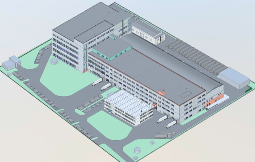
Reality Capture Enterprise is revolutionizing how businesses capture and use real-world data. By leveraging advanced 3D scanning technologies like LiDAR, photogrammetry, and drone mapping, companies can create accurate digital models of buildings, infrastructure, and environments. These digital twins help streamline design, construction, manufacturing, and facility management processes-enhancing efficiency, reducing costs, and enabling better decision-making. What […]