3D Reality Capture in Construction: Transforming the Industry
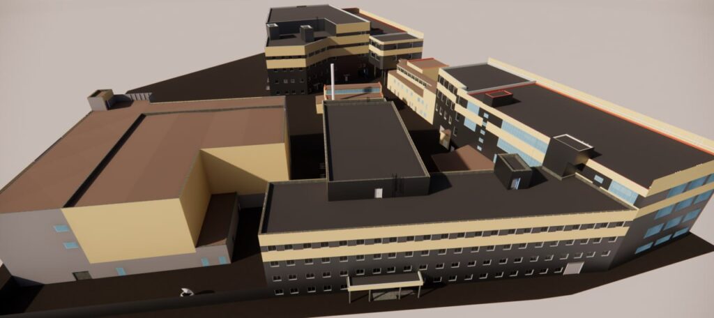
The construction industry is undergoing a digital revolution, with 3D reality capture emerging as a game-changer. This technology utilizes laser scanning, photogrammetry, and LiDAR to create highly accurate digital replicas of construction sites, improving project planning, monitoring, and management. By bridging the gap between the physical and digital worlds, 3D reality capture enhances efficiency, reduces […]
Mappt Alternatives: A Complete Guide to Choosing the Best Solution
In today’s fast-paced industries, Geographic Information System (GIS) tools like Mappt play a crucial role in field data collection, spatial analysis, and mapping. Mappt is widely recognized for its user-friendly design, offline capabilities, and broad application across industries such as environmental management, urban planning, and mining. However, businesses often seek alternatives due to budget constraints, […]
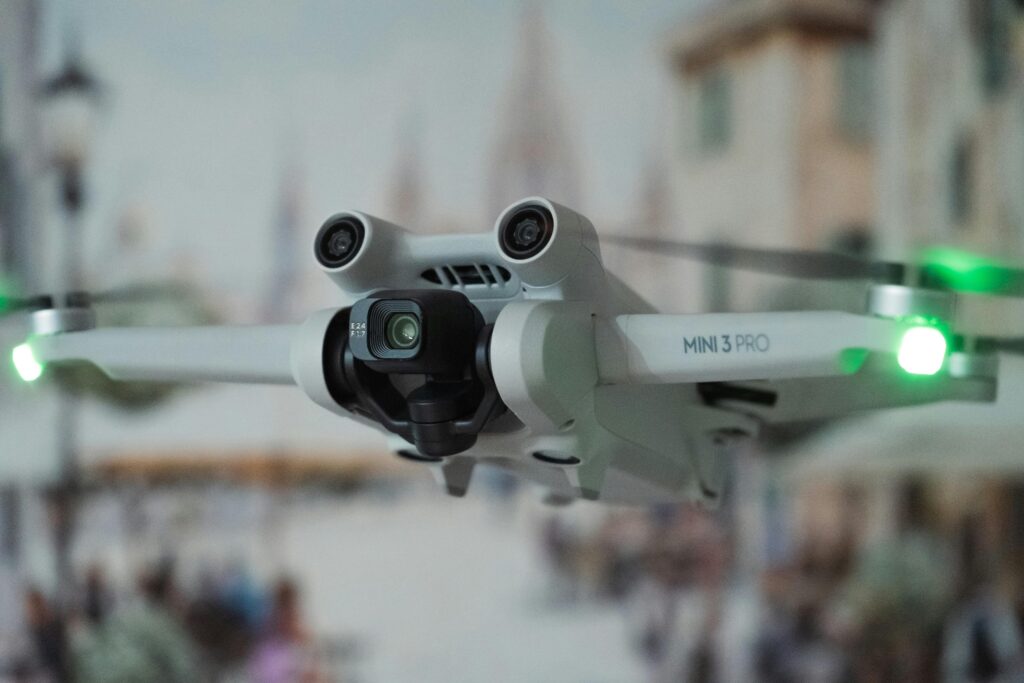
Autonomous Reality Capture: Transforming How We Understand the World

In recent years, autonomous reality capture has emerged as a groundbreaking technology, changing the way industries collect and use data. From construction sites to industrial inspections, autonomous systems powered by advanced laser scanning are setting a new standard for efficiency, accuracy, and safety. This article explores how autonomous reality capture works, its benefits, and its […]
Taranis AI Alternatives: A Complete Guide to Choosing the Best Solution
Taranis AI has emerged as a leader in precision agriculture, offering cutting-edge tools for crop monitoring and pest management. However, businesses exploring alternatives often seek specialized features, cost-effective options, or solutions tailored to specific regional needs. In this guide, we’ll explore 16 top alternatives to Taranis AI, highlighting their unique advantages to help you make […]
Altitude Angel Alternatives: A Complete Guide to Choosing the Best Solution

In the ever-evolving world of drone technology, airspace management has become crucial for safety and efficiency. Altitude Angel stands as a leader in this domain, offering cutting-edge solutions for Unmanned Traffic Management (UTM) and airspace optimization. However, businesses and organizations often seek alternatives to find platforms that better align with their unique needs, budgets, or […]
iAuditor by SafetyCulture Alternatives

When it comes to simplifying audits, inspections, and safety management, iAuditor by SafetyCulture is a popular choice. But it’s not the only option out there. Whether you’re looking for tools tailored to your specific industry, more advanced features, or a different pricing model, there are several alternatives to consider. In this article, we’ll explore the […]
Reality Capture: Transforming the Art of Design

Reality capture technology has revolutionized the way we approach design. By enabling the creation of precise digital representations of physical spaces, this innovative tool is transforming industries such as architecture, construction, and design-build projects. From laser scanning to photogrammetry, reality capture methods are making design faster, more accurate, and collaborative than ever before. This article […]
Top Alternatives to FlytNow for Drone Management
FlytNow is a powerful tool for automating and managing drone operations, but it’s not the only option available. If you’re looking for software that suits specific needs — like enhanced real-time data streaming, better integration capabilities, or a more budget-friendly approach — there are several alternatives to consider. Whether you’re in public safety, agriculture, or […]
Reality Capture in Construction: Benefits, Challenges, and Best Practices

In construction, success often hinges on the smallest details. Missed measurements, outdated drawings, or poor communication can lead to costly mistakes. Enter reality capture—a game-changing technology that brings precision, efficiency, and collaboration to every phase of a construction project. By leveraging advanced tools like LiDAR scanners, drones, and 360-degree cameras, reality capture creates accurate digital […]
Best Alternatives to Esri ArcGIS Online

Esri ArcGIS Online is a powerful tool for mapping and spatial analysis, but it’s not the only option out there. Whether you’re looking for open-source platforms, cost-effective solutions, or specialized tools for your industry, there are plenty of alternatives to explore. These options cater to a variety of needs, from basic mapping to advanced geospatial […]