Geospatial intelligence involves the utilization of satellite and aerial imagery, alongside other geospatial data, to enhance our comprehension of Earth’s surface. Understanding the strengths and weaknesses of these technologies is crucial for making informed decisions when it comes to diverse applications, ranging from agriculture and urban planning to disaster management and environmental monitoring.
In this article, we will explore the differences between satellite and aerial imagery for data collection.
Satellite Imagery: A Global Perspective
Satellite imagery has gained immense popularity due to its broad coverage and its capacity to amass data over time, making it exceptionally suited for tracking changes in the Earth’s environment. The applications of satellites are diverse, encompassing tasks like weather prediction, disaster response, and the management of natural resources.
Advantages of Satellite Imagery
Global Coverage: Satellites offer unparalleled global coverage, as they can collect data from nearly any location on the planet. This poses a great advantage when it comes to monitoring remote or hard-to-reach areas, where traditional data collection methods can be challenging or even impossible.
Historical Data: One of the remarkable aspects of satellite technology is its longevity and continuity. Many satellites have been operational for years, some even decades, providing a valuable archive of historical data. This historical archive is invaluable for trend analysis and change detection. For instance, scientists studying climate change rely on historical satellite data to observe how temperature patterns and ice coverage have evolved over the years.
Multi-Spectral Data: Satellites are equipped with sensors that can capture data in a range of wavelenghts, including visible, infrared, thermal, and microwave, providing a wealth of information on the Earth’s surface. This diverse range of spectral data is particularly beneficial for advanced analysis in fields like agriculture, forestry, and environmental science.
Cost-effectiveness: Although launching and maintaining a satellite can be expensive, the cost per unit of data collected can be much lower when compared to ground-based sensors.
Limitations of Satellite Imagery
Lower Resolution: While contemporary satellites can capture images with resolutions in the range of a few meters, this often falls short for in-depth analysis of individual objects.
Weather Sensitivity: Satellites are subject to atmospheric interference, clouds and haze can obstruct satellite observations, leading to gaps in data acquisition during inclement weather.
Aerial Imagery: Precision at Your Fingertips
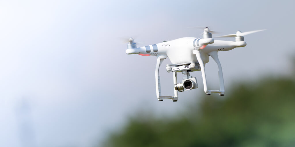
Aerial imagery involves capturing images from aircrafts or drones also known as UAVs (Unmanned Aerial Vehicles) flying at lower altitudes. These drones can capture high-resolution images and videos of specific locations, making them ideal for in-depth analysis of particular objects. Additionally, they can be outfitted with various sensors, such as thermal cameras and LiDAR, enhancing their capacity to provide additional insights regarding the Earth’s surface.
Advantages of Aerial Imagery
Higher Resolution: Aerial imagery, often acquired at lower altitudes compared to satellites, offers significantly higher spatial resolution. Spatial resolution refers to the level of detail captured in an image, and higher resolution means that smaller objects or features can be discerned. This characteristic makes aerial imagery ideal for tasks that require detailed mapping, such as land surveying, urban planning, and infrastructure inspection.
Flexibility: Aerial missions using drones are highly customizable to suit the specific requirements of a project. This flexibility extends to several aspects of the mission, including flight altitude, sensor selection, and timing.
Rapid Deployment: One of the remarkable advantages of aerial imagery using drones is rapid deployment. This feature is particularly valuable in time-sensitive applications, such as disaster response, where it can significantly improve response times. In the aftermath of natural disasters like earthquakes, floods, or wildfires, drones can be swiftly dispatched to assess the extent of damage, locate survivors, or identify areas in need of immediate assistance.
Real-Time Monitoring: Drones equipped with advanced sensors and communication technology can capture and transmit real-time data. This capability enables real-time monitoring, allowing decision-makers to access live information and make immediate decisions.
Limitations of Aerial Imagery
Limited Coverage: Aerial imagery covers a smaller geographic area per flight due to the limited range and endurance of drones. Typically, drones have a flight time of only a few hours, which necessitates frequent landings and takeoffs, making them less efficient for extensive surveying projects.
Weather Sensitivity: Like satellite imagery, aerial data collection can be hindered by adverse weather conditions, potentially leading to mission cancellations.
Regulations: Drone operations are subject to various regulations and airspace restrictions, which can add complexity to aerial data acquisition.
Choosing the Right Tool for the Job
When deciding between satellite and aerial imagery, it’s essential to consider the specific requirements of your project:
Scope and Scale: For large-scale projects covering vast areas, satellite imagery may offer cost-effective coverage. Aerial imagery is better suited for smaller, high-detail projects.
Frequency: Determine if you need real-time or frequent updates. Aerial imagery is more flexible for immediate data collection, while satellites provide regular but less frequent revisits.
Spatial Resolution: Assess the level of detail required for your application. Aerial imagery excels when fine details are critical.
Weather and Accessibility: Consider the weather conditions and regulatory constraints in your region. Aerial imagery may be preferred for immediate response in unpredictable conditions.
Conclusion
In the realm of geographic data and imagery, there is no one-size-fits-all solution. Both satellites and drones both play pivotal roles, each presenting distinct advantages and constraints. The choice between them depends on the unique needs of your project. By understanding the advantages and limitations of each technology, you can make informed decisions that maximize the effectiveness of your applications. To enhance your geospatial data analysis, consider utilizing FlyPix AI. Our versatile object detection platform effectively processes both satellite and aerial imagery, enabling you to maximize your data’s potential and make informed decisions. Contact us today to learn more.


