
")
Introduction
Amid growing environmental concerns and the need for efficient urban planning, tree detection from aerial imagery has become a critical requirement for various industries. Organizations and authorities have sought ways to monitor deforestation, map green spaces in cities, and assess potential risks posed by trees to residential areas.
Fortunately, advancements in machine learning and artificial intelligence (AI) have made automatic tree detection a reality, presenting an efficient solution to these challenges.
FlyPix AI’s object detection capabilities offer a way to fulfil these needs, delivering substantial time savings and increased efficiency. In this article, we will explore how FlyPix AI empowers organizations with its automatic tree detection capabilities, providing valuable insights for deforestation monitoring, urban planning, and risk assessment.
Tree Detection with FlyPix AI
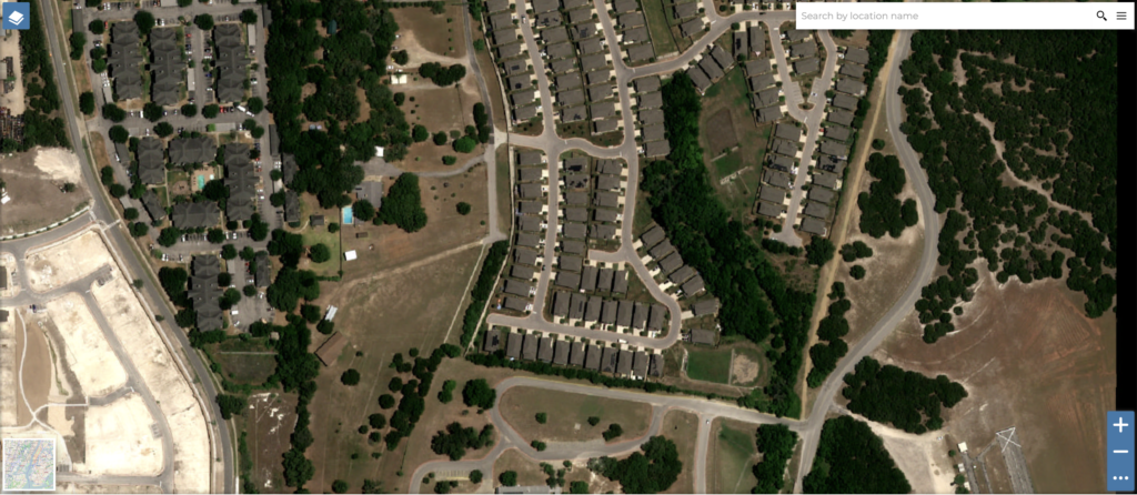
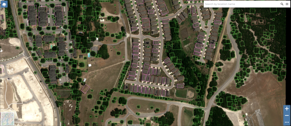
FlyPix AI leverages state-of-the-art deep learning algorithms to accurately detect and recognize objects from aerial imagery. This positions FlyPix as the optimal tool to efficiently process extensive amounts of geospatial data and identify objects of interest, such as trees, with remarkable accuracy across diverse environments. As a result, FlyPix AI emerges as the ideal solution for a wide array of applications, including environmental monitoring and urban planning tasks.
Explore Tree Object Detection Use Cases:
Deforestation Monitoring
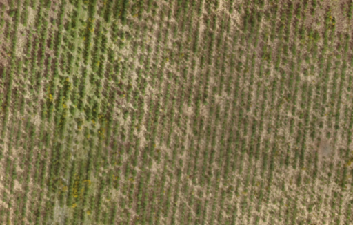
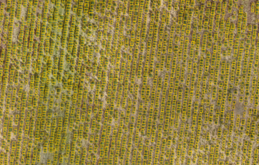
One of FlyPix AI’s prominent use cases is in deforestation monitoring. Conservation organisations and governmental agencies are leveraging the platform to detect and track changes in forest cover over time. By analyzing satellite imagery, FlyPix AI can accurately detect the number of trees in a given area and changes in tree density and distribution, enabling prompt intervention and conservation efforts.
Mapping Recreational Zones in Cities
Urban planning and development require careful assessment of green areas, parks, and recreational zones within cities. FlyPix AI is assisting city planners and municipal authorities in accurately mapping and analyzing such green spaces, contributing to more sustainable urban environments.
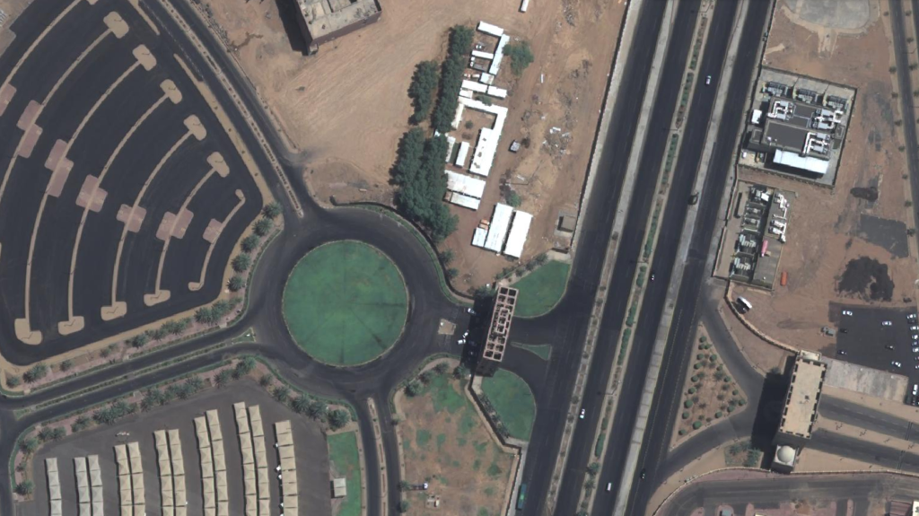
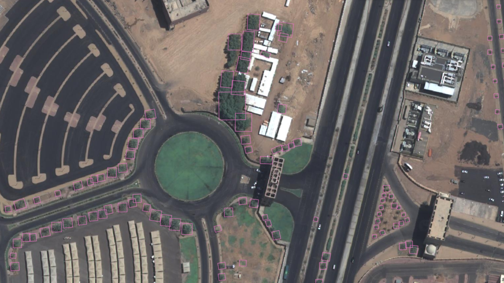
Assessing Tree-Falling Risks for Residential Areas
For insurance companies concerned about the risk of trees falling on houses, FlyPix AI also proves invaluable. By measuring the distance between trees and residential structures, the platform aids in precisely estimating the associated risks. This enables insurance companies to assign appropriate policies and homeowners to take proactive measures, ensuring the safety and protection of their properties.
Conclusion
FlyPix AI’s geospatial capabilities for object detection, segmentation, and localization have enabled it to become a vital tool for diverse industries. Through its application in tree detection, FlyPix AI is facilitating deforestation monitoring, urban planning, and risk assessment, among other essential tasks. As technology continues to advance, FlyPix AI is poised to play an increasingly pivotal role in shaping a more sustainable and data-driven future.
If your organization requires advanced geospatial analysis to address complex challenges and make informed decisions, don’t hesitate to contact us. Our team is eager to discuss how our platform can tailor to your unique needs and drive impactful results.