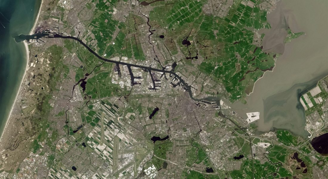
Location intelligence is no longer just about plotting points on a map. It’s about unlocking the stories hidden in geospatial data and applying them to real-world decisions. The companies leading this field design platforms that process satellite, aerial, and ground-level information—helping teams monitor land use, improve infrastructure management, optimize logistics, and understand how people move through cities. In this article, we’ll spotlight the top players shaping the location intelligence market and see how their tools stand out.

1. FlyPix AI
At FlyPix AI, we focus on automating the processing of satellite, aerial, and drone imagery. Instead of manually labeling objects, we train custom models that recognize project-specific features. No programming skills are required, so teams can adapt our platform to their needs without outside support. By cutting repetitive annotation, we spend more time interpreting results and making decisions.
Our platform is flexible across industries. In construction, agriculture, port operations, and forestry, we adjust detectors and workflows to very different feature types. Cloud-based processing lets us handle large image volumes without local infrastructure, scale quickly, and keep pipelines consistent. This reduces routine work and helps us apply insights faster.
Key Highlights:
- Custom AI models trained without coding
- Automated object detection in satellite, aerial, and drone images
- Adaptable to multiple industries and project types
- Cloud-based processing for scalability
- Annotation tools for defining project-specific needs
Services:
- AI-driven image analysis
- Custom model training for geospatial detection
- Industry-specific geospatial monitoring
- Infrastructure and land-use classification
- Support for large-scale image datasets
Contact Information:
- Website: flypix.ai
- LinkedIn: www.linkedin.com/company/flypix-ai
- Address: Robert-Bosch-Str. 7, 64293 Darmstadt, Germany
- Phone Number: +49 6151 2776497
- Email: info@flypix.ai

2. TomTom
TomTom provides mapping and location technology used to build mobility solutions. The platform blends proprietary data with open sources to support custom maps, routing, and traffic-aware applications. APIs and SDKs help teams add navigation, fleet features, and traffic analysis without rebuilding core map functions.
Adoption spans sectors that depend on precise location context, including public projects, automated driving work, and logistics. Tooling focuses on routing choices, real-time traffic signals, and analytics that explain movement patterns so plans and operations align with on-the-ground conditions.
Key Highlights:
- Mapping platform built on proprietary and open data
- APIs and SDKs for navigation, routing, and traffic analytics
- Focus on sectors like public transport, fleets, and automated driving
- Real-time and historical traffic data solutions
- Flexible tools for developers and enterprises
Services:
- Map creation and customization
- Navigation SDKs for mobile and automotive
- Traffic monitoring and analysis
- Fleet and logistics optimization
- Public sector location intelligence solutions
Contact Information:
- Website: www.tomtom.com
- LinkedIn: www.linkedin.com/company/tomtom
- Facebook: www.facebook.com/TomTom
- Twitter: x.com/tomtom
- Instagram: www.instagram.com/tomtomglobal

3. GeoIQ
GeoIQ builds tools for evaluating locations from city scale down to streets and properties. The platform brings together demographics, foot traffic, and competitor context to highlight opportunity and risk for site planning and network changes.
Workflows support decisions at multiple levels, from market prioritization to property checks. Beyond retail, outputs assist with revenue estimation, trade area analysis, and data enrichment, giving teams a clearer view of local demand and neighborhood dynamics.
Key Highlights:
- Location analysis from city to property level
- Integration of demographics, foot traffic, and competitor data
- Tools for market and street prioritization
- Support for site selection and expansion strategies
- Data security aligned with global standards
Services:
- Site selection and expansion planning
- Trade area and market analysis
- Revenue prediction and risk assessment
- Customer data enrichment
- Competitor and catchment analysis
Contact Information:
- Website: geoiq.ai
- LinkedIn: www.linkedin.com/company/geoiq-ai
- Address: UrbanVault 762, 19th Main Rd, Garden Layout, Sector 3, HSR Layout, Bengaluru, Karnataka 560102
- Phone Number: +91 8368660597
- Twitter: x.com/geoiq_ai
- Instagram: www.instagram.com/geoiq.ai
- Email: hello@geoiq.io

4. Esri (ArcGIS)
ArcGIS connects and visualizes data through geography in a single platform. Mapping, spatial analytics, and data integration live together so teams can explore patterns, test scenarios, and manage assets with location as the organizing layer.
Use spans planning, infrastructure, environment, and public services. Tooling covers online, desktop, and enterprise needs, making it possible to build maps, analyze trends, and share results across departments without shifting between disconnected systems.
Key Highlights:
- Comprehensive GIS platform with online, desktop, and enterprise tools
- Focus on integrating data with spatial context
- Used across government, commercial, and nonprofit sectors
- Supports climate, housing, and infrastructure projects
- Training and community resources available for users
Services:
- ArcGIS platform for mapping and analysis
- Data integration and visualization
- Spatial analysis for decision-making
- Industry-specific solutions for public sector, AEC, and environment
- Training, support, and user community programs
Contact Information:
- Website: esri.com
- LinkedIn: www.linkedin.com/company/esri
- Address: 380 New York Street Redlands, California
- Phone Number: +1-909-793-2853
- Facebook: www.facebook.com/esrigis
- Twitter: x.com/Esri
- Instagram: www.instagram.com/esrigram

5. INRIX
INRIX turns mobility data into tools for street management and network planning. Products cover traffic patterns, signal performance, roadway analytics, parking, and curb use, with outputs that slot into existing dashboards and workflows.
Operational needs are supported without new roadside hardware. Teams study intersection timing, set curb rules, track trips, and surface safety alerts. Developer APIs expose routing, speeds, volumes, and signal metrics for custom applications.
Key Highlights:
- Traffic, parking, curb, and safety analytics in one ecosystem
- Signal and roadway performance insights for network management
- Trip and cross-border movement analysis for planning
- APIs for speeds, volumes, routing, and signal metrics
- Tools suited for cities, agencies, automakers, and logistics
Services:
- Traffic and congestion analysis
- Signal timing and corridor performance evaluation
- Parking and curb space management
- Safety alerts and crash risk analysis
- Trip analytics and drive-time studies
- Developer APIs and data delivery
Contact Information:
- Website: inrix.com
- LinkedIn: www.linkedin.com/company/inrix
- Facebook: www.facebook.com/INRIXinc
- Twitter: x.com/inrix

6. HERE Technologies
HERE Technologies operates a unified live map platform for navigation, routing, and location services at global scale. Automotive programs use the stack for in-car experiences, automated driving support, and connected services.
Beyond automotive, the same foundation supports logistics, urban mobility, and energy use cases. Emphasis sits on precision, data control, and adaptive layers so solutions can align with specific operational requirements.
Key Highlights:
- Unified live map platform covering multiple industries
- Strong presence in automotive navigation and connected vehicles
- Global data coverage with real-time updates
- Tools for automated driving, EV routing, and digital cockpit experiences
- Partnerships with major enterprises and technology providers
Services:
- Live map data for navigation and routing
- Automated driving and safety systems support
- EV routing and charging optimization
- Digital cockpit and connected services for vehicles
- Location solutions for logistics, mobility, and urban planning
Contact Information:
- Website: www.here.com
- LinkedIn: www.linkedin.com/company/here
- Facebook: www.facebook.com/here
- Twitter: x.com/HERE
- Instagram: www.instagram.com/here

7. Location, Inc.
Location, Inc. builds data platforms that connect geography with risk, property insight, and business context. Outputs help insurers, real estate teams, and operators quantify exposure and evaluate markets.
Tooling supports property-level assessment, market scoring, and enrichment of business data with spatial attributes. Proprietary methods include school and neighborhood ratings backed by patent filings to standardize comparisons across regions.
Key Highlights:
- Location intelligence tailored to industries like insurance and real estate
- Risk assessment tools based on geographic context
- Proprietary algorithms for school and neighborhood ratings
- Patent-backed methods for data analysis
- Integration with business and operational workflows
Services:
- Risk assessment platforms for insurance
- Real estate and property intelligence tools
- Business data enrichment with geographic context
- School and neighborhood rating algorithms
- Custom data solutions for enterprise clients
Contact Information:
- Website: locationinc.com
- LinkedIn: www.linkedin.com/company/location-inc-
- Address: 40 Pacifica, Suite 900, Irvine, CA 92618
- Phone Number: (508) 753-8029
- Twitter: x.com/locationinc
- Email: info@locationinc.com

8. LocationIQ
LocationIQ provides APIs for geocoding, maps, and routing, serving as an alternative to other mapping platforms. Their services allow developers to translate coordinates to addresses, display maps in applications, and calculate routes between points. The platform is positioned to be affordable and scalable for projects of different sizes.
They rely on data from open sources like OpenStreetMap and OpenAddresses, which makes their coverage global. Developers use LocationIQ for a range of tasks such as asset tracking, fleet optimization, store locators, or integrating location data into websites and mobile apps. The emphasis is on straightforward integration and flexibility in licensing.
Key Highlights:
- Geocoding, mapping, and routing APIs
- Global coverage powered by open data sources
- Focus on affordability and scalability
- Flexible licensing for different project types
- High availability with global datacenters
Services:
- Forward and reverse geocoding
- Static and dynamic map visualization
- Routing and distance matrix APIs
- Asset tracking and fleet optimization
- Location-based features for websites and apps
Contact Information:
- Website: locationiq.com
- LinkedIn: www.linkedin.com/company/locationiq
- Address: Milpitas, CA, United States
- Phone Number: +1-415-651-7129
- Twitter: x.com/location_iq
- Email: hello@locationiq.com

9. Localyse
Localyse partners with organizations to get more value from Google Maps and Google Cloud. Work includes address validation, map performance tuning, and traffic analysis through tools such as ODIQ, plus integrations with Google Earth Engine for environmental and planning projects.
Engagements span customer journeys, process automation, and insight extraction from underused location data. Operations cover Belgium and the Netherlands with sector examples in transport, retail, and municipal services.
Key Highlights:
- Google Premier Partner focused on location-based services
- Tools for traffic analysis, address validation, and map optimization
- Expertise with Google Maps Platform and Google Earth Engine
- Support for both customer-facing and internal business processes
- Case studies across transport, recycling, and public safety
Services:
- Google Maps and Google Cloud integration
- Address validation and location data management
- Traffic analysis with ODIQ
- Environmental monitoring with Google Earth Engine
- Consulting and support for location-based strategies
Contact Information:
- Website: localyse.eu
- LinkedIn: www.linkedin.com/company/localysegroup
- Address: Prins Boudewijnlaan 41 2650 Edegem
- Phone Number: +32 (0)3 375 70 36
- Email: info@localyse.eu

10. Pointr
Pointr specializes in indoor mapping, positioning, and wayfinding for complex venues such as workplaces, hospitals, retail, airports, and events. The platform produces digital building maps, enables turn-by-turn navigation, and locates assets and people with in-building accuracy.
SDKs and APIs let teams add indoor maps to mobile, web, and kiosk apps with minimal code. Beyond navigation, features include geofencing and movement analytics, plus tooling to convert floor plans into structured indoor maps at scale.
Key Highlights:
- Indoor mapping, positioning, and wayfinding for complex venues
- SDKs and APIs for web, iOS, and Android
- Tools to convert floor plans into usable indoor maps
- Geofencing and analytics for in-building insights
- Deployments across workplace, healthcare, retail, aviation, and events
Services:
- Indoor map creation and maintenance
- Turn-by-turn indoor navigation and wayfinding
- Indoor positioning and asset location
- Geofencing and movement analytics
- Developer tooling, SDKs, and implementation support
Contact Information:
- Website: www.pointr.tech
- LinkedIn: www.linkedin.com/company/5364957
- Address: Office 1-10, The Fulham Centre, 20 Fulham Broadway, London, SW6 1AH
- Phone Number: 44-(0)2087207087
- Twitter: x.com/PointrTech
- Email: contact@pointr.tech

11. NIQ
NIQ provides consumer and market measurement that supports location-shaped choices. Insights cover category performance, channel mix, and shopper behavior, which can inform site selection, assortment by area, and regional campaigns.
The platform spans tracking, analysis, and activation. Teams compare channels, test pricing or promotions, and link findings to where customers shop, creating a bridge between market signals and place-based decisions.
Key Highlights:
- Consumer and market measurement used for planning by region and channel
- Insights that support site selection, assortment, and pricing choices
- Tools for brand, media, and innovation analytics
- Coverage across retail and tech and durables categories
- Expert support and partner ecosystem
Services:
- Market and category measurement
- Consumer behavior and panel insights
- Pricing, promotion, and assortment analytics
- Brand and media effectiveness studies
- Data access and advisory support
Contact Information:
- Website: nielseniq.com
- LinkedIn: www.linkedin.com/company/nielseniq
- Address: 200 West Jackson Boulevard Chicago, Illinois 60606 United States
- Phone Number: (312) 583-5100
- Facebook: www.facebook.com/NielsenIQ.global
- Twitter: x.com/nielseniq
- Instagram: www.instagram.com/nielseniq
- Email: media.relations@nielseniq.com

12. AirSage
AirSage focuses on mobility datasets for planning, safety, and project delivery. Sourcing spans multiple streams, with outputs tailored to needs such as origin-destination matrices, trip traces, pedestrian density, and targeted location analysis.
Transportation safety and operations are supported through event and trajectory data. Teams flag corridors, study access to key sites, and compare scenarios during planning. Deliverables arrive as structured files ready for common models, GIS tools, and dashboards.
Key Highlights:
- Mobility data tailored to project scope and geography
- Multiple data sources for broader coverage and consistency
- Options spanning origin-destination, trajectories, and activity density
- Safety event datasets for network screening and planning
- Deliverables designed for common GIS and modeling tools
Services:
- Custom mobility data procurement and processing
- Origin-destination and trip analytics
- Safety event and conflict analysis support
- Pedestrian and activity density reporting
- Target site and corridor evaluation for plans and grants
Contact Information:
- Website: airsage.com
- LinkedIn: www.linkedin.com/company/airsage
- Address: 2146 Roswell Rd, Suite 108, PMB 862, Marietta, GA 30062
- Phone Number: (404) 809-2499
- Twitter: x.com/AirSage
- Email: support@airsage.com

13. Latlong
Latlong offers a stack for market and location analytics. Core APIs cover geocoding, reverse geocoding, place search, and point matching. Aaloka provides a no-code analytics layer for customer and territory insight, while Anuga adds fleet tracking and survey tools for field teams.
Focus sits on practical workflows for marketing and sales. Users identify strong areas, segment audiences, connect campaign results to place, and close the loop by collecting structured field responses offline and syncing later.
Key Highlights:
- APIs for core mapping and places functions
- No-code analytics for market and customer insights
- Fleet tracking and survey collection with offline support
- Focus on practical workflows for marketing and sales
- Integrations aimed at quick adoption by product teams
Services:
- Geocoding, reverse geocoding, and place search APIs
- Territory and cohort analysis in a no-code interface
- Fleet tracking, form building, and field survey tools
- Audience targeting and campaign performance by area
- Implementation support and developer documentation
Contact Information:
- Website: www.latlong.ai
- LinkedIn: www.linkedin.com/company/onze
- Address: Hubstairs Co-Works No. 882 and 883 KSRTC Layout, J.P. Nagar 3rd Phase, Bengaluru 560078, Karnataka, India.
- Phone Number: +91 95 9115 5334
- Facebook: www.facebook.com/latlong
- Twitter: x.com/latlong_ai
- Instagram: www.instagram.com/latlong_ai
- Email: admin@laltong.ai

14. Locatium
Locatium delivers a cloud platform that blends data streams with optimization models for retail, telecom, smart cities, logistics, and mobility. Predictive modeling and industry algorithms support scenario testing, option comparison, and strategy choices for sites and networks.
Dashboards visualize model outputs on maps and guide moves from analysis to action. Work covers strategic and operational levels so teams can evaluate sites, plan coverage and rollout, and design multimodal networks with fewer manual steps.
Key Highlights:
- Cloud platform combining location data with optimization models
- Scenario testing for site, network, and coverage planning
- Industry algorithms for retail, telco, logistics, and mobility
- Map-based dashboards to review and compare outcomes
- Workflow designed to reduce manual analysis steps
Services:
- Site selection and network redesign for retail
- Coverage and rollout planning for telecom
- Logistics routing and territory optimization
- Public transport and mobility network analysis
- Data onboarding, modeling setup, and ongoing support
Contact Information:
- Website: locatium.ai
- LinkedIn: www.linkedin.com/company/locatiumsolutions
- Address: Boulevard Plaza Tower 2, (Floor 22), Downtown, Dubai, UAE
- Facebook: www.facebook.com/Locatium-107987975129434
- Instagram: www.instagram.com/locatium.ai

15. Geoblink
Geoblink offers a location management platform for retailers and consumer brands. Internal business data is centralized and layered with external inputs such as footfall, spending patterns, and competitor activity to show performance in local context.
Workflow tools help teams act on findings. Alerts surface issues early, and site or territory plans can be tailored and tracked. Executives, planners, and operations teams share one environment to spot risk, identify growth potential, and adjust strategy based on real conditions.
Key Highlights:
- Location management platform built for multi-site retail networks
- Combines internal performance data with external location datasets
- Automatic alerts for site performance issues
- Supports planning, sales, and operational use cases
- Tools to identify growth opportunities and risks across the network
Services:
- Data integration and centralization for retail networks
- Location intelligence and performance monitoring
- Site selection and network optimization
- Alerts and reporting for operational teams
- Strategic planning tools for product mix, campaigns, and relocation decisions
Contact Information:
- Website: www.geoblink.com
- LinkedIn: www.linkedin.com/company/13224055
- Email: info@geoblink.com
Conclusion
Location intelligence is not a single product but a toolkit. Some platforms center on base maps and APIs, others on mobility and traffic, indoor navigation, retail network planning, or risk and property context. Each solves a different slice of the problem, so the right pick depends on the questions you need to answer and how the results plug into your daily work.
A simple way to choose: define the decision first, then match the tool to the output you need. Check data sources and coverage, privacy and compliance, API limits, and how well it fits your stack. Put usability for your team ahead of shiny features. Run a small pilot against a clear baseline, measure outcomes, and scale only if it proves its value. Fewer tools used well will beat a big stack you cannot maintain.
