
Reality Capture depends on the right hardware to turn real-world objects into precise digital models. From high-resolution cameras to LiDAR scanners, drones, and powerful computers, every component plays a role in capturing and processing accurate 3D data. Whether you’re scanning buildings, landscapes, or small objects, choosing the best gear ensures smoother workflows and better results.
What is Reality Capture?
Reality Capture is a technology that enables the digital reconstruction of real-world objects, spaces, and environments. By utilizing imaging techniques such as photogrammetry, LiDAR (Light Detection and Ranging), laser scanning, and depth-sensing cameras, it generates highly accurate 3D models. These models are widely used in industries where precision and spatial data are critical, including construction, urban planning, industrial design, and digital content creation.
At its core, Reality Capture transforms physical spaces into digital assets. This process allows professionals to analyze, modify, and integrate real-world data into their workflows. The ability to create digital twins-virtual replicas of physical structures or objects-offers significant advantages. These models enable real-time collaboration, reduce errors in planning, and eliminate the need for multiple on-site visits.
Reality Capture is applied in various fields:
- Architecture, Engineering, and Construction (AEC): Used for site surveys, BIM (Building Information Modeling), and progress tracking.
- Geospatial Mapping and Infrastructure: Helps in city planning, environmental monitoring, and topographic mapping.
- Manufacturing and Product Design: Supports reverse engineering, quality control, and rapid prototyping.
- Heritage Preservation and Cultural Documentation: Digitizes historical artifacts, landmarks, and archaeological sites for restoration and study.
- Entertainment and Virtual Production: Used in film, gaming, and VR for creating realistic environments and 3D assets.
The versatility of Reality Capture makes it a powerful tool for professionals who need accurate spatial data, whether for construction management, research, or immersive digital experiences.
Why is Choosing the Right Equipment Important?
The effectiveness of Reality Capture depends on the hardware used. High-resolution imaging, precise laser scanning, and powerful processing tools ensure that the final 3D model is accurate and usable. Different projects require different levels of precision and scalability, making equipment selection a key factor in workflow efficiency.
When choosing hardware, professionals must consider multiple factors, including data accuracy, project scale, and compatibility with processing software. A poorly chosen device can lead to errors in measurements, inefficient workflows, and increased costs.
Several factors influence hardware selection:
- Accuracy & Precision: The resolution of cameras and LiDAR sensors determines the detail of the captured data.
- Project-Specific Needs: Large-scale infrastructure projects require drones and laser scanners, while product design may only need structured-light scanners.
- Processing Power: The speed and efficiency of Reality Capture software depend on high-performance GPUs and CPUs.
- Software Compatibility: Captured data must integrate seamlessly with industry-standard software for efficient processing and visualization.
- Cost Considerations: Balancing budget constraints with the need for high-quality data capture is essential for maximizing return on investment.
Additionally, scalability plays a crucial role. As Reality Capture technology evolves, AI-driven processing, real-time 3D modeling, and cloud-based collaboration demand more powerful and flexible systems. Investing in upgradeable and future-proof hardware ensures long-term efficiency.
By selecting the right equipment, businesses and professionals can streamline workflows, reduce errors, and fully leverage the potential of Reality Capture in their industries.
Cameras and Sensors
Cameras and sensors serve as the primary tools for collecting data in Reality Capture. They determine the level of detail, accuracy, and realism in the final 3D model. Without high-quality image data, software algorithms cannot reconstruct an accurate digital representation.
Types of Cameras Used in Reality Capture
- RGB Cameras: These standard digital cameras capture high-resolution color images. When used in photogrammetry, overlapping images are stitched together to create 3D models.
- Multispectral and Thermal Cameras: These cameras go beyond visible light, capturing different wavelengths for applications in agriculture, environmental monitoring, and industrial inspections.
- 360-Degree Cameras: These provide panoramic views for virtual reality (VR) experiences, real estate walkthroughs, and immersive digital environments.
- LiDAR Sensors: Unlike traditional cameras, LiDAR sensors use laser pulses to measure distances, creating highly accurate depth maps.
Essential Camera Features
A professional-grade camera for photogrammetry must deliver consistency and precision. Key attributes include:
Resolution
A minimum of 24 megapixels ensures sufficient detail for most models, though 36-50 megapixels is ideal for large or intricate subjects. Higher resolution translates to finer granularity in the resulting mesh.
Manual Controls
Full command over exposure, aperture, and ISO allows for uniform shots across changing conditions-crucial when lighting shifts mid-session.
RAW Format Support
RAW files retain unprocessed sensor data, offering greater flexibility for adjustments during processing compared to compressed JPEGs.
Prime Lenses
Fixed focal length lenses (e.g., 50mm f/1.8) minimize optical distortion, ensuring cleaner alignment in RealityCapture compared to zoom lenses, which can introduce subtle warping.
Cameras You’ll Love
- Nikon D7200: A 24.2 MP workhorse that’s affordable and reliable. Great for snapping small stuff like sculptures or outdoor scenes.
- Sony a7 III: Full-frame goodness with 24.2 MP and killer low-light skills-perfect for moody indoor shoots or dusk landscapes.
- Canon EOS R5: A 45 MP beast for pros who want insane detail. Imagine scanning a cathedral and seeing every crack!
- Nikon Z5 + 40mm Lens: Compact and mirrorless, it’s a budget-friendly pick for fieldwork.
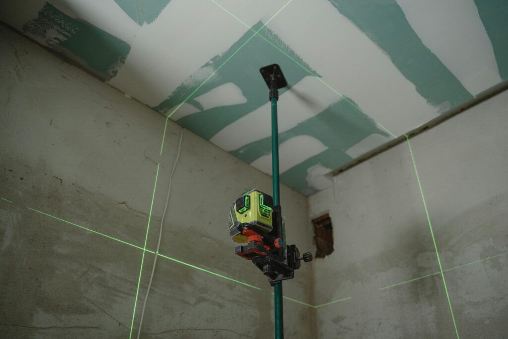
Laser Scanners
Unlike cameras, which rely on images, laser scanners generate 3D data directly. These devices emit laser pulses that bounce off surfaces and return to the scanner, calculating distances with extreme accuracy. This allows them to create point cloud models of physical spaces, capturing fine details that cameras alone might miss.
Types of Laser Scanners
- Terrestrial Laser Scanners (TLS): These are stationary scanners, often mounted on tripods, that provide precise measurements of buildings, construction sites, and industrial facilities. They are ideal for scanning interiors and static objects.
- Mobile Laser Scanners (MLS): These scanners are mounted on moving platforms, such as vehicles or handheld devices, to capture 3D data while in motion. They are often used for urban mapping, road scanning, and large-scale infrastructure projects.
- Airborne LiDAR: Installed on drones, helicopters, or airplanes, these scanners are used for topographical surveys, environmental studies, and forestry mapping.
Where Laser Scanners Are Used
Laser scanners play a crucial role in Reality Capture applications that require extreme accuracy. In architecture, they are used to create as-built models of existing buildings. In industrial settings, they help engineers analyze factory layouts. In city planning, airborne LiDAR enables large-scale mapping without requiring teams to be on the ground.
Laser Scanners You’ll Love
- Leica RTC360: A high-speed 2 million points per second scanner with real-time registration. Ideal for architecture, construction, and industrial sites.
- FARO Focus Premium: 350m range with ±1mm accuracy, lightweight, and perfect for infrastructure mapping, site monitoring, and heritage preservation.
- Trimble X7: Automated calibration, high-precision point clouds, and seamless BIM/GIS integration. Great for engineering, surveying, and facility management.
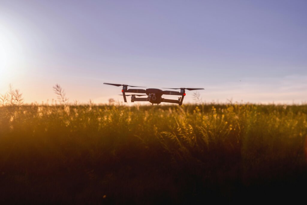
Drones
Drones have made Reality Capture more accessible by allowing professionals to collect data from angles and locations that were previously difficult or expensive to reach. They provide aerial perspectives that are particularly useful for mapping, surveying, and large-scale construction monitoring.
What to Look for in a Reality Capture Drone
- Flight Stability and GPS Accuracy: Drones need to maintain stable flight paths to ensure precise data collection. Advanced models feature RTK (Real-Time Kinematic) GPS for centimeter-level positioning accuracy.
- Payload Capacity: Determines what kind of cameras or LiDAR sensors the drone can carry. Some drones are designed for photogrammetry with high-resolution cameras, while others are built to handle heavier LiDAR scanners.
- Battery Life: The longer a drone can stay in the air, the more data it can collect in a single flight. This is critical for large-scale surveys.
- Automated Flight Modes: Many drones offer pre-programmed flight paths and AI-assisted data collection, which simplifies Reality Capture operations.
Industries That Benefit from Drone-Based Reality Capture
- Construction: Monitoring site progress, creating accurate 3D site models, and improving safety inspections.
- Urban Planning: Mapping entire neighborhoods and infrastructure layouts efficiently.
- Environmental Science: Studying landscapes, tracking deforestation, and monitoring coastal erosion.
- Agriculture: Using multispectral cameras to analyze crop health and optimize farming practices.
Drones have become an essential tool for Reality Capture, making large-scale 3D mapping faster, safer, and more cost-effective than traditional ground-based methods.
Drones You’ll Love
- DJI Phantom 4 RTK: High-precision mapping with centimeter-level accuracy, built-in RTK module, and long flight time. Perfect for surveying, construction, and land-use planning.
- DJI Mavic 3 Enterprise: Compact, 56x hybrid zoom, and thermal imaging for infrastructure inspection, forestry, and emergency response.
- senseFly eBee X: Fixed-wing drone with 90-minute flight time and interchangeable sensors for large-scale mapping, agriculture, and environmental monitoring.
- DJI Matrice 300 RTK: Heavy-lift drone with LiDAR compatibility, multi-payload support, and extreme durability for industrial surveys, oil & gas, and utility inspections.
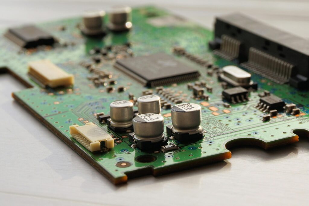
The Ultimate PC Setup for RealityCapture Performance
Once the data is collected, the next challenge is processing it into a usable format. Reality Capture involves handling massive datasets-sometimes consisting of millions or even billions of data points. Without the right computing resources, this process can be slow and inefficient.
Key Hardware Requirements for Reality Capture Processing
- High-Performance CPUs and GPUs: The faster the processor and graphics card, the quicker Reality Capture software can generate 3D models. GPUs are particularly useful for rendering high-resolution textures and handling complex point clouds.
- Ample RAM and Fast Storage: Since Reality Capture software processes large image sets, at least 32GB of RAM is recommended for professional workflows. Fast SSD storage is also critical for quickly loading and saving data.
- Cloud-Based Solutions: Many professionals are shifting to cloud computing for Reality Capture, allowing for scalable processing power without needing expensive local hardware. Cloud services enable remote collaboration, making it easier for teams to work on large projects from different locations.
Below is a detailed breakdown of each component, explaining what it is and why it matters.
CPU (Central Processing Unit) – The Brain of Your PC
The CPU is the main processing unit of your computer, responsible for executing tasks and calculations. In RealityCapture, the CPU handles data processing, image alignment, and certain reconstruction steps.
Best Options:
- AMD Ryzen 9 7950X – 16 cores / 32 threads, high single-core performance
- Intel Core i9-14900K – 24 cores (8 Performance cores, 16 Efficiency cores), excellent clock speeds
For Extreme Workloads:
- AMD Threadripper 7970X (32 cores) / 7980X (64 cores) – Designed for workstation-level processing
- Intel Xeon W-2400 / W-3400 series – Built for high-end professional applications
Why is it important?
RealityCapture requires a processor with high clock speeds for quick calculations and multiple cores to handle large datasets efficiently.
GPU (Graphics Processing Unit) – Accelerates 3D Processing
The GPU is responsible for rendering graphics and performing parallel computing tasks. In RealityCapture, it speeds up depth map generation and 3D reconstruction using CUDA cores.
Best Options:
- NVIDIA RTX 4090 – 24GB VRAM, the most powerful consumer GPU for RealityCapture
- NVIDIA RTX 4080 Super 16GB VRAM, strong CUDA performance at a lower cost
- NVIDIA RTX 6000 Ada Generation – 48GB VRAM, designed for massive datasets and professional workflows
Budget-Friendly Option:
- NVIDIA RTX 4070 Ti Super – Decent CUDA performance for smaller projects
Why is it important?
RealityCapture relies on NVIDIA’s CUDA technology for processing 3D reconstructions much faster than a CPU alone could.
RAM (Random Access Memory) – Handles Large Data Sets
RAM is your computer’s short-term memory, where active data is stored for quick access. More RAM allows RealityCapture to process large projects without slowing down.
Recommended RAM:
- Minimum: 32GB – Suitable for small to medium projects
- Recommended: 64GB – Ideal for professional use with larger datasets
- For Heavy Projects: 128GB+ – Required for handling aerial mapping and large-scale photogrammetry
Why is it important?
If you don’t have enough RAM, RealityCapture may be forced to use slower storage drives for temporary data, significantly reducing performance.
Storage – Fast Access to Large Files
Storage determines how quickly your computer can read and write data. RealityCapture processes huge amounts of information, so fast storage is essential.
Best Storage Setup:
- Primary Drive (OS & Software): 2TB NVMe Gen 4 SSD (Samsung 990 Pro, WD Black SN850X) – Runs Windows and RealityCapture at high speed
- Working Drive (Project Files & Cache):
4TB+ NVMe Gen 4 SSD (Sabrent Rocket 4 Plus, Crucial T700) – Stores active projects for the fastest processing - Backup Storage (Long-Term Archiving): 10TB+ HDD (Seagate IronWolf Pro, Western Digital Gold) – Used for storing completed projects
Why is it important?
Slow storage can create bottlenecks, making RealityCapture take longer to load images and save results.
Cooling – Keeps Performance Stable
Cooling prevents your CPU and GPU from overheating, ensuring stable performance during intensive tasks.
Cooling Solutions:
- Air Cooling: Noctua NH-D15 – High-end air cooler for powerful CPUs
- Liquid Cooling: 360mm AIO (Corsair iCUE H150i, NZXT Kraken X73) – Best for heavy workloads
- Workstation Cooling: Custom water loops for Threadripper/Xeon builds
Why is it important?
Overheating can cause your PC to throttle (reduce performance to lower temperatures), slowing down RealityCapture processing.
Power Supply (PSU) – Provides Stable Energy
The power supply unit (PSU) delivers electricity to all components. A high-quality PSU ensures system stability.
Recommended PSU Ratings:
- 850W+ (Platinum-rated): For high-end consumer builds
- 1000W+ (Platinum-rated): Required for Threadripper or multi-GPU configurations
Why is it important?
An insufficient power supply can cause crashes, instability, and system shutdowns during processing.
Monitor – Display Quality for 3D Model Inspection
A good monitor allows you to view and edit high-resolution 3D models with accuracy.
Recommended Displays:
- 32” 4K IPS monitor (LG UltraFine 32UN880, Dell UltraSharp U3223QE) – High-resolution and color accuracy
- Secondary display (optional) – Helps with multitasking and workflow management
Why is it important?
A high-quality display provides better visualization of details in 3D models and ensures accurate editing.
Operating System-The Foundation
RealityCapture is a Windows-exclusive application, making the right OS choice important.
Best Choice:
- Windows 10 or 11 (64-bit): Pro editions offer additional performance enhancements and security features beneficial for professionals.
Pro Tip: Regularly update your OS to maintain system stability. Disable unnecessary background applications to free up system resources. Windows 11 is optimized for multi-core processors, further improving efficiency.
Additional Accessories for a Smoother Workflow
To streamline your photogrammetry process, consider these accessories:
- USB 3.2 / USB-C Hub: Faster file transfers from external storage
- SD/CFexpress Card Reade: Quickly imports images from drones and cameras
- Uninterruptible Power Supply (UPS): Prevents power failures from interrupting long processing sessions
PC Build Recommendations for RealityCapture
Selecting the right hardware is essential for efficient and high-quality 3D scanning. Below are tailored PC builds for different needs and budgets.
Budget-Friendly Starter ($1500–$2000)
Ideal for: Small objects, personal projects, entry-level photogrammetry.
Recommended Setup
- Camera: Nikon D7200
- PC Specs:
- Processor Intel i7-12700K
- Graphics Card RTX 3060
- Memory 32 GB RAM
- Storage 1 TB SSD
This setup is great for beginners who want to explore 3D scanning without a heavy investment.
Mid-Range Professional ($3000–$4000)
Ideal for: Buildings, medium-scale landscapes, professional photogrammetry.
Recommended Setup:
- Drone: DJI Air 3S
- PC Specs:
- Processor AMD Ryzen 9 7950X
- Graphics Card RTX 4080
- Memory 64 GB RAM
- Storage 2 TB SSD
A solid balance of performance and cost, this build is suited for professionals handling larger datasets.
High-End Beast ($6000+)
Ideal for: Large sites, complex 3D models, professional LiDAR scanning.
Recommended Setup
- LiDAR Scanner: NavVis VLX
- PC Specs:
- Processor Threadripper 7980X
- Graphics Card RTX 4090
- Memory 128 GB RAM
- Storage 4 TB SSD
Designed for professionals working with high-precision scans and massive datasets, this build offers top-tier performance.
FlyPix AI: Optimizing Reality Capture Hardware for Wetland Mapping
FlyPix AI transforms how remote sensing technology is used, integrating UAV imagery, satellite data, and LiDAR to provide fast, AI-driven insights for habitat assessment, conservation planning, and land-use management.
By leveraging Reality Capture hardware-drones, high-resolution cameras, and LiDAR scanners-FlyPix AI enables precise identification of wetland boundaries, vegetation types, and hydrological changes. Its no-code AI-powered platform simplifies geospatial analysis, making advanced environmental monitoring accessible to professionals without extensive technical expertise.
Key Features of FlyPix AI in Reality Capture
- AI-Powered Analytics: Uses machine learning to analyze UAV and satellite imagery, providing accurate wetland classification, vegetation health assessment, and hydrological pattern detection.
- No-Code Interface: Designed for accessibility, allowing environmental professionals to generate maps and analyze data without coding experience.
- Multi-Source Data Compatibility: Supports drone imagery, satellite data, and LiDAR, offering flexibility for various mapping and monitoring applications.
- Scalability & Customization: Adaptable for both small-scale wetland studies and large-scale conservation efforts.
Reality Capture Applications in FlyPix AI Services
FlyPix AI enhances mapping efficiency by automating wetland classification, vegetation analysis, and water level monitoring. By using high-resolution cameras, UAVs, and LiDAR, the platform enables rapid, data-driven decision-making while reducing fieldwork costs and minimizing environmental impact.
Core Services:
- UAV-Based Wetland Mapping: High-precision Reality Capture tools define wetland boundaries and classify vegetation.
- Automated Change Detection: AI-powered analysis identifies ecological changes and anomalies over time.
- Hydrological Analysis: Monitors water levels and seasonal variations for wetland health assessments.
- Custom AI Model Development: Tailored AI algorithms for specialized wetland monitoring and environmental compliance.
- 3D Model & Heatmap Generation: Provides enhanced visualization for conservation planning and land-use management.
With seamless integration into existing GIS and land management systems, FlyPix AI ensures that wetland mapping workflows remain efficient, accurate, and actionable. Combining Reality Capture hardware and AI-driven analytics, it sets a new standard for environmental monitoring and ecosystem assessment.
Conclusion
The quality of your Reality Capture results depends on the hardware you use. High-resolution cameras and LiDAR scanners ensure precision, while powerful processors, GPUs, and RAM handle the massive data processing required for 3D modeling. Investing in the right tools reduces errors, speeds up workflows, and delivers better digital reconstructions.
As technology advances, AI-driven enhancements and cloud-based processing will continue to improve Reality Capture. Staying updated with the latest hardware ensures you get the most accurate and efficient results for your industry.
FAQs
A high-resolution DSLR or mirrorless camera (24MP or higher) with RAW support and a prime lens works best for photogrammetry.
LiDAR provides precise depth data for large environments, while photogrammetry is more affordable and detailed for smaller objects.
Yes. A fast CPU (Ryzen 9 or Intel i9), high-end GPU (RTX 4090), 64GB+ RAM, and NVMe SSD storage are recommended for smooth processing.
Absolutely! Drones with RTK GPS and high-resolution cameras or LiDAR sensors are ideal for large-scale aerial 3D scanning.
NVIDIA RTX 4090 is the top choice, but RTX 4080 or 4070 Ti are great for mid-range projects. CUDA cores boost processing speed.
At least 32GB for small projects, 64GB for professional work, and 128GB+ for massive datasets or LiDAR scanning.