

Satellites are classified by orbit (LEO, MEO, GEO, HEO) and function (communication, weather, navigation, Earth observation, scientific, military). Low Earth Orbit satellites circle at 160-1,500 km and capture high-resolution imagery, while geostationary satellites at 35,786 km provide constant coverage for communications and weather monitoring. Each type serves specific real-world applications from GPS navigation to climate research.
Thousands of artificial satellites orbit Earth right now, and they’re not all doing the same thing. Some track hurricanes. Others beam your streaming video across continents. A few are mapping every inch of the planet’s surface.
Understanding satellite types isn’t just academic—it explains why your GPS works differently than weather forecasts, and why some satellite internet has lag while others promise near-instant response times.
Here’s how satellites are categorized, what makes each type unique, and the real-world applications keeping modern civilization connected.
How Satellites Are Classified
Satellites get grouped two ways: by their orbit around Earth, and by what they actually do up there.
Orbital classification matters because altitude determines speed, coverage area, and signal delay. A satellite skimming just above the atmosphere behaves completely differently than one parked 36,000 kilometers out.
Functional classification cuts across orbital types. A communication satellite might sit in geostationary orbit, while another handles the same job from low Earth orbit with a different technical approach.
Classification By Orbit: Altitude Determines Capability
Where a satellite orbits dictates its strengths and limitations. The physics are unforgiving—closer means faster, higher means wider coverage but more delay.
Low Earth Orbit (LEO) Satellites
LEO satellites zip around Earth at altitudes between 160 and 1,500 kilometers. At these heights, they complete one orbit every 90 to 120 minutes.
According to NASA, the Aqua satellite at approximately 705 kilometers altitude requires about 99 minutes to orbit Earth. That speed means a single LEO satellite can pass over the same spot up to 16 times daily.
The proximity to Earth’s surface delivers major advantages. Signal delay stays minimal—just milliseconds. Resolution for imaging satellites reaches impressive detail levels because the cameras are relatively close to their targets.
But there’s a trade-off. Each LEO satellite sees only a small slice of Earth at any moment. Providing continuous global coverage requires constellations of dozens or hundreds of satellites working together.
Real-world LEO applications include Earth observation, some communication networks, scientific research missions, and the International Space Station.
Medium Earth Orbit (MEO) Satellites
MEO satellites occupy the space between 2,000 and 35,786 kilometers above Earth. This orbital zone balances coverage area with signal strength.
Navigation satellite systems particularly favor MEO orbits. GPS satellites, for instance, orbit at approximately 20,200 kilometers. From that altitude, each satellite covers a substantial portion of Earth’s surface while maintaining signals strong enough for precise positioning.
According to ESA’s Galileo program specifications, each satellite carries a passive hydrogen maser clock that is accurate to within 0.45 nanoseconds over 12 hours. This precision enables the meter-level accuracy modern navigation demands.
MEO satellites orbit more slowly than their LEO counterparts but still move relative to Earth’s surface. A constellation approach ensures continuous coverage as satellites pass overhead.
Geostationary Orbit (GEO) Satellites
Geostationary satellites orbit at exactly 35,786 kilometers above Earth’s equator. At this precise altitude, the orbital period matches Earth’s rotation—24 hours.
The result? From the ground, GEO satellites appear to hover motionlessly over a fixed point. This makes them ideal for applications requiring constant coverage of the same geographic area.
According to NOAA, geostationary weather satellites orbit at 22,236 miles (35,786 kilometers) altitude, enabling them to monitor weather systems continuously without the coverage gaps that LEO satellites experience.
Three GEO satellites positioned around the equator can theoretically cover most of Earth’s populated regions. That’s why broadcast television, many communication services, and meteorological monitoring rely heavily on this orbital slot.
The downside? Signal delay becomes noticeable. Radio waves take about 240 milliseconds to travel up to GEO altitude and back, creating lag that matters for real-time applications.
Highly Elliptical Orbit (HEO) Satellites
HEO satellites follow elongated orbits that swing close to Earth at one end and far away at the other. These specialized orbits serve specific geographic or mission needs.
Russia’s Molniya satellites pioneered this approach to serve high-latitude regions poorly covered by geostationary satellites. The orbit spends most of its time at high altitude over northern territories, providing extended coverage windows.
Scientific missions also use HEO orbits to study phenomena at varying distances or to escape Earth’s radiation belts for sensitive measurements.
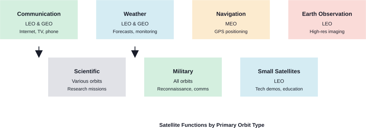
Classification By Function: What Satellites Actually Do
Orbital altitude tells you where a satellite lives. Function tells you why it’s there.
Communication Satellites
Communication satellites relay signals—television broadcasts, internet data, phone calls, military communications. They’re the backbone of global connectivity.
GEO communication satellites dominate traditional broadcasting. Their fixed position means ground antennas don’t need to track moving targets. One satellite can serve an entire continent.
But LEO communication constellations are reshaping the industry. Companies like SpaceX’s Starlink deploy thousands of low-altitude satellites to provide low-latency internet globally. According to NASA’s small spacecraft technology documentation, the Integrated Solar Array and Reflectarray Antenna (ISARA) mission demonstrated high bandwidth Ka-band CubeSat communications with over 100 Mbps downlink rate.
The physics matter here. According to ESA, signals can take up to 24 minutes to travel between Earth and Mars. Even at GEO distances, the roughly 240-millisecond delay affects real-time applications like video calls or online gaming.
Weather Satellites
Weather satellites monitor atmospheric conditions, track storms, measure temperature patterns, and enable the forecasts modern society depends on.
NOAA launched the world’s first meteorological satellite—TIROS-1—on April 1, 1960. That mission demonstrated how cloud patterns visible from space could revolutionize weather prediction.
Modern weather satellites operate in two orbital regimes. Geostationary weather satellites provide continuous monitoring of weather systems as they develop. Polar-orbiting satellites in LEO scan the entire planet twice daily with higher-resolution instruments.
The applications go beyond daily forecasts. According to NOAA, fog is responsible for 70% of ship collisions at sea.
Weather satellites also track hurricanes, measure sea surface temperatures, monitor vegetation health, and provide data for climate research.
Navigation Satellites
Navigation satellites broadcast precise timing signals that receivers use to calculate position. The U.S. GPS system pioneered this approach, but other nations now operate similar constellations.
GPS satellites orbit in MEO at about 20,200 kilometers altitude. Europe’s Galileo system, Russia’s GLONASS, and China’s BeiDou provide alternative or complementary positioning services.
The technology relies on atomic clock precision. Galileo satellites carry hydrogen maser clocks accurate to fractions of a nanosecond. Position calculations depend on measuring signal travel time, so timing errors directly translate to position errors.
Navigation satellites enable obvious applications like car GPS and smartphone maps. But they’re also critical infrastructure for shipping, aviation, agriculture, surveying, military operations, and even financial networks that use GPS timing for transaction synchronization.
Earth Observation Satellites
Earth observation satellites monitor the planet’s surface, oceans, atmosphere, and ice sheets. They track deforestation, measure crop health, map urban growth, and document environmental change.
LEO orbits dominate Earth observation because proximity enables high-resolution imaging. Some satellites capture detail down to sub-meter resolution—enough to distinguish individual vehicles or small structures.
According to the Polar Geospatial Center, satellite remote sensing provides continuous global monitoring impossible through ground-based observation alone. Satellites measure properties across the electromagnetic spectrum, revealing information invisible to human eyes.
During disasters, satellite data becomes critical. NOAA uses satellite imagery to track oil spills, monitor their movement, and coordinate cleanup efforts. The Deepwater Horizon spill in 2010 demonstrated how satellite observations guide response teams even when ground access is limited.
Agricultural applications are expanding rapidly. Satellites monitor soil moisture, track growing seasons, identify plant stress before visible symptoms appear, and help optimize irrigation and fertilizer application.
Scientific Research Satellites
Scientific satellites exist to answer research questions—studying Earth’s magnetosphere, observing distant galaxies, measuring cosmic radiation, testing physics theories in microgravity.
The Hubble Space Telescope exemplifies this category. Hubble operates 24 hours a day, every day of the year, collecting an average of 18 gigabytes of science data each week. Its communication system uses satellites in higher orbits to relay data to ground stations.
Scientific missions often use orbits tailored to their specific research goals. Some need sun-synchronous orbits that maintain constant lighting conditions. Others require high-altitude perches to escape Earth’s radiation belts. Deep space missions might use Earth orbit as a brief stepping stone before heading to other planets.
Military and Reconnaissance Satellites
Military satellites support national security through reconnaissance, surveillance, secure communications, missile warning systems, and signals intelligence.
These satellites span multiple orbital regimes. Spy satellites in LEO capture detailed imagery. Communication satellites in GEO relay secure military traffic. Early warning satellites in HEO detect missile launches.
Specific capabilities remain classified, but the strategic importance is obvious. Modern military operations depend on satellite intelligence, navigation, and communication.
Real-World Satellite Applications That Shape Daily Life
Most people interact with satellite services constantly without realizing it.
Global Communications Infrastructure
Satellite communication enables internet access in remote regions, connectivity for ships and aircraft, and backup for terrestrial networks during disasters.
Traditional GEO satellites handle television broadcasting to millions of homes. Maritime and aviation industries rely on satellite phones and data links. Emergency responders use satellite terminals when ground infrastructure fails.
LEO constellations are democratizing satellite internet. Lower altitude reduces latency to levels competitive with ground-based broadband, making satellite service viable for applications previously limited by signal delay.
Precision Agriculture
Farmers use satellite data to optimize crop management. Multispectral imaging reveals plant health variations invisible to the naked eye. Soil moisture measurements guide irrigation scheduling. Growth monitoring helps predict yields.
Combined with GPS-guided equipment, satellite services enable precision agriculture—applying water, fertilizer, and pesticides only where needed, reducing waste and environmental impact.
Disaster Response and Management
When hurricanes approach, satellites track storm movement and intensity. During wildfires, they map fire perimeters and detect hotspots through smoke. After earthquakes, they identify damaged infrastructure and guide relief efforts.
Satellite communications provide connectivity when ground networks fail. First responders coordinate using satellite phones. Aid organizations use satellite imagery to plan logistics.
Environmental Monitoring and Climate Science
Long-term satellite records document climate change. Ice sheet measurements track melting rates. Sea level monitoring reveals global trends. Atmospheric sensors measure greenhouse gas concentrations.
Satellites detect deforestation, monitor coral reef health, track wildlife migrations, and measure ocean productivity. This data informs conservation policy and environmental management.
Urban Planning and Infrastructure
City planners use satellite imagery to analyze urban growth patterns, monitor traffic congestion, and plan infrastructure development. Construction projects verify progress through satellite surveillance.
Subsidence monitoring detects ground settling that threatens buildings and utilities. Change detection algorithms automatically identify new construction or demolished structures.
Turn Satellite Data Into Something You Can Act On
Different types of satellites generate huge amounts of data, but the value comes from how that data is used on the ground. FlyPix AI focuses on analyzing satellite, drone, and aerial imagery with AI – helping detect objects, track changes over time, and identify patterns across large areas. Instead of manually reviewing images, teams can train custom models without coding and quickly extract insights relevant to their specific use case.
This matters in real-world scenarios like agriculture, land monitoring, and environmental analysis, where satellite data needs to translate into clear decisions. If you’re already working with satellite imagery or planning to use it, it’s worth reaching out to the FlyPix AI team to see how their platform can help you move from raw data to practical insights.
Satellite Technology Trends in 2026
Satellite technology continues evolving rapidly. Several trends are reshaping the industry.
Mega-Constellations
Thousands of small satellites launched into coordinated constellations now provide global coverage. SpaceX, OneWeb, and Amazon are deploying massive LEO networks.
This approach trades satellite complexity for network redundancy. Individual satellites remain simple and cheap. Coverage comes from sheer numbers.
Small Satellite Revolution
CubeSats and other small satellites democratize space access. Universities launch research missions. Startups test new technologies. Developing nations deploy their first satellites.
Standardized form factors reduce costs. Rideshare launches split expenses among multiple payloads. What once required national space agencies now costs a fraction of traditional missions.
Advanced Propulsion and Orbital Management
Electric propulsion extends satellite lifespans. Active debris removal systems tackle the growing orbital junk problem. Automated collision avoidance prevents accidents.
As orbital space grows crowded, traffic management becomes critical. Satellites must dodge debris, deorbit safely at end-of-life, and coordinate within mega-constellations.
Inter-Satellite Links and Edge Computing
Modern satellites communicate directly with each other using laser links, reducing dependence on ground stations. Onboard processing handles data analysis before downlink, saving bandwidth.
These capabilities enable new architectures. Satellite networks route data through space rather than bouncing every transmission to ground stations and back.
| Orbit Type | Altitude Range | Orbital Period | Key Advantages | Primary Uses |
|---|---|---|---|---|
| LEO | 160-1,500 km | 90-120 minutes | Low latency, high resolution | Earth observation, ISS, some communications |
| MEO | 2,000-35,786 km | 2-12 hours | Balanced coverage and signal strength | Navigation systems (GPS, Galileo) |
| GEO | 35,786 km | 24 hours | Fixed position over Earth | Weather, broadcasting, communications |
| HEO | Varies widely | Varies | Extended high-latitude coverage | Northern region coverage, scientific missions |
Technical Challenges and Limitations
Satellite operations face significant constraints.
Signal Delay and Bandwidth
Physics imposes latency limits. GEO satellites introduce noticeable delay. Deep space missions experience minutes or hours of signal travel time—ESA reports nearly 24 minutes between Earth and Mars.
Bandwidth remains limited. Even with modern Ka-band systems achieving 100+ Mbps downlink rates, satellites can’t match fiber optic capacity.
Space Debris and Collision Risk
Orbital debris threatens active satellites. Even tiny fragments traveling at orbital velocities cause catastrophic damage. The problem compounds as failed satellites and rocket stages accumulate.
Collision avoidance requires constant monitoring and occasional maneuvers. End-of-life disposal protocols aim to prevent creating new debris.
Harsh Space Environment
Radiation degrades electronics. Temperature swings stress components. Vacuum conditions prevent traditional cooling methods. Micrometeorites pose impact risks.
Satellites must function for years or decades without maintenance. Redundant systems provide backup when components fail.
Launch Costs and Access
Despite falling launch prices, reaching orbit remains expensive. Satellites must survive launch vibration and acceleration. Mass restrictions limit capability.
Rideshare missions reduce costs but sacrifice launch timing flexibility and orbital parameter optimization.
Future Directions: Where Satellite Technology Heads Next
Several developments will shape the next decade of satellite technology.
Lunar communication networks are planned to support sustained Moon exploration. ESA and NASA are developing relay satellites for lunar missions, enabling continuous communication with bases on the far side.
Optical communication promises dramatically higher data rates. Free-space laser links can transmit far more information than radio frequencies. Several missions are demonstrating the technology.
On-orbit servicing and manufacturing could extend satellite lifespans and enable in-space assembly of large structures. Robotic missions might refuel, repair, or upgrade existing satellites.
Earth observation resolution and revisit rates continue improving. More satellites with better sensors will enable near-real-time global monitoring.
The commercial space economy expands beyond traditional applications. Space-based solar power, asteroid mining, and space tourism represent long-term possibilities enabled by satellite infrastructure.
Conclusion
Satellite technology underpins modern civilization in ways most people never consider. Weather forecasting, navigation, internet connectivity, environmental monitoring, and global communications all depend on thousands of spacecraft circling overhead.
Different satellite types serve different needs. LEO satellites excel at high-resolution observation and low-latency communications. MEO satellites enable global navigation systems. GEO satellites provide constant coverage for broadcasting and weather monitoring. Each has strengths matching specific applications.
The industry continues evolving rapidly. Mega-constellations democratize satellite internet. Small satellites reduce barriers to space access. Advanced sensors improve Earth observation. New orbital infrastructure supports lunar exploration.
Understanding how satellites work—their orbits, functions, and limitations—reveals the invisible infrastructure keeping the modern world connected and informed. Next time your GPS guides you home or weather forecasts help you plan the week, remember the sophisticated orbital dance happening hundreds or thousands of kilometers overhead.
Frequently Asked Questions
LEO satellites orbit at 160-1,500 km altitude with 90-120 minute orbital periods, providing low latency and high-resolution imaging but requiring constellations for continuous coverage. GEO satellites orbit at exactly 35,786 km with 24-hour periods, appearing stationary over Earth and providing constant coverage of one region but with higher signal delay.
Several thousand active satellites currently orbit Earth, with the number growing rapidly due to mega-constellation deployments. This doesn’t include thousands of pieces of space debris from defunct satellites and rocket stages. Exact counts change weekly as new satellites launch and old ones deorbit.
MEO at about 20,200 km balances signal strength with coverage area while providing better geometric diversity. Multiple GPS satellites at different positions enable precise triangulation. GEO satellites would all cluster over the equator, providing poor geometry for accurate position calculation and weak signals at high latitudes.
Visible-light cameras cannot see through clouds, but weather satellites carry multiple sensor types. Infrared sensors measure cloud-top temperatures. Microwave sensors penetrate clouds to measure precipitation. Radar instruments profile atmospheric structure. This multi-sensor approach enables weather monitoring in all conditions.
Mission lifespans vary widely by satellite type and orbit. LEO satellites might operate 3-7 years before atmospheric drag causes orbital decay. GEO satellites often function 15 years or more, limited by fuel for station-keeping and component degradation. Many missions receive extensions beyond their design life when systems remain functional.
LEO satellites in low enough orbits naturally deorbit within years due to atmospheric drag, burning up on reentry. Higher LEO satellites and those in MEO or GEO should perform controlled deorbit or move to graveyard orbits away from operational zones. According to ESA mission planning, satellites are typically built with enough fuel for end-of-life disposal maneuvers.
Not always. Hubble Space Telescope, for example, relays data through NASA’s Tracking and Data Relay Satellites positioned at higher altitudes. Modern mega-constellations use inter-satellite laser links to route data through the network before downlinking. Deep space missions sometimes relay through Mars orbiters rather than transmitting directly to Earth.