
")
Quick Summary: AFRY Smart Forestry is a comprehensive software suite that combines precision inventory mapping through TreeMaps, strategic planning via Planner, and operational forest management with Manager. These cloud-based tools leverage remote sensing, AI, and digital twins to help forest owners and managers optimize sustainable forestry decisions, improve wood supply estimates, and manage entire forest portfolios from any device.
Digital transformation has reached the forestry sector, and AFRY Smart Forestry represents one of the most complete software ecosystems available. Forest owners face complexity at every turn—scattered data, manual inventories, uncertain growth projections, and operational planning that still relies on guesswork.
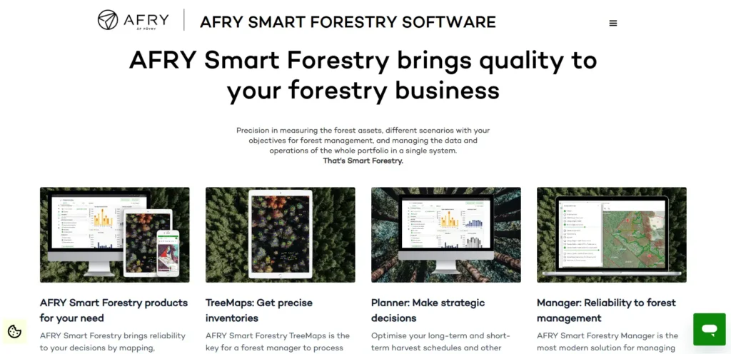
AFRY’s Smart Forestry product family addresses these challenges head-on. It’s built around three core products that work together or independently: TreeMaps handles remote sensing-based inventories, Planner tackles strategic and tactical planning, and Manager serves as the operational hub for day-to-day forest management.
Here’s the thing though—these aren’t just incremental improvements over traditional methods. According to the official website, AFRY Smart Forestry brings reliability to decisions by mapping, optimising, monitoring and continuously learning about the life cycle and functions in forest supply chains.
What Makes AFRY Smart Forestry Different
Most forestry software handles one piece of the puzzle. AFRY built an integrated ecosystem that covers strategic, tactical, and operational planning levels.
The platform was developed by AFRY’s in-house team of foresters, combining cutting-edge forest industry expertise with modern software capabilities. That distinction matters. Software engineers can build beautiful interfaces, but foresters understand what data actually drives management decisions.
Smart Forestry solutions aim to optimize forest management through digital twins—virtual replicas of forest areas that capture far more detail than the naked eye can see. As described in a 2023 AFRY publication, TreeMaps recreates a digital twin of a forest area so that forest owners can maximise the benefits of their forest management efforts.
TreeMaps: Precision Inventory Through Remote Sensing
Traditional forest inventories rely on manual fieldwork with low sampling intensity. A few plots get measured, and the rest gets extrapolated. It works, but accuracy suffers.
AFRY Smart Forestry TreeMaps flips that model. It’s a SaaS solution that extracts high-resolution 3D information and tree measurements from drone surveys equipped with cameras or LiDAR sensors.
Small-sized forest sites, rarely larger than 500 hectares, can be surveyed using drones flying 120-150 meters above the ground, according to official AFRY documentation. The data gathered enables individual tree detection that locates and measures 100% of trees in the forest area.
For larger forest areas, the main data source shifts to satellite or aircraft-based remote sensing. TreeMaps processes both types of data, turning raw sensor information into actionable forest inventory reports.
The software handles the entire workflow: drone fleet management, flight planning, data processing, and integration with standard forest inventory processes. No need for multiple disconnected tools.
Digital Twins of Forests
TreeMaps creates what AFRY calls digital twins—virtual representations that capture individual tree locations, heights, diameters, and species classifications. These twins reveal patterns invisible during a simple walk through the woods.
Forest inventories can be created without manual fieldwork, dramatically reducing costs and time while improving accuracy. The digital twin updates as new data arrives, keeping inventory information current.
Planner: Strategic and Tactical Decision-Making
Once you know what’s growing in the forest, the next challenge is deciding what to do with it. Harvest now or wait? Which stands should be thinned? How do you balance timber production with conservation goals?
AFRY Smart Forestry Planner addresses these strategic and tactical questions. It’s designed for scenario planning—running different management strategies against forest data to see which approach delivers the best outcomes.
The platform lets users set objectives for forest management, then simulates how different decisions play out over time. Growth models predict how stands develop under various management regimes.
This capability helps improve wood supply estimates, a critical factor for forestry businesses that need reliable projections. Better estimates mean better contracts, better pricing, and better resource allocation.
Manager: Operational Forest Management Hub
Strategic plans are worthless without execution. That’s where AFRY Smart Forestry Manager enters the picture.
According to official AFRY documentation, Manager is designed as a modern solution for managing forest inventory data and forest management activities. It serves as the operational system where day-to-day forest management happens.
Manager maintains high-quality forest inventory data through built-in data validation and growth simulation updates. The system tracks operations, manages activities, and keeps all forest data synchronized across the entire portfolio.
It’s cloud-based and device-agnostic. Log in from an office workstation, a tablet in the field, or a smartphone at a remote site. The flexibility matters for teams that spend time away from desks.
Key Manager Capabilities
Manager handles the operational details that determine whether forest management plans succeed or fail:
- Centralized forest inventory database with validation rules
- Activity planning and execution tracking
- Multi-property portfolio management
- Growth simulation and data updates
- Integration with TreeMaps and Planner data
- Reporting and visualization tools
The software brings reliability to forest management by consolidating scattered data sources into a single system. No more hunting through spreadsheets, paper records, and disconnected databases.
How the Three Products Work Together
TreeMaps, Planner, and Manager can operate independently. But they’re designed to integrate.
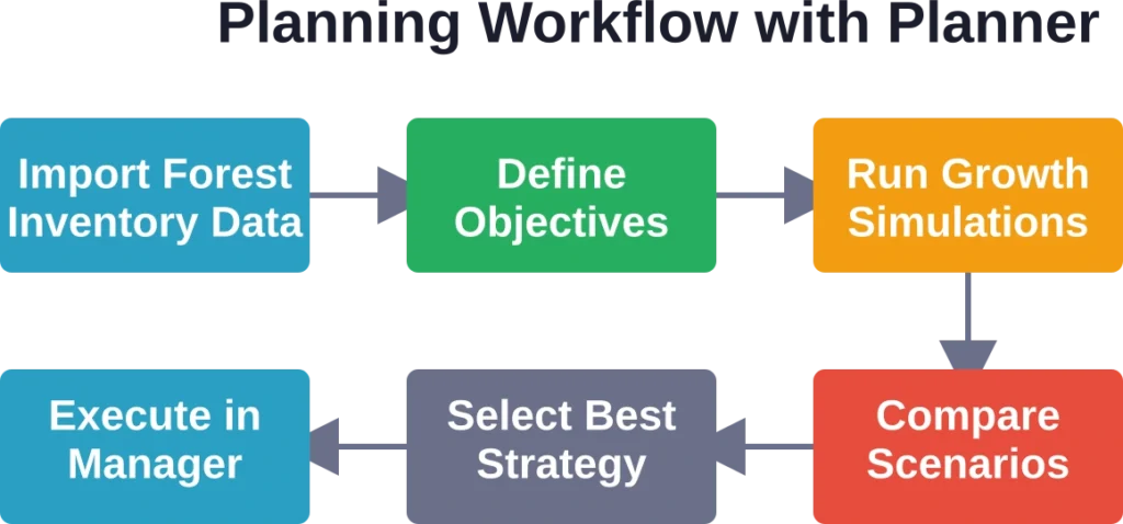
A typical workflow might start with TreeMaps conducting a remote sensing inventory. That data flows into the Manager as the operational database. Planner pulls from Manager to run strategic scenarios. Once a strategy is selected, the execution plan goes back to Manager for implementation tracking.
| Product | Primary Function | Planning Level | Key Output |
|---|---|---|---|
| TreeMaps | Remote sensing inventory | Data acquisition | Digital twin, tree-level data |
| Planner | Strategic planning | Strategic & tactical | Optimized management scenarios |
| Manager | Operational management | Operational | Activity tracking, updated inventory |
This integration eliminates the data silos that plague traditional forestry workflows. Information flows between planning levels automatically, reducing manual data entry and the errors that come with it.

Review Forest Areas from Above with FlyPix AI
AFRY Smart Forestry is connected with forestry planning, monitoring, and forest data. FlyPix AI can support related work by analyzing satellite, drone, and aerial imagery to review vegetation patterns, forest boundaries, land changes, and visible site conditions.
FlyPix AI can help forestry and land management teams with tasks such as:
- Mapping forest cover, vegetation zones, and land boundaries
- Detecting visible changes across forested or rural areas
- Comparing imagery over time to monitor site conditions
- Training custom AI models for specific forestry or land features
Contact FlyPix AI to discuss how geospatial image analysis can support forestry monitoring and land review work.
Who Benefits from AFRY Smart Forestry
AFRY Smart Forestry targets several user groups:
- Forest owners gain precision inventory data and better long-term management strategies. The digital twin approach reveals opportunities and risks that manual inventories miss.
- Forestry companies improve operational efficiency through centralized data management and optimized planning. Better wood supply estimates translate directly to better business decisions.
- Forest managers get modern tools that match the complexity of their job. Managing multiple properties across large areas becomes feasible with cloud-based access and integrated data.
- Consultants and service providers can offer higher-value services when they have access to precision inventory data and scenario planning tools.
The Technology Behind Smart Forestry
AFRY Smart Forestry leverages several technological capabilities that weren’t practical a decade ago.
Remote sensing technology—both drone-based and satellite-based—has become accurate and affordable enough for routine forestry use. LiDAR sensors capture 3D forest structure. Multispectral imaging helps with species classification and health assessment.
Cloud computing makes it possible to process massive datasets and deliver results through web interfaces accessible from anywhere. No need for powerful local workstations or complex software installations.
AI and machine learning algorithms handle pattern recognition tasks like individual tree detection and species classification. These models improve as they process more data.
Growth simulation models predict how stands develop over time under different management regimes, enabling the scenario planning that makes strategic forestry possible.
Sustainable Forest Management Through Digital Tools
Digital solutions are key enablers for new approaches to sustainable forest management, according to AFRY’s Smart Forestry overview. The complexity of balancing timber production, ecosystem services, and conservation goals demands data-driven decision-making.
Smart Forestry tools help quantify trade-offs. What’s the carbon impact of different harvesting schedules? How do thinning operations affect wildlife habitat? Which stands should be prioritized for conservation?
These questions require detailed forest data and sophisticated analysis—exactly what the Smart Forestry platform provides. Sustainability isn’t just an environmental goal; it’s a business requirement as regulations tighten and markets demand verified sustainable sourcing.
Implementation Considerations
Adopting AFRY Smart Forestry represents a shift from traditional forestry practices. Organizations should consider several factors:
- Data migration: Existing forest inventory data needs to be transferred into the new system. Manager includes validation tools to ensure data quality during this process.
- Training requirements: Staff need training on the software interfaces and workflows. The cloud-based design simplifies deployment, but effective use still requires learning.
- Remote sensing setup: Organizations must decide between conducting their own drone surveys or contracting remote sensing services. TreeMaps supports both approaches.
- Integration with existing systems: Many forestry organizations use additional software for specific functions. Understanding how Smart Forestry fits into the broader technology ecosystem matters.
For current pricing and specific implementation details, check AFRY’s official website or contact their forestry specialists directly.
Frequently Asked Questions
AFRY Smart Forestry is an integrated software suite for modern forest management consisting of three core products: TreeMaps for remote sensing-based inventories, Planner for strategic and tactical planning, and Manager for operational forest data and activity management. The platform uses digital twins, AI, and cloud computing to optimize sustainable forestry decisions.
TreeMaps processes remote sensing data from drones, aircraft, or satellites to create detailed forest inventories. For areas under 500 hectares, drones flying at 120-150 meters capture data for individual tree detection, measuring 100% of trees. The software creates a digital twin—a 3D virtual replica of the forest area—without requiring manual fieldwork.
Yes, TreeMaps, Planner, and Manager can operate independently. Organizations can adopt one product based on specific needs. However, the products are designed to integrate, allowing data to flow automatically between inventory, planning, and operational management for maximum efficiency.
Manager is cloud-based and device-agnostic, accessible from any device with a web browser—office workstations, tablets, smartphones. This flexibility is particularly valuable for forest management professionals who work in remote locations away from traditional office settings.
Planner runs growth simulations on forest inventory data, modeling how stands develop under different management scenarios over time. By comparing multiple strategies against defined objectives, forest managers can select approaches that deliver the most reliable and optimized wood supply projections, improving business planning and contract reliability.
TreeMaps processes data from multiple remote sensing sources: drone-mounted cameras, drone-mounted LiDAR sensors, aircraft-based sensors, and satellite imagery. The choice depends on forest area size, required detail level, and budget. The software handles the full workflow from raw sensor data to finished inventory reports.
AFRY Smart Forestry scales from small forest sites to large multi-property portfolios. TreeMaps explicitly supports sites as small as a few hectares using drone surveys. Manager handles single-property operations as well as complex multi-site portfolios. The cloud-based deployment eliminates large upfront infrastructure costs, making the platform accessible to various organization sizes.
Conclusion
AFRY Smart Forestry represents a comprehensive approach to modern forest management. By integrating precision inventory tools, strategic planning capabilities, and operational management systems, the platform addresses the full spectrum of forestry decision-making.
The shift from traditional manual methods to digital forestry isn’t just about technology adoption. It’s about making better decisions with better data. Forest management involves long time horizons, complex ecological interactions, and significant economic stakes. Tools that improve decision quality deliver value for decades.
Organizations serious about optimizing their forest management should evaluate how AFRY Smart Forestry fits their needs. Book a demo through the official AFRY website to see the platform in action and discuss specific requirements with their forestry specialists.