
Quick Summary: ALS Goldspot (now part of ALS Geoanalytics) is an AI-powered mineral exploration platform that integrates machine learning, geoscience expertise, and data science to identify drilling targets and accelerate discovery timelines. The tool processes geological, geochemical, and geophysical data to generate predictive models that help mining companies reduce exploration costs and improve success rates.
Mineral exploration has always been a numbers game. Drill enough holes in the right places, and eventually you hit pay dirt. But what if machine learning could narrow down those “right places” before a single rig ever mobilizes?
That’s the promise behind ALS Goldspot, a geoanalytics platform that’s been making waves in the mining exploration sector since its integration into ALS Global’s broader suite of services. The tool combines cutting-edge AI technology with traditional geoscience expertise to help exploration teams eliminate manual processes and transform raw data into actionable drilling targets.
But does it actually deliver? Here’s a detailed look at what the platform offers, how it works in practice, and whether it’s worth the investment for exploration companies operating in 2026.
What Is ALS Goldspot and How Does It Work?
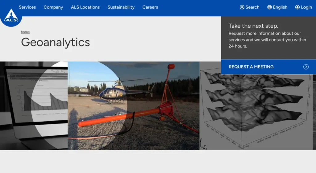
ALS Goldspot’s historical status as a standalone company before integration into ALS Global is not confirmed in available source material. The official ALS website presents Geoanalytics services without detailing this acquisition history. According to the official website, the platform now operates under the ALS Geoanalytics umbrella, which focuses on data generation, analysis, and consulting services specifically designed for mining and exploration managers.
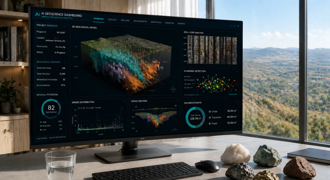
The core functionality revolves around machine learning models trained on geological, geochemical, and geophysical datasets. The system ingests data from multiple sources—regional soil surveys, historical drilling results, geophysical surveys, and satellite imagery—then applies predictive algorithms to identify high-probability zones for mineralization.
Here’s the thing though: it’s not a fully automated “push button, get targets” solution. The platform requires input from geoscience experts who understand the geological context of a project. That human-AI collaboration is what separates it from purely algorithmic approaches that might miss critical geological nuance.
Data Integration and Processing Capabilities
One of the platform’s strengths lies in its ability to handle disparate data types. Field data acquisition services feed directly into the analysis pipeline, which means real-time decision-making becomes feasible rather than waiting weeks for lab results and manual interpretation.
The system processes regional soil geochemistry, structural geology mapping, geophysical survey data (including IP surveys like the ones mentioned in recent project deployments), and historical production records. All of this gets normalized and weighted according to the specific deposit type being targeted.
Real-World Application: Project Deployments in 2026
The proof of any exploration tool lies in field results. Recent deployment examples provide insight into how the platform performs in active exploration programs.
In addition, J2 has received and is currently integrating the final OreVision™ IP geophysical survey results completed by Abitibi Geophysics at the Company’s Miniac Project in Quebec. The newly released 41km of line data to 580m depth is being incorporated into the Company’s evolving GIS database to refine high-priority drill targets. The OreVision™ IP survey has identified several prospective chargeability and resistivity anomalies coincident with previously identified EM anomalies by ALS Goldspot.
The Miniac Project consists of 78 mining claims (41 square kilometres) located approximately 35 km north of Amos, Quebec in the Northern Volcanic Zone of the Abitibi Subprovince. The company anticipates identifying a large number of high-priority targets for drill evaluation based on the integrated data analysis approach.
This represents the typical workflow: acquire field data through surveys and mapping, process it through the AI platform, then generate ranked targets for drilling. The key advantage? Teams can prioritize where to deploy expensive drilling resources rather than using a scatter-shot approach.
Time-to-Market Improvements
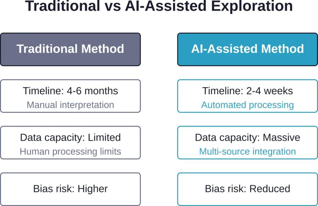
One of ALS Geoanalytics’ stated goals is accelerating insights for improved output and faster time-to-market. In practice, this means reducing the lag between data collection and drilling decisions.
Traditional workflows might take months to compile, interpret, and model datasets manually. With AI-assisted processing, that timeline compresses significantly—sometimes from months to weeks. For junior exploration companies operating on tight budgets and investor timelines, that acceleration can be the difference between securing the next funding round or not.
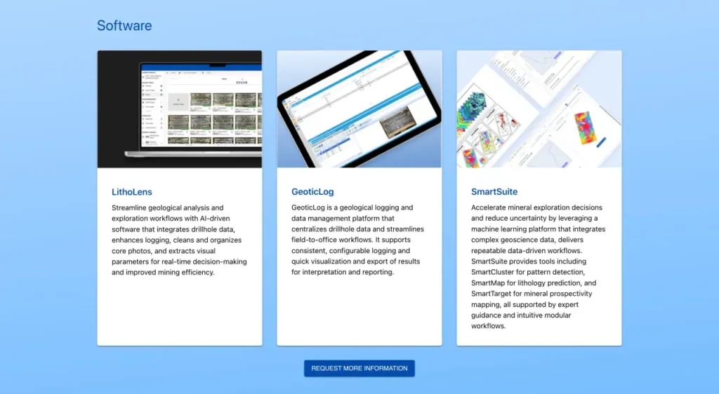
Key Features and Capabilities
Based on available information from the official ALS website and real-world deployments, here’s what the platform offers:
| Feature | Description | Benefit |
|---|---|---|
| Multi-Source Data Integration | Combines geological, geochemical, geophysical, and satellite data | Holistic view of exploration targets |
| AI Predictive Modeling | Machine learning algorithms trained on deposit-specific characteristics | Higher-confidence target identification |
| Processing Capabilities | Field data feeds directly into analysis pipeline | Faster decision cycles |
| Geoscience Expertise Integration | Human experts validate and refine AI outputs | Context-aware recommendations |
| Regional to Prospect Scale | Works across multiple scales from regional surveys to drill-target refinement | Applicable throughout exploration lifecycle |
The platform isn’t just about identifying where to drill—it’s about eliminating where not to drill. That negative space is just as valuable when budgets are tight.
How ALS Goldspot Compares to Traditional Exploration Methods
Traditional mineral exploration relies heavily on experienced geologists interpreting data manually, building conceptual models, and making educated guesses about where mineralization might occur. It works, but it’s slow, subjective, and prone to human bias.
ALS Goldspot doesn’t replace that expertise—it augments it. The AI can process patterns across thousands of data points simultaneously, identifying correlations that might not be obvious to human observers. But it still needs geologists to validate whether those patterns make geological sense.
The hybrid approach tends to work well in practice. Machine learning excels at pattern recognition and data processing speed, while human experts excel at contextual reasoning and handling ambiguous or incomplete information.
Review Exploration Sites with FlyPix AI
ALS GoldSpot is connected with mineral exploration, geoscience, and data-driven resource discovery. FlyPix AI can support the visual side of exploration work by helping teams analyze satellite, drone, and aerial imagery to review land features, site access, surface conditions, and visible changes across large areas.
FlyPix AI can support image-based site review tasks such as:
- Mapping visible roads, terrain features, vegetation, water, or infrastructure
- Detecting surface-level objects or changes across exploration areas
- Segmenting land zones and site features from geospatial imagery
- Creating custom AI models for specific detection needs
Contact FlyPix AI to discuss how geospatial image analysis can support exploration site review.
Pricing and Service Structure
ALS doesn’t publish standardized pricing for Goldspot/Geoanalytics services on their official website. Instead, they operate on a consultation basis where project scope determines cost.
According to the official ALS Geoanalytics website, interested parties can request a meeting and the company will contact them within 24 hours. This makes sense given that each exploration project has unique requirements—data volumes, project scale, deposit types, and timeline constraints all factor into service costs.
For exploration companies evaluating whether to engage ALS Geoanalytics, the calculation typically comes down to whether the potential cost savings from more targeted drilling outweigh the service fees. Drilling costs vary significantly depending on terrain, depth, and project type, so avoiding even a handful of unsuccessful holes can pay for the analytics work.
Strengths and Limitations
No tool is perfect, and understanding where ALS Goldspot excels versus where it faces constraints helps set realistic expectations.
Where the Platform Excels
The system performs best when there’s abundant historical data to train models against. Mature mining districts with decades of exploration history provide rich training datasets that improve prediction accuracy.
It also shines in scenarios where multiple data types are available. A project with comprehensive soil geochemistry, detailed structural mapping, and modern geophysical surveys gives the AI more patterns to correlate.
Speed is another clear advantage. The ability to process and integrate datasets in weeks rather than months creates real competitive advantages for companies racing to secure ground or meet milestone deadlines.
Where Challenges Emerge
Greenfield exploration in poorly-studied regions can be trickier. When there’s minimal historical data to train models against, the AI has less to work with. The system can still process new data, but prediction confidence may be lower.
The platform also can’t replace boots-on-the-ground fieldwork. Someone still needs to collect high-quality data through mapping, sampling, and geophysical surveys. Garbage in, garbage out applies just as much to AI systems as to traditional analysis.
And there’s the human factor: exploration teams need to trust the system’s recommendations enough to commit drilling resources. Building that confidence takes time and successful track records.
Who Benefits Most from ALS Goldspot?
The platform makes the most sense for specific types of exploration programs:
- Junior exploration companies with limited budgets that can’t afford to drill dozens of speculative holes
- Mid-tier producers looking to extend mine life by identifying near-mine targets more efficiently
- Projects with existing data that hasn’t been fully integrated or analyzed using modern techniques
- Exploration teams working in competitive land positions where speed matters
- Programs targeting complex deposit types where multiple geological factors control mineralization
Conversely, large producers with substantial in-house data science teams may already have equivalent capabilities. And grassroots exploration with minimal existing data might not provide enough input for the AI to deliver maximum value.
The Future of AI in Mineral Exploration
The integration of AI into exploration workflows represents a broader industry trend. As machine learning models become more sophisticated and training datasets expand, prediction accuracy should continue improving.
ALS Geoanalytics positions itself at the intersection of this technological evolution and traditional geoscience expertise. The platform evolves as new data becomes available and models are refined based on drilling results—creating a feedback loop that theoretically improves performance over time.
But AI won’t replace exploration geologists anytime soon. The best results come from collaboration between computational pattern recognition and human geological reasoning. That hybrid approach seems likely to define the next generation of exploration technology.
Frequently Asked Questions
The platform can be adapted to various deposit types including gold, base metals, silver, uranium, and other commodities. The AI models are trained on deposit-specific characteristics, so the system can target different mineralization styles depending on project requirements and available training data.
Generally speaking, more data improves model confidence. At minimum, projects need some combination of geological mapping, geochemistry (soil or rock), and/or geophysical surveys. Historical drilling data from the region helps significantly but isn’t always required. ALS evaluates data sufficiency during the initial consultation phase.
Yes. While ALS has its own comprehensive lab network, the Geoanalytics platform can process data from any source as long as it’s properly formatted and quality-controlled. The system is designed to handle multi-source datasets regardless of origin.
Timeline varies based on project complexity and data volume. Simple target generation from existing datasets might take 2-4 weeks. More comprehensive programs involving new field data acquisition and multi-phase analysis can extend to several months. Processing capabilities enable faster results compared to traditional manual methods, though timelines depend on project complexity and data volume.
No technology can guarantee discovery. The platform identifies statistically higher-probability zones based on available data and learned patterns, but geology remains inherently uncertain. The goal is improving success rates and reducing costs, not eliminating all unsuccessful holes.
ALS Goldspot was originally a separate AI-focused company that has been integrated into ALS Global’s broader Geoanalytics service offering. The underlying AI technology developed by Goldspot now forms part of the comprehensive data analysis and consulting services available through ALS Geoanalytics.
ALS structures services based on project scope and budget constraints. During the initial consultation, companies can discuss budget parameters and ALS will propose service packages that fit available resources. Phased approaches are possible, starting with desktop analysis before committing to more extensive fieldwork integration.
Final Verdict: Is ALS Goldspot Worth It?
For exploration companies facing the perpetual challenge of stretching limited budgets across vast target areas, ALS Goldspot (now ALS Geoanalytics) offers a compelling value proposition. The platform won’t replace experienced exploration teams, but it can make those teams significantly more efficient.
The technology is mature enough to deliver real results, as evidenced by ongoing deployments across active exploration projects. The integration of AI processing with traditional geoscience expertise creates a hybrid approach that leverages the strengths of both methodologies.
The best fit tends to be projects with existing datasets that haven’t been fully exploited, or programs where drilling dollars are precious and targeting precision matters more than broad coverage. Companies operating in well-studied districts with good historical data see the most immediate benefit.
Real talk: this isn’t magic. The platform processes data and identifies patterns faster and more comprehensively than manual methods, but someone still needs to collect quality data and make final decisions about where to drill. What it does provide is a significant edge in speed, pattern recognition, and data integration capacity.
For teams serious about data-driven exploration and willing to adapt workflows to incorporate AI insights, ALS Geoanalytics represents one of the more robust options available in 2026. Request a consultation through their official website to discuss specific project requirements and see if the technology aligns with exploration objectives and budget realities.