3D Reality Capture for Building Construction
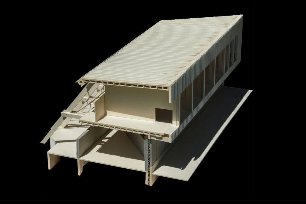
3D reality capture is changing the way buildings are designed, constructed, and managed. By using advanced scanning technologies like LiDAR, photogrammetry, and drones, construction professionals can create precise digital models of real-world structures. This technology enhances accuracy, reduces errors, and improves collaboration across all project phases. What is 3D Reality Capture in Building Construction 3D […]
Reality Capture Methods: Digitizing the World Made Simple

Reality capture is the fascinating process of transforming the physical world-your cluttered desk, a sprawling park, or a delicate handmade object-into a digital format you can explore, measure, or manipulate. With tools like everyday cameras, high-tech lasers, and buzzing drones, it’s more accessible than it sounds. This guide dives deep into the core methods-photogrammetry, LiDAR, […]
Reality Capture in Surveying: Technologies, Applications & Future Trends
Reality Capture is changing the way surveyors collect and analyze data. With advanced tools like LiDAR, drones, and 3D scanning, professionals can create highly detailed 3D models, accurate maps, and digital twins. This technology improves accuracy, efficiency, and safety in various industries, from construction and urban planning to environmental monitoring and infrastructure assessment. Let’s explore […]
Mixed Reality Capture: How It Works and Why It Matters
Mixed reality capture lets you blend real-life footage with virtual elements in real time. Whether you’re a gamer, content creator, or developer, it enhances your visuals, making them more engaging and interactive. What is Mixed Reality Capture (MRC) Mixed Reality Capture (MRC) refers to the process of blending real-world and virtual elements into a single, […]
Best Wetland Mapping Tools for Accurate Analysis

Wetlands play a crucial role in our environment – they store carbon, filter water, and provide habitats for wildlife. Mapping them correctly is essential for conservation and land planning. But with so many tools available, choosing the right one can be tricky. In this guide, we’ll explore some of the best wetland mapping tools that […]
Best Tools for Monitoring Vegetation Health

Keeping plants healthy isn’t just about watering them regularly – it’s about understanding their condition at a deeper level. Whether you’re a farmer, researcher, or environmentalist, monitoring vegetation health helps detect early signs of stress, prevent crop loss, and manage ecosystems more effectively. Luckily, modern technology makes this easier with a range of tools designed […]
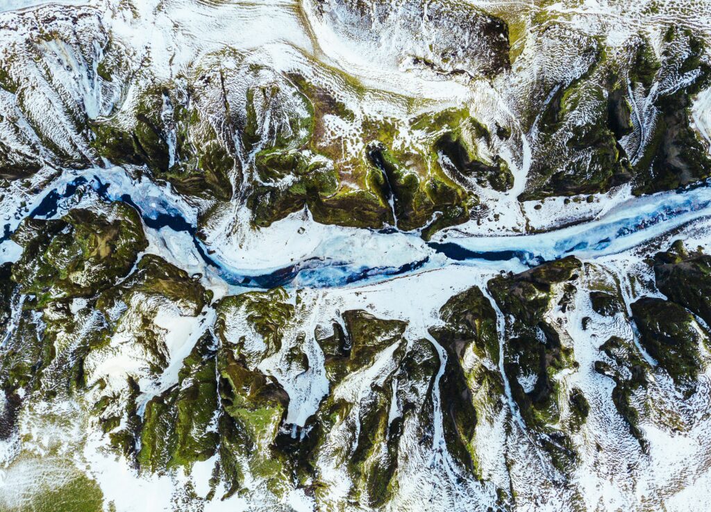
Top Glacier Monitoring Tools

Glaciers are melting faster than ever, and keeping track of them is crucial for understanding climate change. Scientists and researchers rely on advanced monitoring tools to measure ice movement, thickness, and melting rates. From satellites to GPS sensors, these tools provide valuable data to help predict future changes. Let’s explore the best glacier monitoring tools […]
Top Renewable Energy Site Selection Tools

Disaster assessment tools and renewable energy site selection tools play a crucial role in planning for both safety and sustainability. Whether it’s preparing for natural disasters or identifying the best locations for solar and wind energy, these tools help experts make informed decisions. With the right technology, we can reduce risks, protect communities, and optimize […]
Top Disaster Assessment Tools for Effective Response

When disaster strikes, having the right tools to assess damage quickly can make all the difference. Whether it’s a natural disaster like an earthquake or a man-made emergency, disaster assessment tools help responders gather critical information, coordinate relief efforts, and speed up recovery. In this article, we’ll explore some of the best tools available today, […]
Top Shoreline Erosion Tools for Coastal Protection

Shoreline erosion is a serious issue for many coastal areas, causing land loss and threatening property. Thankfully, there are effective tools and solutions to help prevent and manage this problem. In this article, we’ll look at some of the best tools available for protecting your shoreline and keeping your coastlines intact for the future. Whether […]