
Geospatial Reality Capture: Shaping the Future of Mapping and Beyond
Geospatial reality capture has rapidly become one of the most transformative innovations in technology today. Bridging the gap

The Transformative Power of Reality Capture Technology
Reality capture technology is revolutionizing the way industries approach design, construction, safety, and project management. This innovative tool
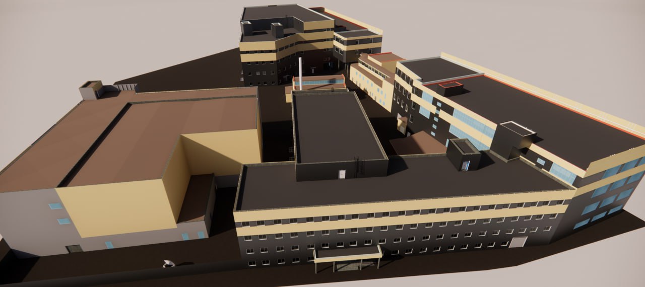
3D Reality Capture in Construction: Transforming the Industry
The construction industry is undergoing a digital revolution, with 3D reality capture emerging as a game-changer. This technology

Mappt Alternatives: A Complete Guide to Choosing the Best Solution
In today’s fast-paced industries, Geographic Information System (GIS) tools like Mappt play a crucial role in field data

Autonomous Reality Capture: Transforming How We Understand the World
In recent years, autonomous reality capture has emerged as a groundbreaking technology, changing the way industries collect and

Taranis AI Alternatives: A Complete Guide to Choosing the Best Solution
Taranis AI has emerged as a leader in precision agriculture, offering cutting-edge tools for crop monitoring and pest

Altitude Angel Alternatives: A Complete Guide to Choosing the Best Solution
In the ever-evolving world of drone technology, airspace management has become crucial for safety and efficiency. Altitude Angel
iAuditor by SafetyCulture Alternatives
When it comes to simplifying audits, inspections, and safety management, iAuditor by SafetyCulture is a popular choice. But

Reality Capture: Transforming the Art of Design
Reality capture technology has revolutionized the way we approach design. By enabling the creation of precise digital representations