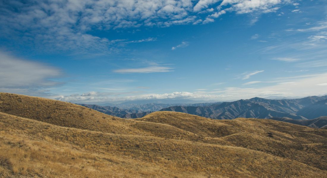
If you’ve ever seen a landslide – or even just photos of one – you know how quickly the ground can surprise you. One minute it’s solid, and the next, it’s sliding downhill. That’s why slope stability monitoring tools exist. They help engineers and geologists spot warning signs early, long before the ground starts to move in dangerous ways.
But monitoring has come a long way from just planting sensors in the soil. These days, we’ve got radar systems, drones, satellite data, and AI-powered platforms that can detect movements smaller than a millimeter. The goal? Keep people safe, protect infrastructure, and get a better understanding of what’s really happening beneath our feet – without spending weeks in the field.

1. FlyPix AI
We use advanced AI to analyze geospatial images and detect patterns or changes that may indicate slope instability. By identifying and outlining multiple objects across complex terrain, we make it easier to understand how a slope behaves over time. Our platform processes large image sets quickly, allowing users to monitor surface movements or erosion trends that could point to potential hazards.
We also enable users to train custom AI models without needing programming skills. By adding their own annotations, users can adapt the system to detect specific objects or surface features relevant to slope stability monitoring. This flexibility helps us support different conditions, from soil movement along road embankments to early signs of landslides in hilly terrain.
Key Highlights:
- AI-based object detection for geospatial imagery
- Ability to train custom models using user-defined annotations
- Fast processing of large image datasets for slope analysis
- Identification of changes and anomalies across terrain surfaces
- Applicable for continuous or periodic slope monitoring
Who it’s best for:
- Geotechnical and environmental engineers monitoring slope changes
- Researchers studying surface deformation or erosion
- Infrastructure teams managing landslide-prone areas
- Organizations needing large-scale image-based terrain analysis
Contact and Social Media Information:
- Website: flypix.ai
- Email: info@flypix.ai
- LinkedIn: www.linkedin.com/company/flypix-ai
- Address: Robert-Bosch-Str. 7, 64293 Darmstadt, Germany
- Phone: +49 6151 2776497

2. Soil Instruments
They develop and supply geotechnical and structural monitoring tools used to track changes in ground and structural behavior. Their instruments are often applied in slope stability monitoring to measure parameters such as movement, pore pressure, and deformation. With decades of field experience, they create systems suited for projects like dams, tunnels, and landslide-prone areas.
Their tools are typically used to collect long-term data that helps engineers understand how slopes react to natural or construction-related stress over time.
Key Highlights:
- Geotechnical instruments for slope, dam, and tunnel monitoring
- Focus on deformation and stability measurements
- Long-term data collection and analysis
- Proven field use across global infrastructure projects
Who it’s best for:
- Geotechnical engineers working on slopes and embankments
- Civil infrastructure projects needing continuous monitoring
- Consultants managing large-scale slope stability assessments
Contact Information:
- Website: www.soilinstruments.com
- E-mail: sales@soilinstruments.com
- LinkedIn: www.linkedin.com/company/soil-instruments-ltd:
- Address: Bell Lane, Uckfield, East Sussex TN22 1QL
- Phone: +44 01825 765044

3. Worldsensing
They provide wireless IoT-based monitoring networks designed for large infrastructure and geotechnical applications. In slope stability projects, their systems are used to collect data from multiple sensors without requiring complex wiring. The collected data helps identify movement or instability in slopes, mines, or excavations.
Their monitoring approach focuses on connectivity, allowing remote access to real-time information that supports decision-making and early warning systems.
Key Highlights:
- Wireless IoT networks for geotechnical monitoring
- Integration with slope movement and deformation sensors
- Remote data access and real-time reporting
- Scalable setup for large or difficult-to-access areas
Who it’s best for:
- Engineers monitoring slopes in remote or hazardous locations
- Operators of mines, dams, and civil infrastructure
- Organizations needing continuous and remote slope data collection
Contact Information:
- Website: www.worldsensing.com
- E-mail: press@worldsensing.com
- Twitter: x.com/worldsensing
- LinkedIn: www.linkedin.com/company/worldsensing

4. GroundProbe
They design radar-based geotechnical monitoring systems widely used in mining and civil engineering. For slope stability, their radar and software detect even small ground movements, helping teams assess the risk of failure. These systems are applied in open-pit mines, tailings dams, and construction slopes to maintain operational safety.
Their focus lies in delivering high-precision monitoring that provides early detection of instability, supporting risk management and operational planning.
Key Highlights:
- Radar and laser monitoring systems for slope movement
- High-accuracy detection of surface displacement
- Real-time visualization and alerting tools
- Applications in mining and civil slope stability monitoring
Who it’s best for:
- Mining operators managing pit wall or waste dump stability
- Civil engineers monitoring critical slopes
- Safety teams requiring rapid movement detection systems
Contact Information:
- Website: www.groundprobe.com
- E-mail: info@groundprobe.com
- Facebook: www.facebook.com/GroundProbe
- Twitter: x.com/GroundProbeTM
- LinkedIn: www.linkedin.com/company/groundprobe
- Address: 72 Newmarket Road Windsor, Qld 4030 Australia
- Phone: +61 7 3010 8999

5. Trimble Geospatial
They provide geospatial technology for surveying, mapping, and monitoring. In slope stability applications, their equipment and software capture precise spatial data that reveals subtle terrain changes. Trimble tools integrate GNSS, total stations, and remote sensing methods to track surface movement over time.
Their systems allow for both periodic surveys and automated monitoring, helping users maintain accuracy in deformation tracking and slope analysis.
Key Highlights:
- Geospatial instruments for deformation and slope monitoring
- Integration of GNSS, total stations, and imaging data
- High-precision positioning and data analysis
- Flexible use for both manual and automated workflows
Who it’s best for:
- Surveyors monitoring slope or ground displacement
- Infrastructure managers needing long-term stability data
- Engineers working on geotechnical or construction slopes
Contact Information:
- Website: geospatial.trimble.com
- Facebook: www.facebook.com/TrimbleSurvey
- LinkedIn: www.linkedin.com/showcase/trimble-geospatial
- Instagram: www.instagram.com/trimblegeospatial

6. Geocomp
They specialize in geotechnical monitoring and data systems, offering integrated solutions for understanding ground behavior. In slope stability, their tools and services combine field instrumentation with data management software to track displacement and pore pressure.
Their approach involves providing reliable systems that help engineers interpret slope conditions and respond to potential instability during or after construction.
Key Highlights:
- Geotechnical monitoring systems for slopes and structures
- Combination of sensors, data logging, and analysis software
- Support for construction and post-construction monitoring
- Focus on data quality and interpretation
Who it’s best for:
- Engineering firms conducting slope stability assessments
- Construction projects with ground movement risk
- Research groups studying geotechnical behavior
Contact Information:
- Website: www.geocomp.com
- Email: info@geocomp.com
- Facebook: www.facebook.com/GeocompGeoTestingExpress
- Twitter: x.com/GeocompInc
- LinkedIn: www.linkedin.com/company/geocomp-geotestingexpress
- Address: 17300 Park Row Houston, TX 77084-5935
- Phone: (281) 492-6688

7. sSLOPE (Roozbeh GM)
They developed a mobile app designed for quick slope stability analysis. Using the simplified Bishop method, sSLOPE calculates the Factor of Safety (FOS) for soil or rock slopes directly on a phone.
It provides an accessible way to perform preliminary assessments or educational demonstrations without needing specialized desktop software.
Key Highlights:
- Mobile-based slope stability analysis tool
- Uses simplified Bishop method
- Fast estimation of Factor of Safety (FOS)
- Simple and user-friendly interface
Who it’s best for:
- Geotechnical students and educators
- Engineers performing quick field checks
- Professionals needing mobile access to slope stability analysis
Contact Information:
- Website: www.roozbehgm.com
- Twitter: x.com/RoozbehRocks
- LinkedIn: www.linkedin.com/in/roozbeh-geraili-mikola-ph-d-p-e-15711690

8. Bentley Systems
They develop software used across infrastructure design, construction, and operation. For slope stability monitoring, their applications support data integration, modeling, and visualization from geotechnical sensors. Bentley tools help engineers connect field monitoring data with digital models, improving understanding of slope behavior over time.
Their focus is on interoperability and data management within large-scale infrastructure environments.
Key Highlights:
- Software for integrating slope and structural monitoring data
- 3D modeling and visualization capabilities
- Compatibility with various geotechnical instruments
- Support for long-term infrastructure monitoring
Who it’s best for:
- Infrastructure managers overseeing slope stability
- Engineers integrating geotechnical data with BIM systems
- Multi-disciplinary project teams handling complex terrains
Contact Information:
- Website: www.bentley.com
- Facebook: www.facebook.com/BentleySystems
- Twitter: x.com/bentleysystems
- LinkedIn: www.linkedin.com/company/bentley-systems
- Instagram: www.instagram.com/bentleysystems
- Address: 685 Stockton Drive Exton, PA 19341, United States
- Phone: 1 800 236 8539

9. Ensoft
They develop engineering software for analyzing foundations and soil-structure interaction. In slope stability work, their programs support geotechnical analysis involving piles, retaining structures, and earth pressures, which often relate to slope performance.
Their tools are used for precise modeling of ground-structure interaction and for understanding how support systems affect overall stability.
Key Highlights:
- Software for foundation and soil-structure interaction analysis
- Tools applicable to slope and retaining wall design
- Based on current geotechnical research methods
- Used for detailed numerical modeling
Who it’s best for:
- Geotechnical engineers analyzing supported slopes
- Structural engineers designing retaining systems
- Researchers studying soil-structure performance
Contact Information:
- Website: www.ensoftinc.com
- E-mail: sales@ensoftinc.com
- Address: 3003 West Howard Lane Austin, TX 78728
- Phone: +1 (512) 244 6464

10. Fine Software (GEO5)
They offer a suite of geotechnical software covering slope stability, foundation design, and ground modeling. GEO5 includes several modules dedicated to slope analysis, enabling users to simulate conditions and calculate safety factors.
It provides flexibility for different soil types, reinforcement methods, and analysis approaches within one integrated environment.
Key Highlights:
- Software suite for geotechnical and slope stability analysis
- Multiple calculation methods available
- Modular tools for soil, rock, and reinforcement modeling
- User-friendly interface and clear output presentation
Who it’s best for:
- Geotechnical and structural engineers
- Academic users studying slope mechanics
- Designers analyzing embankments, cuts, or landslides
Contact Information:
- Website: www.finesoftware.eu
- E-mail: hotline@finesoftware.eu
- Facebook: www.facebook.com/FineSoftware
- LinkedIn: www.linkedin.com/company/fine-software
- Address: Reporyjska 490/17, 158 00 Prague 5, Czech Republic
- Phone: +420 233 089 490

11. Rocscience
They develop geotechnical modeling and analysis software for civil and mining industries. Their slope stability tools combine 2D and 3D modeling to evaluate potential failure surfaces and safety factors. The software supports both limit equilibrium and numerical methods.
Their systems help engineers visualize slope conditions and test different reinforcement or excavation scenarios with precision.
Key Highlights:
- 2D and 3D slope stability analysis software
- Supports limit equilibrium and numerical methods
- Visualization of failure surfaces and displacement
- Used in mining and civil engineering applications
Who it’s best for:
- Engineers analyzing slope failures or reinforcements
- Mining operators evaluating pit wall stability
- Consultants modeling geotechnical risk
Contact Information:
- Website: www.rocscience.com
- Facebook: www.facebook.com/rocscience
- Twitter: x.com/Rocscience
- LinkedIn: www.linkedin.com/company/rocscience
- Instagram: www.instagram.com/rocscience

12. Geotechnical Observations
They provide end-to-end monitoring services for geotechnical projects, including slope stability work. Their team advises on instrument selection, installation, calibration, and data interpretation. They emphasize correct setup and verification to ensure accurate results throughout a monitoring project.
Their process integrates engineering understanding with practical field execution, helping projects maintain reliability and safety in complex conditions.
Key Highlights:
- Full monitoring service from design to data reporting
- Skilled technicians with accredited calibration facilities
- Emphasis on installation quality and verification checks
- Geotechnical expertise in interpreting slope data
Who it’s best for:
- Project owners seeking managed slope monitoring services
- Engineering firms needing end-to-end instrumentation support
- Clients requiring interpretation of long-term monitoring data
Contact Information:
- Website: www.geo-observations.com
- E-mail: info@geo-observations.com
- Address: The Peter Vaughan Building 9 Avro Way, Brooklands, Weybridge Surrey, KT13 0YF, United Kingdom
- Phone: +44 (0)1932 352040
Conclusion
Keeping slopes stable isn’t a one-time job – it’s a constant process of measuring, watching, and learning how the ground reacts. The good news? Today’s tools make it easier than ever to catch small changes before they become big problems.
From old-school sensors to AI image analysis and remote radar, slope monitoring has gone high-tech. You don’t need to be on-site every day to know what’s going on anymore – you can track an entire hillside from your laptop. Every tool on this list plays a role in that bigger picture, helping us see the earth more clearly and respond faster when it starts to move.
