
You’ve probably heard the term location intelligence thrown around in tech briefings, real estate meetings, or maybe even in a supply chain discussion. It sounds complex, but the idea is surprisingly down to earth: it’s about making smarter decisions by understanding where things happen and why. Whether you’re tracking foot traffic near a potential store site or trying to pinpoint flood risks in urban zones, location intelligence helps turn raw geographic data into practical, often visual, insight.
It’s not just maps. It’s not just data. It’s the layer that makes the “where” just as important as the “what.” And as more industries wake up to its potential, location intelligence is quickly becoming a quiet powerhouse in decision-making across the board.
Location Intelligence, Stripped Down
In simple terms, location intelligence (LI) is the ability to extract insights from geographic or spatial data. This can mean anything from satellite imagery and foot traffic data to demographic trends and weather patterns. What ties it all together is the geographic reference.
But here’s where LI steps beyond traditional mapping tools. It’s not just about visualizing “where.” It’s about analyzing the why behind the where, layering different datasets together, and asking smarter questions.
Think of it as the spatial cousin of business intelligence. Where BI gives you dashboards of KPIs and sales figures, LI shows you how location affects those numbers, patterns, risks, and outcomes.
It’s Not Just GIS Anymore
Yes, GIS (Geographic Information Systems) is at the heart of location intelligence. GIS software lets you store, analyze, and visualize geographic data. But modern LI stacks take things further.
Today, location intelligence often combines:
- GIS platforms (like ArcGIS).
- Artificial intelligence and machine learning.
- Real-time data streams from IoT sensors.
- Satellite and drone imagery.
- Custom analytics and forecasting models.
It’s a toolkit, not just a single piece of software. The real power comes when you integrate these tools with your existing systems – ERP, CRM, supply chain dashboards – and start building decisions around location-aware data.
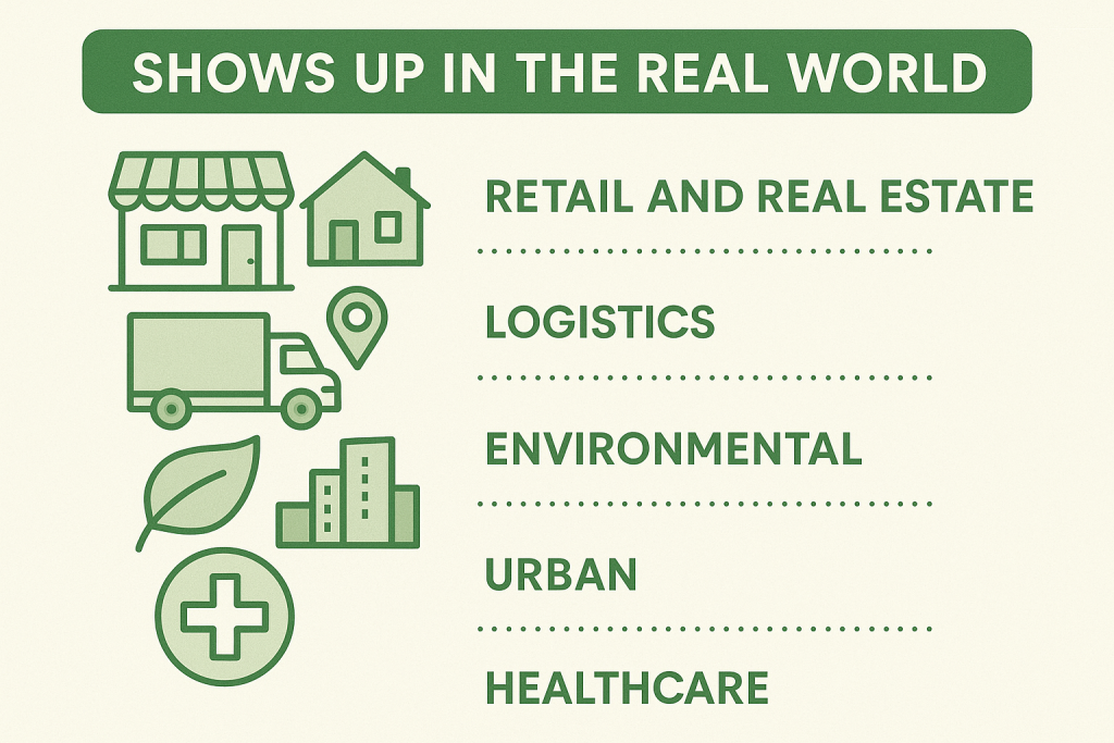
Where It Shows Up in the Real World
Most people still associate location intelligence with maps and pins on a screen. But that’s just surface-level. When used well, LI becomes a quiet engine behind smarter, faster decisions in dozens of sectors. Below are just a few areas where it’s already making a measurable impact.
1. Retail and Real Estate
When it comes to physical locations, the stakes are high. One bad site can drag down an entire brand’s performance. That’s why retailers and developers lean heavily on location data before they commit to opening a new store or launching a housing project.
They’re using LI to:
- Monitor real-world foot traffic patterns, not just rely on projections.
- Analyze neighborhood shifts in income, age groups, and household size.
- Understand where competitors are gaining or losing ground.
- Assess ease of access, school quality, even seasonal climate data.
Some companies even plug this data into predictive models to simulate future performance before signing a lease. It’s no longer about hunches or gut feel – it’s about location-backed confidence.
2. Logistics and Fleet Management
In logistics, every mile and minute counts. A delayed truck isn’t just an inconvenience – it’s a cost. That’s why real-time, location-based decision-making is now baked into most logistics strategies.
Fleet managers use location intelligence to:
- Trim down fuel usage by calculating optimal routes in real time.
- Avoid areas affected by road closures, traffic jams, or weather disruptions.
- Monitor vehicle movement live and flag issues before they snowball.
- Identify underperforming delivery zones and reallocate resources accordingly.
In some cases, companies use LI to compare delivery windows against competitor benchmarks, finding new ways to speed up fulfillment without burning through their budget.
3. Environmental Monitoring
Nature doesn’t come with a dashboard, but location intelligence helps build one. From slow-moving threats like deforestation to urgent crises like wildfires or floods, LI gives scientists, responders, and policymakers the spatial awareness they need to act quickly and accurately.
One example: using high-res satellite imagery combined with vegetation data and wind models to forecast fire spread across vulnerable communities. In many cases, these insights can be mapped against population data to prioritize evacuations or deploy resources with precision.
This same approach works for coastal erosion, illegal mining, glacier melt, and more. When change is tied to geography, LI helps us keep up.
4. Urban Planning
Modern cities generate more data than ever. The challenge is turning that noise into usable insight. That’s where LI fits in, providing planners and public agencies with a clear, location-based understanding of how cities function day to day.
With LI, cities can:
- Fine-tune bus routes and train schedules based on real-time usage.
- Predict where housing demand will spike as new businesses move in.
- Spot infrastructure vulnerabilities before they become failures.
- Map where public services fall short and correct for equity.
Some cities are now using location intelligence to simulate long-term impacts of zoning changes or environmental policy, helping leaders weigh their decisions before putting them into action.
5. Healthcare Resource Allocation
Healthcare isn’t just about what patients need – it’s also about where those needs are most urgent. That’s why public health officials increasingly rely on spatial analysis to inform where they build, staff, and supply care facilities.
With the help of LI, they can:
- Track the geographic spread of contagious illnesses with precision.
- Identify underserved areas lacking clinics or pharmacies.
- Allocate mobile resources like testing vans or vaccination sites.
- Predict which neighborhoods may be more vulnerable during a health crisis.
This kind of visibility isn’t just helpful in emergencies. It’s also being used for long-term public health planning, from reducing travel time to care to improving maternal health outcomes in remote areas.
Why Location Intelligence Is Becoming Non-Negotiable
There’s a reason this field is growing fast. A few, actually:
- Too much data, not enough context. We’re swimming in data. But without geographic context, much of it is useless. LI connects data points to real-world places, making patterns easier to spot.
- Real-time is the new standard. Businesses and governments can’t wait weeks for reports anymore. With IoT and cloud-based LI tools, decisions can be made on live data feeds.
- Better decisions require spatial thinking. Where to allocate funds, build infrastructure, expand a network, or mitigate risk – these are all location questions. LI lets you move beyond hunches.
- Climate change and risk are deeply geographic. Flood zones, drought patterns, energy use, emissions – every piece of the climate puzzle is location-based. LI is how you make sense of it all.
The Technical Side: What Makes It Tick
Location intelligence might look seamless on the front end, but under the hood, it’s a multi-layered system built from a mix of spatial data, analytics, and real-time technology. Here’s how the pieces fit together.
Understanding the Two Main Flavors of Geospatial Data
At the heart of location intelligence is geospatial data – and not all of it is created equal. Most of what powers modern analysis falls into two categories: vector and raster.
Vector data is what most people think of when they picture digital maps. It’s made up of points, lines, and polygons – basically, coordinates that represent real-world features like roads, city boundaries, buildings, or park areas. This format is great for precision and is often used when you want to track specific objects or events.
Raster data, on the other hand, works more like a grid of pixels. Imagine satellite imagery or heatmaps showing temperature, moisture, or elevation. Raster is ideal for broad, continuous coverage where changes need to be analyzed across large surfaces.
Where the Data Comes From
The raw material behind location intelligence is constantly expanding. What used to rely heavily on government records and static maps has evolved into a living stream of location-rich data pulled from a wide range of sources.
Satellite and drone imagery provide overhead visuals with stunning resolution, giving analysts a top-down view of everything from farmland to city grids. Mobile phone data adds movement and behavior patterns, often anonymized but still incredibly useful for understanding foot traffic and population flows.
Then there’s the flood of information from IoT sensors – those tiny devices measuring air quality, road traffic, noise levels, even soil moisture. They’re embedded everywhere now, from highways to shipping containers. Add in open government datasets (like census records or infrastructure maps) and commercial feeds (transaction data, store visits, and so on), and you’ve got a massive, diverse pool to work with.
How It Gets Processed and Made Useful
Of course, having the data is one thing. Making sense of it is another. That’s where processing tools come in – and this part has changed drastically over the last few years.
GIS platforms like ArcGIS or QGIS are still the backbone of many location intelligence setups. They help store, structure, and visualize spatial data. But newer layers have been added to boost power and usability.
Many teams now train custom AI and machine learning models to recognize patterns or predict trends. Want to detect construction progress from aerial images? Or forecast traffic congestion based on historical weather and road data? That’s what these models are built for.
On top of that, cloud platforms such as AWS or Google Earth Engine handle real-time analysis and heavy lifting. These systems let you process huge datasets without setting up complicated infrastructure – something that used to be a barrier for smaller teams.
And finally, the rise of user-friendly APIs and dashboards means that non-technical users can now interact with the results without needing to understand the data science behind it. Stakeholders can ask questions, explore results, and take action – all through clean, visual interfaces.

What Makes a Good LI Platform?
If you’re looking into building or buying location intelligence tools, here’s what actually matters:
- Data integration: Can it pull in multiple data types and sources easily?
- Scalability: Will it still work when you have 10x the data?
- Real-time updates: Does it support streaming data from sensors or mobile apps?
- Custom modeling: Can you train models or tweak analytics for your use case?
- Visualization: Are the outputs intuitive for stakeholders?
- Security: Is sensitive geographic or customer data protected?
Challenges Worth Knowing
Location intelligence isn’t magic. A few caveats:
- Garbage in, garbage out: Bad or biased data leads to bad decisions.
- Privacy concerns: Especially with mobile and personal location data, ethics matter.
- Skill gaps: Teams may need training to interpret maps or models accurately.
- Cost creep: Advanced tools and high-res imagery can get pricey fast.
Location Intelligence in the Next Few Years
Looking ahead, the field is moving fast. A few trends to watch:
- AI-native platforms: Expect more tools that start with AI instead of tacking it on later.
- Custom model training: No-code platforms that let you define what to detect, even in satellite imagery.
- Integration with digital twins: Cities, ports, buildings – all with live, virtual replicas that respond to LI inputs.
- Micro-scale insights: Hyperlocal analysis down to a single field, store, or block.
- More accessible tooling: Even non-technical users can train models or query data visually.
How FlyPix AI Uses Artificial Intelligence to Make LI Practical at Scale
At FlyPix AI, we help organizations move beyond static maps and into dynamic, automated insight. Our platform uses advanced AI agents to process satellite, drone, and aerial imagery faster than any manual method ever could. In dense, complex scenes, like ports, agricultural fields, or active construction zones, we train models to detect, classify, and monitor features with precision that would take a human hours to match.
But the goal isn’t just automation for the sake of speed. It’s about scale. Location intelligence only works if you can keep up with the volume of visual data coming in from the sky. We’ve built FlyPix AI so that companies across industries, whether in government, infrastructure, forestry, or logistics, can interpret this data in near real time, with minimal setup and no deep technical background required.
You can train your own custom AI models inside the platform, define what you want to detect, and apply that logic to thousands of images in minutes. That’s how we see location intelligence evolving: not just more data, but better tools to understand it, faster, and with far less friction. It’s how we help teams go from raw imagery to actionable decisions – without getting stuck in the middle.
Final Thoughts: Why Now’s the Time
Here’s the thing: location intelligence isn’t new. But its role is changing. It’s not just for scientists, city planners, or mapping teams anymore. It’s becoming essential for anyone who needs to understand their environment and act accordingly. That means business leaders, supply chain managers, healthcare planners, conservationists, and more.
And as tools get smarter, faster, and more accessible, LI is moving from a specialized capability to a core business function. If you’re not already thinking spatially, you’re likely missing part of the picture. Probably the most important part.
FAQ
GIS is the technical foundation. It’s the software and structure that stores and analyzes spatial data. Location intelligence builds on that by layering in other datasets, applying analytics or AI, and turning the result into something decision-makers can actually use. One’s the engine, the other is the insight.
Not necessarily. Some platforms still require GIS expertise, but many newer tools are no-code or low-code, meaning you don’t need to be a data scientist to use them. If you can work with dashboards or basic map interfaces, you can usually get started. The hard part is knowing the right questions to ask.
Retail, logistics, real estate, agriculture, utilities, city governments, insurance, energy… the list goes on. Any organization that operates in physical space or depends on movement, infrastructure, or people-location dynamics can use LI. It’s no longer just for geographers or planners.
It depends on the source. High-resolution satellite imagery and real-time sensor feeds can be incredibly accurate, but it’s always important to verify data quality and relevance. Garbage in, garbage out still applies here. A good platform will let you audit your sources and refresh outdated data.
Absolutely. It’s already being used to track deforestation, measure urban heat islands, plan renewable infrastructure, and assess climate risk across supply chains. When you tie environmental data to real locations, you can start doing more than reporting – you can act.
It depends on your use case. For routing deliveries or managing wildfire response, yes, real-time is critical. For long-term planning or site selection, near real-time or even periodic updates might be enough. The key is to match the data refresh rate to your actual operational needs.