
簡単な概要: ArcGIS Proは、Esriの主力デスクトップGISアプリケーションであり、3つのライセンスレベル(ベーシック、スタンダード、アドバンスト)で、堅牢な空間分析、2D/3Dマッピング、データ管理機能を提供します。パフォーマンスはハードウェア仕様によって大きく異なり、システムメモリが80~85%を超えるとパフォーマンスが低下します。また、3Dレンダリングや複雑な視覚化には、専用GPUのサポートが不可欠です。.
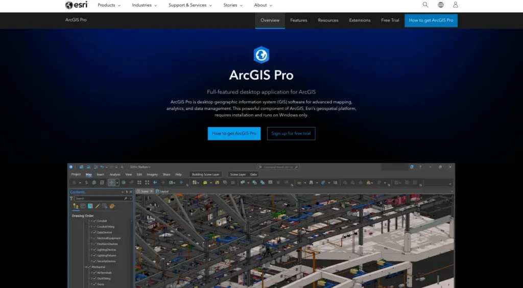
ArcGIS Proは、従来のArcMapプラットフォームに代わり、プロフェッショナルなデスクトップGIS作業における業界標準となっています。しかし、その期待に応えているのでしょうか?本レビューでは、公式ドキュメントと実際の導入シナリオに基づき、ツールの機能、パフォーマンス特性、および実用的な制約について検証します。.
ArcGIS Proの実際の機能
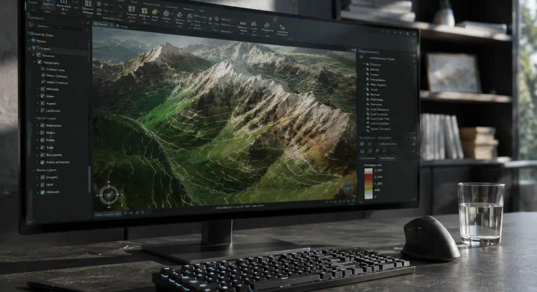
公式ウェブサイトによると、ArcGIS Proはデスクトップシステム上で空間データを作成・操作するための必須アプリケーションです。2Dマップ、3Dシーン、レイアウト、レポート、グラフなど、様々な形式で地理空間データを視覚化、分析、コンパイル、共有するためのツールを提供します。.
このアプリケーションは、作業をプロジェクトに整理します。プロジェクトとは、マップ、データ接続、ツールボックス、およびアクティブなポータルへのリンクを格納するコンテナです。プロジェクトは、ローカルドライブ、データベース、サーバー、およびArcGIS OnlineまたはArcGIS Enterpriseポータルに接続します。.
しかし重要なのは、ArcGIS Proは単なるマッピングツールではないということです。基本的な視覚化から高度な空間統計、地理情報処理ワークフロー、機械学習の統合まで、あらゆる機能を備えたプロフェッショナル向けのデスクトップGISアプリケーションなのです。.
FlyPix AIで衛星画像とドローン画像を処理
地理空間プロジェクトでは、多くの場合、複数のソースから収集された大量の画像データが必要となります。FlyPix AIは、検出、監視、分類のために設計されたAI搭載ツールを用いて、これらの画像を処理・分析するチームを支援します。.
複雑な地理空間データセットを扱うには?
FlyPix AIは以下の点で役立ちます:
- 衛星画像解析
- ドローン画像処理
- 物体検出と追跡
- カスタム地理空間AIモデル
👉 FlyPix AIをお試しください AIが地理空間ワークフローをどのようにサポートできるかをご覧ください。.
ライセンスレベルと機能の内訳
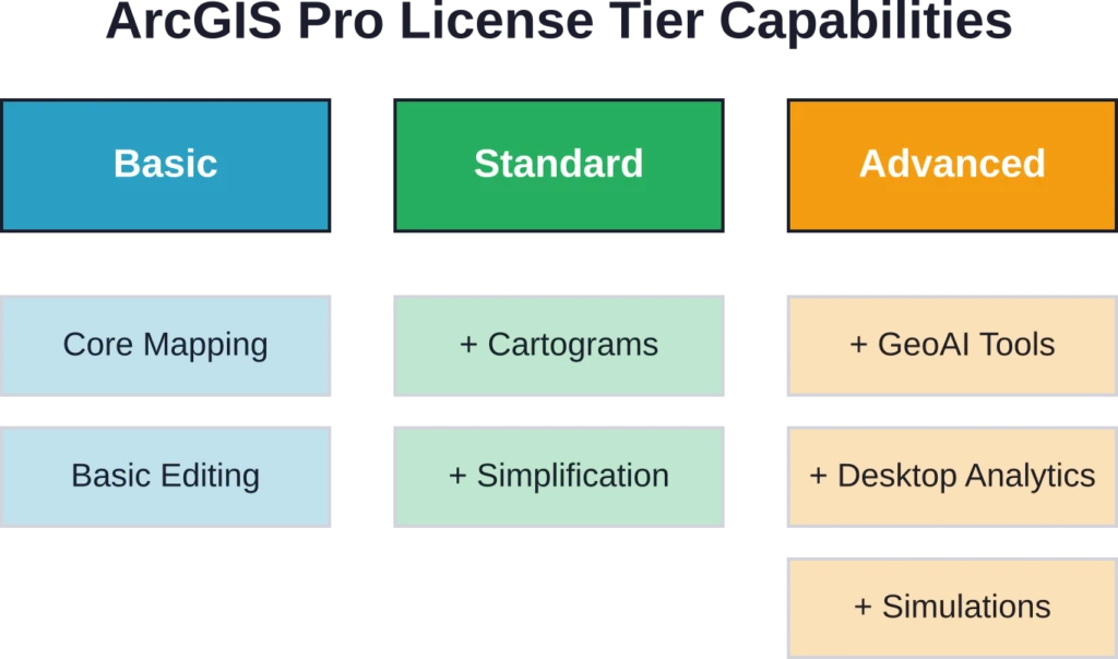
ArcGIS Proには、ベーシック、スタンダード、アドバンストの3つのライセンスレベルがあります。これらのレベルを理解することは、機能が大きく異なるため重要です。.
| 機能カテゴリ | 基本 | 標準 | 高度な |
|---|---|---|---|
| 2D/3Dマッピング | ✓ | ✓ | ✓ |
| カスタムシンボル | ✓ | ✓ | ✓ |
| 地理情報処理 | ✓ | ✓ | ✓ |
| 空間統計学 | ✓ | ✓ | ✓ |
| カートグラムを生成する | ✗ | ✓ | ✓ |
| 簡略化/平滑化 | ✗ | ✓ | ✓ |
| 地図作成の精度向上 | ✗ | ✗ | ✓ |
| 予測分析/地理空間AI | ✗ | ✗ | ✓ |
| デスクトップ地理分析 | ✗ | ✗ | ✓ |
3つのライセンスレベルすべてにおいて、テンプレート、ドメイン、サブタイプを使用した編集がサポートされています。マップシリーズとレイアウトの自動化機能は、すべてのレベルで共通して利用できます。違いは、高度な地図作成、洪水シミュレーション、予測分析といった、上位レベル限定の機能に現れます。.
性能特性とハードウェア依存性
パフォーマンスはハードウェア構成によって大きく異なります。システムメモリは重要なボトルネックとなり、公式サポートドキュメントによると、使用量が約80~85%を超えると、ArcGIS Proのパフォーマンスが低下したり、予期しない障害が発生したりします。.
GPU構成は非常に重要です。Intel統合グラフィックスとNVIDIAまたはAMD専用GPUを搭載したノートパソコンなど、複数のグラフィックス処理ユニットを備えたシステムでは、ArcGIS Proはデフォルトで統合GPUを使用する場合があります。その結果、2Dまたは3Dレンダリングのパフォーマンスが低下し、シーンのナビゲーションが遅くなります。.
正直なところ、Windowsは依然として必須要件です。ArcGIS ProはWindowsシステム(Windows 11推奨)向けのデスクトップアプリケーションですが、Macでアクセスするには、教育機関のガイドラインに従って仮想マシン構成を行う必要があります。.
座標系と空間参照のサポート
ArcGIS Proは、座標系と地図投影法を幅広くサポートしており、管轄区域やデータソースを問わず、正確な地図作成と分析を可能にします。最新バージョンでは、座標系が地理的カテゴリ別に再編成され、より簡単に検索・活用できるようになりました。.
- 豊富な座標系ライブラリ: 幅広い地理座標系および投影座標系に対応しています。.
- 地図投影法のサポート: 異なる地域やデータセット間で空間データが正しく整合するようにします。.
- バージョン3.7 再編成: 座標系は地理的な区分に基づいて分類されているため、適切な座標系をより迅速に見つけて適用することができる。.
- 管轄区域をまたいだ統合: 空間参照が異なる複数の情報源からのデータを統合することを容易にします。.
- 発見性の向上: 専門家がそれぞれのプロジェクトのニーズに合った適切な座標系を見つけやすく、使いやすくする。.
地理情報処理および分析機能
分析ツールボックスには、空間オーバーレイ、バッファ作成、統計計算、近接分析のためのツールが含まれています。これらの操作は、ほとんどのGISワークフローの基盤となります。.
画像解析モジュールには、ラスター処理のための機能が、解析、外観、バンドインデックス、分類、変換、補正、データ管理、数学、再分類、統計、サーフェスといったカテゴリに分類されて含まれています。一部の機能では、Image Analyst または Spatial Analyst のライセンスが必要です。例えば、ラスター分類機能と線形混合分離機能は、ArcGIS Pro の基本ライセンス以外に追加のライセンスが必要となります。.
最近のアップデートとバージョン変更
パフォーマンスの向上
ArcGIS Pro 3.7では、マップ描画のパフォーマンスを評価するための新しい「マップ分析」ペインが導入され、レンダリング速度とワークフローの効率が向上しました。.
生産性の向上
更新された編集ツール、カスタムツールバー、および管理者が作成したシステムのお気に入り機能により、日常業務が効率化され、頻繁に使用する機能へのアクセスが容易になります。.
ModelBuilderとチャートの更新
ModelBuilderの図は、ノードをよりコンパクトに表示するためにデフォルトで150%ズームを使用するようになり、折れ線グラフは積み重ね表示と100%積み重ね面表示をサポートするようになり、視覚化の柔軟性が向上しました。.
高度な分析機能
新しいツールには、ファイルベースの知識グラフ、通信ドメインネットワーク(伝播リセッターにはバージョン8が必要)、埋め込みベースの空間分析のためのGeoAIツールなどが含まれており、より高度なデータ分析が可能になります。.
データ検証と品質管理
ArcGIS Data Reviewer拡張機能は、データ品質管理フレームワークを追加します。Data Reviewerは、空間的な関係性と整合性をテストするチェックを使用してデータを検証し、検証中に発見されたエラーを修正するためのツールを提供します。.
データレビューツールボックスには、レビューセッションの作成と削除、バッチジョブの実行、ランダムデータサンプルの選択を行うためのツールが含まれています。これは、品質保証が不可欠な大規模データセットを管理する組織にとって重要です。.
現実世界における制約と既知の問題点
ArcGIS Proの導入には、いくつかの互換性および運用上の課題が影響を与える可能性があります。
- プログラムの競合: ArcGIS ProをMicrosoft Visual Studioと併用すると、共有機能やドライバーが自動的に更新されてワークフローに影響を与える可能性があるため、新規または既存のプロジェクトファイルを開く際に問題が発生する可能性があります。.
- 一般的な機能障害エラー: これらのエラーは、具体的な診断情報なしに発生し、最も一般的にはマップ、レイヤー、プロジェクトのエクスポート時、またはパッケージ作成時に発生し、コミュニティにとって長年の悩みの種となっている。.
- バージョン廃止の影響: ArcGIS Pro バージョン 3.1.x が 2026 年 4 月にサポート終了となったことにより、特に .NET Framework との互換性に関して、ソフトウェア環境の要件が更新され、旧バージョンを使用している組織はアップグレードが必須となりました。.
よくある質問
3つのティアすべてで、基本的なマッピング、地理情報処理、空間統計がサポートされています。スタンダードでは、カートグラムと簡略化ツールが追加されます。アドバンストでは、地図の精緻化、予測分析、GeoAIツール、デスクトップ地理分析が含まれます。ワークフローで高度な分析が必要か、標準的なマッピングと分析タスクに重点を置くかに応じて選択してください。.
いいえ、ArcGIS ProはWindowsオペレーティングシステムを必要とします。システム要件によると、Windows 11が推奨されています。Macユーザーは仮想マシン構成を介してWindowsを実行する必要があり、これによりパフォーマンスのオーバーヘッドと複雑さが増します。.
複数のGPUを搭載したシステムでは、ArcGIS Proは専用のNVIDIAまたはAMD GPUではなく、統合型Intelグラフィックスを選択する場合があります。この場合、Windowsの設定でGPUを手動で構成する必要があります。GPU構成の手順については、2026年初頭に公開された公式サポート記事に記載されています。.
公式ドキュメントによると、システムメモリの使用量が約80~85%を超えると、パフォーマンスの低下や予期せぬ障害が発生するとのことです。複雑な3Dシーンや大規模なデータセットを扱う場合、最低仕様で推奨されているよりも、32GB以上のメモリが実用的になります。.
一部の機能(ContrastBrightness、Convolution、Pansharpenなど)は、ArcGIS Proの基本ライセンスで動作します。その他の機能(公式ドキュメントによると、Classifyラスター機能とLinearUnmixing機能など)は、Image AnalystまたはSpatial Analystの拡張機能が必要です。.
この包括的なエラーは診断情報を提供しませんが、マップのエクスポート、レイヤーのエクスポート、またはパッケージの作成時によく発生します。まずシステムメモリの使用状況を確認し、データソースへのアクセス可能性を検証し、すべてのレイヤーで座標系が一致していることを確認してください。コミュニティの議論によると、これらのエラーはパッチを適用してもバージョン間で継続して発生しているようです。.
メジャーバージョンはほぼ毎年リリースされます(バージョン3.6は2025年11月、バージョン3.7は2026年にリリース)。パッチは定期的にリリースされます。例えば、ArcGIS Pro 3.6 Patch 2は2026年2月にリリースされました。パッチは累積的なものであり、以前のパッチを段階的にインストールする必要はありません。.
結論
ArcGIS Proは、マッピング、分析、データ管理のワークフロー全体にわたる包括的なGIS機能を提供します。3段階のライセンス構造により拡張性を確保していますが、GeoAIツールやデスクトップ地理分析などの高度な機能は、Advancedライセンスでのみ利用可能です。.
パフォーマンスはハードウェア仕様、特にシステムメモリとGPU構成に大きく依存します。ArcGIS Proを導入する組織は、システムメモリの使用率が80-85%を超えた場合に発生するパフォーマンス低下を回避するため、堅牢なハードウェアへの予算を確保する必要があります。.
最新の価格とライセンスの詳細については、Esriの公式ウェブサイトをご確認ください。エンタープライズ展開を決定する前に、評価期間中に特定のデータセットを使用してパフォーマンスをテストしてください。.