
")
Earth observation used to mean waiting days for cloud-free images. Now, satellites equipped with synthetic aperture radar (SAR) can capture surface-level detail through fog, darkness, or forest canopy – and that’s just the start. Behind the scenes, there’s a whole infrastructure making this possible: satellite buses, onboard sensors, fast data links, and increasingly, intelligent software that knows what to look for.
The real shift isn’t just about getting more images. It’s about turning all that data into something usable – quickly, reliably, and often automatically. Whether it’s tracking deforestation, spotting illegal fishing vessels, or inspecting farmland from orbit, SAR has become a core part of how we understand the planet at scale.
Why Earth Observation Infrastructure Matters and Where It Starts
Not long ago, satellite data was mainly the domain of space agencies and researchers. Now, it’s become a core input for how we monitor the planet, respond to crises, and plan for the future. Climate policy, disaster response, supply chain oversight – they all rely on Earth observation. But what actually makes it work isn’t just having satellites in orbit. It’s the full infrastructure behind them.
At the foundation are the satellites themselves – not just flying cameras, but platforms packed with sensors built for very specific jobs. Optical payloads still do a lot of heavy lifting, but they depend on clear skies and daylight. That’s where SAR (synthetic aperture radar) takes over. It sends out its own radar signals and measures what bounces back, giving us reliable images through clouds, fog, even forest canopy – day or night. Here’s what makes up this foundation layer:
- SAR payloads that can cut through weather and darkness, ideal for real-time monitoring
- Specialized radar bands like X-band for high detail and L-band for deeper terrain penetration
- Satellite buses that handle power, orientation, and data transmission with minimal ground support
- Agile platforms like µDRAGONFLY that enable compact, responsive missions
- Inter-satellite links that move data quickly without relying solely on ground stations
Different radar bands serve different use cases. High-resolution X-band is great for detailed imagery, while L-band penetrates deeper into terrain and vegetation. Both are actively used today – from tracking deforestation to monitoring infrastructure and detecting early signs of flooding. But radar alone isn’t enough.
The satellite bus – the platform responsible for orientation, power, and data transmission – plays just as crucial a role. Without it, none of that data makes it back to Earth. Companies like Dragonfly Aerospace are building compact, flexible platforms like µDRAGONFLY and DRAGONFLY to carry radar and camera payloads efficiently. These buses are getting smaller, more agile, and smarter – and they’re quickly becoming the foundation for the next wave of Earth observation systems.
The Processing Layer: How FlyPix AI Turns Raw Imagery into Actionable Data
At FlyPix AI, we focus on helping teams move faster from raw satellite, aerial, or drone imagery to decisions that actually matter. Instead of spending time manually drawing boxes or tagging objects, users can automate the entire process with AI agents trained on real-world patterns. The platform handles complex, dense scenes with ease – speeding up what used to be tedious work.
Our platform works out of the box for common tasks like land-use classification, construction monitoring, or detecting movement in ports. But we also make it simple to train custom models without touching code. You decide what needs to be tracked – whether it’s infrastructure damage, crop variation, or vehicle types – and FlyPix AI adapts. It’s reliable, fast, and works across different image formats and sources.
We support users across industries where visual data needs to scale – agriculture, environmental monitoring, infrastructure, and more. If you want to see how others are using FlyPix AI in real projects, you can find updates and stories on LinkedIn.
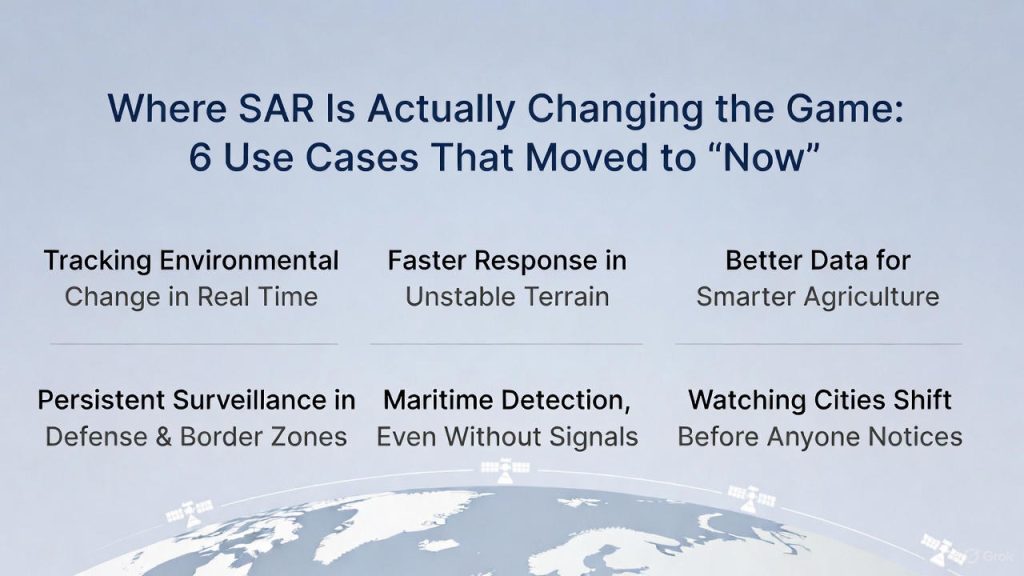
Where SAR Is Actually Changing the Game: 6 Use Cases That Moved to “Now”
Synthetic aperture radar (SAR) has been around for decades, but until recently it was limited to a small group of users with big budgets and long timelines. That’s changed. With more commercial SAR satellites in orbit and more accessible processing tools, radar imaging has moved into everyday workflows across industries. The shift is clear: from occasional snapshots to continuous, high-value insight – even when weather or daylight conditions aren’t ideal.
1. Tracking Environmental Change in Real Time
SAR gives us consistent, repeatable monitoring – even in areas where cloud cover never clears or seasons are unpredictable. For climate scientists, conservation teams, and policymakers, that kind of data is essential.
- See deforestation patterns under canopy or cloud
- Measure vegetation health and soil conditions
- Monitor glacial movement, ice melt, and seasonal shifts
2. Faster Response in Unstable Terrain
When something breaks – a dam, a hillside, a riverbank – SAR can catch the movement and show the extent without waiting for visibility. It helps teams triage disaster zones, route resources, and act before things get worse.
- Map flood zones without needing daylight
- Detect landslides, sinkholes, and subsidence
- Support early response with up-to-date impact maps
3. Better Data for Smarter Agriculture
Farmers and agri-tech teams use SAR to fill in the gaps when optical data isn’t enough – during overcast weeks, during night passes, or when fields are too remote. It’s not about perfect visuals – it’s about usable signals.
- Assess field saturation or drought conditions
- Track crop growth across large or varied terrain
- Help plan irrigation, fertilization, and harvest
4. Persistent Surveillance in Defense & Border Zones
In areas where visibility is limited – by weather, foliage, or deliberate camouflage – SAR keeps the feed going. It detects motion, new structures, and landscape changes, making it a staple in security monitoring.
- Spot vehicle or vessel movement in low-visibility conditions
- Monitor terrain for unauthorized activity or changes
- Maintain situational awareness with regular revisits
5. Maritime Detection, Even Without Signals
Illegal fishing and ship traffic often go dark – turning off transponders or staying outside radar range. SAR helps close that gap, giving coastal and port authorities another layer of visibility.
- Identify ships not broadcasting location
- Track unusual behavior in restricted waters
- Flag oil spills or surface disruptions early
6. Watching Cities Shift Before Anyone Notices
Urban areas move. Sometimes it’s subtle, sometimes it isn’t. SAR helps spot those shifts early – before a crack becomes a collapse. For infrastructure teams, it’s a quiet layer of risk management.
- Detect slow ground movement near buildings or roads
- Watch for subsidence around construction sites
- Flag signs of structural stress over time
Across all these use cases, SAR works best when paired with systems that know what to look for — and when. That’s where the rest of the infrastructure comes in: real-time tasking, fast downlink, and streamlined tools that help teams move straight from imagery to insight.
Software-Led Infrastructure: ReOrbit and the Future of EO Satellite Design
In Earth observation, raw hardware is no longer the bottleneck. What matters now is how fast satellites can respond, how well they communicate, and how easily they adapt. That’s the shift ReOrbit is working on – moving from traditional hardware-centric designs to software-led satellite infrastructure.
Instead of relying on heavy ground control and static mission plans, ReOrbit builds systems that behave more like flexible networks. Satellites can share data between each other, run updates in orbit, and process information before it ever reaches Earth. That means less delay, more autonomy, and better use of every pass. Here’s what defines this software-first approach:
- Inter-satellite links that let satellites talk to each other, not just the ground
- Onboard computing for pre-processing data before downlink
- Modular architecture that allows new software functions to be added mid-mission
- Reduced ground dependency, making EO faster, cheaper, and more resilient
- Mission adaptability, with satellites able to re-task on the fly
- Support for time-sensitive use cases, like real-time surveillance or rapid disaster mapping
ReOrbit isn’t trying to reinvent the satellite – just rethink how it works. And in a world where SAR, AI, and real-time insights are becoming standard expectations, that rethink feels long overdue.
What’s Still Hard and What’s About to Change
Even with all the advances in satellite tech, radar systems, and AI processing, Earth observation isn’t frictionless yet. Some of the toughest problems are less about getting the data and more about making it usable, shareable, and secure. The infrastructure is evolving fast, but there are still a few big gaps to close.
Too Much Data, Not Enough Context
Earth observation platforms generate an enormous stream of raw imagery – but most of it goes unused. Sorting signal from noise takes time, especially when you’re working with multi-source input across different formats. What’s missing isn’t resolution – it’s relevance.
- Automated detection and classification speed up the jump from imagery to action without manual bottlenecks
- Pre-processing on orbit is gaining ground but still limited by power and payload constraints
- End users still struggle with turning imagery into day-to-day decisions
The Bottleneck Isn’t in Space – It’s on the Ground
As satellites become smarter, the challenge shifts to downlink speed, bandwidth availability, and storage infrastructure. High-resolution SAR and hyperspectral sensors push huge amounts of data, but ground networks aren’t always ready to receive and move that fast.
- Inter-satellite links (like those used by ReOrbit) offer one solution
- Edge computing and in-orbit filtering reduce transmission loads
- But for many operators, ground logistics are still the limiting factor
Trust, Transparency, and Traceability
As more decisions – especially around climate, insurance, or infrastructure – rely on EO data, trust becomes critical. Where did the data come from? What was done to it? Can it be audited? These aren’t just technical questions – they’re business-critical.
- Stakeholders want clarity on how insights were generated
- Models need better explainability, especially for compliance and ESG use
- There’s growing demand for EO platforms that log their entire processing chain
What’s Next: Leaner, Smarter, and More Connected
Looking ahead, the next big shifts will come from the edges of the system:
- Autonomous satellite networks that self-organize and prioritize observations
- AI models that train on constantly updated ground truth datasets
- EO platforms that plug directly into real-world workflows, not just dashboards
The more seamless the link between what satellites see and what users need to know, the more valuable this entire ecosystem becomes. Not just for agencies or analysts – but for teams working in the field, making decisions on the move.
Conclusion
Earth observation isn’t just about launching more satellites. It’s about building the right systems around them – the payloads that collect useful data, the links that move it quickly, and the platforms that turn it into insight without slowing people down. SAR has played a big part in making that shift possible, especially for use cases where weather, time, or terrain used to get in the way.
What’s changed is the pace. With radar-based imaging and AI-driven analysis working in sync, we’re no longer waiting days to react. Whether it’s spotting crop stress, tracking deforestation, or flagging movement near critical infrastructure, the data is already flowing – the challenge now is making sure it’s accessible and actionable for the teams who need it most.
FAQ
SAR stands for synthetic aperture radar. It captures surface data using radar waves instead of visible light, which means it can see through clouds, smoke, or even forest canopy – day or night. That makes it reliable for consistent monitoring in conditions where optical sensors fall short.
It used to be. But today, SAR data is used across agriculture, disaster response, climate tracking, and infrastructure monitoring. With more commercial satellites and better access to analysis tools, it’s no longer just a defense asset – it’s part of the commercial and environmental toolkit.
Volume and complexity. SAR generates a lot of data, and it doesn’t always look intuitive to the human eye. That’s why platforms that can handle preprocessing, detection, and context – without needing a radar expert on hand – are becoming essential.
Not exactly. What AI does well is remove the repetitive steps — tagging, filtering, sorting — so humans can focus on interpretation and action. It’s more about speeding things up than taking people out of the loop.