
LiDAR isn’t just another fancy tech acronym tossed around in engineering circles. It’s actually one of those behind-the-scenes tools quietly shaping how we understand, monitor, and plan the physical world. Short for Light Detection and Ranging, LiDAR sends out rapid laser pulses to measure distances with serious precision. But what’s it really used for?
Turns out, a lot. From helping self-driving cars detect road edges to uncovering long-lost cities in dense jungles, LiDAR’s reach is wider than most people think. In this article, we’re taking a closer look at the actual jobs LiDAR is doing right now – on the ground, in the air, and even underwater. No fluff, just real-world use cases that show why this tech keeps gaining ground.

First Things First: A Quick Recap of What LiDAR Is
LiDAR stands for Light Detection and Ranging. It’s a remote sensing method that uses laser pulses to measure distances between the sensor and surfaces. By firing off thousands (or millions) of light pulses per second and recording how long they take to return, LiDAR builds what’s called a point cloud, essentially a super-detailed 3D model of whatever it’s scanning.
Depending on the setup, LiDAR sensors can be mounted on planes, drones, vehicles, satellites, or even tripods. Because LiDAR emits its own light pulses, it works day or night and isn’t affected by shadows or low light, unlike passive sensors that rely on ambient lighting.
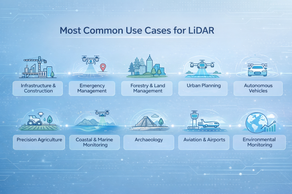
Most Common Use Cases for LiDAR
LiDAR’s not limited to one field. It’s already being used in construction, emergency response, forestry, autonomous vehicles, city planning, and even archaeology. What makes it so effective is its ability to deliver precise, real-time spatial data across all kinds of environments. Let’s take a closer look at how it’s applied in real-world scenarios.
1. Infrastructure and Construction: Site Planning Gets Smarter
Construction sites might look messy from the outside, but behind the scenes, precision matters. And that’s where LiDAR comes in.
Planners use mobile or airborne LiDAR to create accurate 3D scans of terrain before ground is even broken. It’s way faster than traditional surveying and doesn’t require teams to walk every inch of the property. LiDAR helps with:
- Assessing slope stability and drainage.
- Spotting potential obstacles or buried features.
- Tracking construction progress over time.
- Creating “as-built” documentation at project close-out.
It’s also a safety tool. LiDAR can highlight shifting ground or early signs of structural stress that might not be obvious to the naked eye.
2. Emergency Management: Responding Faster With Better Data
When a natural disaster hits, timing is everything. Rescue teams need to know where roads are washed out, where power lines are down, or where land has shifted. LiDAR helps deliver that situational awareness fast.
After events like earthquakes, hurricanes, or wildfires, drones equipped with LiDAR can scan the affected area in hours, not days. The data gets turned into maps showing everything from blocked roads to unstable slopes. Emergency teams can then plan safer evacuation routes, prioritize areas for rescue, or decide where to send supplies.
A few ways LiDAR supports emergency response:
- Flood modeling and damage mapping.
- Post-event terrain change detection.
- Mapping firebreaks and fuel loads in wildfire zones.
- Supporting search and rescue with updated maps.
3. Forestry and Land Management: Seeing the Forest and the Trees
Forests are complex, layered environments. From above, they can look like a solid green mass. But what’s going on underneath the canopy is just as important. LiDAR helps measure both.
Because LiDAR can penetrate gaps in tree cover, it allows forest managers to scan an entire wooded area, not just the visible top. This gives them insight into tree height and canopy structure, biomass estimates for timber resources, understory density (important for wildlife habitat), and signs of pest damage, drought stress, or dead zones.
In wildfire-prone regions, LiDAR is used to map out fuel density and plan preventive measures before fire season kicks in. And when paired with historical scans, it helps track how forests change over time.
4. Urban Planning: Building Smarter Cities from the Ground Up
City planners juggle a ton of variables – roads, buildings, utilities, green spaces, zoning laws, and more. LiDAR helps simplify that complexity by giving them a precise snapshot of what’s already there.
With accurate elevation models and surface scans, planners can:
- Design smarter drainage and flood prevention systems.
- Analyze how new buildings will affect line-of-sight or shade.
- Monitor infrastructure aging and deformation over time.
- Plan transport routes based on real terrain, not old maps.
In historic districts, LiDAR also helps document older structures with millimeter precision, making preservation and renovation easier to plan without guesswork.
5. Autonomous Vehicles: Eyes on the Road, Literally
LiDAR plays a starring role in self-driving car technology. It gives vehicles a real-time, 360-degree view of their surroundings with enough detail to spot road edges, signs, curbs, pedestrians, and other cars.
LiDAR is crucial for autonomous systems because it doesn’t depend on lighting conditions to function. Whether it’s bright daylight, nighttime, or foggy weather, it keeps scanning. Unlike regular cameras that capture flat images, LiDAR builds a full 3D map of the surroundings, giving the vehicle a much deeper understanding of where things are.
While some companies are exploring other sensor combinations (like radar plus cameras), LiDAR remains one of the most reliable tools for environmental awareness in autonomous systems.
6. Agriculture: Precision Farming Gets a Boost
Farming might seem like a ground-level job, but aerial data has changed how modern farms are run. LiDAR is used to build elevation profiles, measure slope, and assess field variability.
This allows farmers to:
- Optimize irrigation by understanding drainage patterns.
- Identify low or compacted spots that need soil treatment.
- Improve planting strategies based on terrain.
- Combine data with crop health sensors for more targeted care.
It’s not just about efficiency. Smarter land use also helps reduce environmental impact by minimizing water, fertilizer, and pesticide overuse.
7. Coastal and Marine Monitoring: Mapping What the Eye Can’t See
When you’re trying to understand shifting shorelines or underwater topography, traditional survey tools fall short. Bathymetric LiDAR solves that by using green laser light that can penetrate water to some depth, depending on clarity.
Used from planes or drones, bathymetric LiDAR helps with:
- Mapping seafloor elevation and reef structures.
- Monitoring coastal erosion and sediment movement.
- Supporting offshore energy development.
- Charting riverbeds for navigation or restoration work.
For projects like coral reef protection or marine habitat tracking, this kind of data is gold. It captures subtle changes that might take years to notice otherwise.
8. Archaeology: Uncovering History Hidden by Nature
One of the more unexpected success stories of LiDAR is in archaeology. When researchers started flying LiDAR-equipped aircraft over jungles, deserts, or rolling hills, they started spotting patterns hidden for centuries.
LiDAR cannot see through solid surfaces, but airborne systems can detect terrain beneath sparse vegetation, and bathymetric systems can scan through shallow, clear water. And the best part? It’s non-invasive. No digging needed. Just data and interpretation, which protects fragile sites and speeds up discovery timelines.
9. Aviation and Airports: Smoother Landings and Safer Takeoffs
LiDAR isn’t just used in planes – it helps manage airports too. Surveying runways, taxiways, and nearby terrain ensures that flight paths stay safe and obstacles are spotted early.
Airports use LiDAR for:
- Mapping surfaces for irregularities or debris.
- Detecting obstacles near approach paths.
- Monitoring terrain around the airport for changes.
- Wildlife management by scanning surrounding habitats.
When layered with real-time monitoring tools, this data helps reduce flight delays, manage expansions, and comply with aviation safety rules.
10. Environmental Monitoring and Climate Work
This is one of LiDAR’s quietest but most important roles. Scientists use it to track how landscapes evolve, how vegetation responds to climate stress, and how water levels shift over time.
Specific tasks include:
- Mapping glacier retreat and permafrost changes.
- Monitoring coastal flood risks due to sea level rise.
- Tracking deforestation and land degradation.
- Measuring atmospheric pollutants using specialized LiDAR setups.
It’s the kind of work that happens behind the scenes but provides critical data for climate models, conservation efforts, and long-term planning.
How We Support LiDAR-Enhanced Projects at FlyPix AI
At FlyPix AI, we help organizations turn complex geospatial imagery into clear, usable insights using AI. Our platform is designed for automated analysis of satellite, aerial, and drone imagery, which often includes elevation-rich datasets from tools like LiDAR.
Many of the industries we support – like construction, agriculture, and infrastructure monitoring – work with data that combines traditional imagery and 3D mapping sources. When that’s the case, our AI agents can dramatically speed up the process of object detection, change tracking, and pattern recognition, even in dense or high-detail scenes.
You don’t need coding experience to use FlyPix AI. Teams can train custom models to detect specific features based on project goals. Whether you’re analyzing flat terrain or elevation-heavy environments, our system helps you move from raw visuals to decisions faster.
Final Thoughts: Why LiDAR Keeps Expanding Its Reach
What makes LiDAR so useful is its blend of precision, speed, and adaptability. Whether mounted on a drone scanning a cornfield or integrated into a Mars lander, the core idea stays the same: send out pulses of light, and map the world one reflection at a time.
But what’s really changed is how accessible it’s becoming. Sensors are getting smaller, cheaper, and easier to deploy. Tools that once sat in the hands of governments and big corporations are now available to startups, universities, and even farmers with drones.
So when someone asks “What is LiDAR used for?”, the answer is: almost everything where understanding space, shape, and change matters.
FAQ
Not quite. Both are remote sensing technologies, but they use different parts of the electromagnetic spectrum. Radar uses radio waves, while LiDAR uses laser light. That means LiDAR can create much more detailed 3D models, which is why it’s often used for high-resolution mapping. But radar has the edge in bad weather or low visibility. In many systems, you’ll find both working together.
It depends on the setup. LiDAR can’t see through solid objects, but in forested areas, laser pulses can travel through small gaps in the canopy and reflect off the ground below, allowing for terrain mapping under vegetation. For water, bathymetric LiDAR uses green light that can penetrate shallow, clear water and reflect off the seabed.
Not at all. While LiDAR gets used in major civil engineering and government projects, it’s also showing up in agriculture, forestry, urban planning, and even archaeology. Some farmers use it to map irrigation zones. Researchers use it to track erosion. It’s not just for massive construction sites or transportation networks anymore.
LiDAR is known for being extremely precise. In ideal conditions, you can get accuracy down to a few centimeters. Of course, the actual precision depends on the equipment, altitude, scanning density, and how the data is processed. But for most professional applications, it’s more than enough to build reliable models or make solid decisions based on the data.
Most LiDAR data is stored as point clouds, usually in formats like LAS, LAZ, or sometimes as raster files like DEMs (Digital Elevation Models). Depending on how it’s processed, it can be converted into 3D models, contour maps, or GIS-compatible layers. But unless you’re working directly with raw data, a good platform will handle the heavy lifting and give you something visual and easy to work with.