
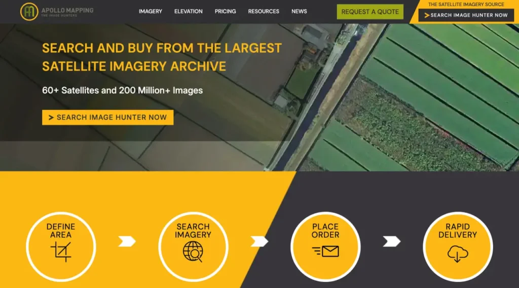
Kurzzusammenfassung: Apollo Mapping ist ein führender Anbieter kommerzieller Satellitenbilder und bietet hochauflösende Erdbeobachtungsdaten sowie maßgeschneiderte Kartierungslösungen. Das Unternehmen – auch bekannt als ‘Image Hunters’ – ist spezialisiert auf die Beschaffung, Verarbeitung und Bereitstellung von Satellitenbildern für Kunden aus dem öffentlichen, privaten und akademischen Bereich. Die Dienstleistungen reichen vom einfachen Bildkauf bis hin zu komplexen Geodatenanalysen und machen Satellitendaten auch für Organisationen zugänglich, die keine eigene Expertise im Bereich Fernerkundung besitzen.
Wenn Satellitenbilder für wichtige Aufgaben unerlässlich sind – sei es die Beobachtung von Umweltveränderungen, die Infrastrukturplanung oder die Anlagenüberwachung – benötigen Teams mehr als nur kostenlose Standardtools. Sie brauchen präzise, hochauflösende Daten, die schnell geliefert, korrekt verarbeitet und von Experten unterstützt werden, die die feinen Unterschiede zwischen Sensortypen, Auflösungen und Lizenzbedingungen verstehen.
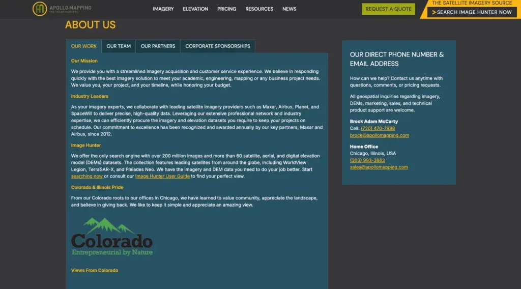
Hier kommt Apollo Mapping ins Spiel. Das in Colorado ansässige Unternehmen, das unter dem Spitznamen ‘Die Bildjäger’ firmiert, hat sich über Jahre hinweg einen Namen als bevorzugter Vermittler zwischen Satellitenbetreibern und Endnutzern gemacht, die Erdbeobachtungsdaten benötigen, ohne sich mit der Komplexität der direkten Zusammenarbeit mit Satellitenkonstellationen auseinandersetzen zu müssen.
Aber hält Apollo Mapping, was es verspricht? Was unterscheidet es vom Herunterladen von Bildmaterial von offenen Plattformen oder von direkten Verträgen mit Satellitenbetreibern? Und wann lohnt es sich, für seine Dienste zu bezahlen, anstatt Alternativen zu prüfen?
Dieser Bericht geht auf alle Details ein: Was Apollo Mapping genau macht, wer am meisten von ihren Tools und Services profitiert, wie ihre Preisgestaltung funktioniert und wo sie sich im breiteren Kontext der Satellitenbildanalyse im Jahr 2026 positionieren.
Was ist Apollo-Kartierung? Die Bildsammler verstehen
Apollo Mapping ist kein Satellitenbetreiber. Sie besitzen nicht die Satelliten, die Bilder der Erdoberfläche aufnehmen. Stattdessen fungieren sie als spezialisierter Vermittler – in der Branche als Value-Added Reseller bezeichnet – und verbinden Kunden mit Bildmaterial von Dutzenden Satellitenanbietern weltweit.
Der Spitzname ‘Image Hunters’ spiegelt ihre Kernleistung wider: die Beschaffung exakt der benötigten Bilddaten, seien es Archivdaten aus vergangenen Jahren oder aktuelle Aufnahmen, die innerhalb weniger Tage geplant sind. Sie bewältigen die komplexe Navigation durch verschiedene Satellitenkonstellationen mit jeweils eigenen Sensoren, Überflugraten und Lizenzstrukturen.
Aufschlüsselung der Kernleistungen
Apollo Mapping bietet verschiedene Bildkategorien an. Mit dem Basis-Bilddatenverkauf können Kunden hochauflösende Satellitenbilder als einmalige Anschaffung erwerben – ideal für spezifische Projektanforderungen ohne laufende Abonnements. Die individuelle Bilddatenerfassung organisiert neue Satellitenaufnahmen, wenn Archivdaten nicht ausreichen, und beauftragt Satelliten mit der Fotografie bestimmter Gebiete an festgelegten Tagen.
Ihre Verarbeitungsdienste wandeln Rohsatellitendaten in analysebereite Formate um. Orthorektifizierung korrigiert geometrische Verzerrungen, Pansharpening führt hochauflösende panchromatische und niedrigauflösende multispektrale Daten zusammen, und Mosaikierung fügt mehrere Szenen zu einer nahtlosen Abdeckung zusammen.
Geodatenanalysedienste gehen noch weiter – sie extrahieren Merkmale, berechnen Vegetationsindizes, führen Veränderungsanalysen durch oder erstellen digitale Höhenmodelle. Für Organisationen ohne eigene Fernerkundungsspezialisten wandelt dies Bildmaterial in verwertbare Informationen um.
Der Ansatz des Bilderjägers
Was Apollo Mapping auszeichnet, ist ihr beratungsorientierter Ansatz. Anstatt Bildmaterial einfach in einem Katalog aufzulisten, arbeitet das Team eng mit den Kunden zusammen, um die Anforderungen zu definieren: Welche Auflösung benötigen Sie tatsächlich? Welche Spektralbänder sind für Ihre Anwendung relevant? Wie aktuell müssen die Daten sein, und ist eine gewisse Bewölkung tolerierbar?
Dieser praxisorientierte Ansatz reduziert den häufigen Fehler, Bildmaterial zu kaufen, das zwar beeindruckend aussieht, aber nicht die für das Projekt erforderlichen technischen Spezifikationen erfüllt. Ein Bild mit 30 cm Auflösung klingt vielversprechend, bis man feststellt, dass die Anwendung multispektrale Bänder benötigt, die der Sensor nicht liefert.
Wer braucht eigentlich Apollo Mapping?
Nicht jeder benötigt einen kommerziellen Satellitenbildanbieter. Kostenlose Plattformen wie Landsat, Sentinel und NASA Earthdata bieten einen enormen Mehrwert für umfassende regionale Analysen, Langzeitbeobachtungen und Anwendungen, bei denen eine Auflösung von 10–30 Metern ausreicht.
Die Dienstleistungen von Apollo Mapping sind sinnvoll für bestimmte Anwendungsfälle, in denen kostenloses Bildmaterial nicht ausreicht.
Regierungs- und Verteidigungsanwendungen
Kommunen, die Infrastrukturerweiterungen planen, benötigen hochauflösende Bilder im Submeterbereich, um Grundstücksgrenzen zu ermitteln, Wegerechte zu beurteilen und Entwässerungsmuster zu modellieren. Katastrophenschutzbehörden benötigen nach Naturkatastrophen – wie der Kartierung von Überschwemmungsgebieten, der Bewertung von Waldbrandschäden und der Beurteilung der Infrastruktur nach Erdbeben – schnell verfügbare Bilder, da hier die Schnelligkeit wichtiger ist als die Kosten.
Anwendungen im Verteidigungs- und Nachrichtendienstbereich erfordern die höchstmögliche Auflösung, oft mit spezifischen Aufnahmewinkeln, minimaler Sicht außerhalb des Nadirs und strengen Lizenzbestimmungen, die die Exklusivität der Daten gewährleisten. Die Beziehungen von Apollo Mapping zu kommerziellen Satellitenbetreibern ermöglichen den Zugang zu diesen Premiumprodukten.
Gewerbliche und industrielle Überwachung
Energieunternehmen überwachen Pipelineverläufe, den Bau von Bohrplätzen und Stromleitungskorridoren in weitläufigen Gebieten. Bergbaubetriebe erfassen Haldenmengen, das Management von Abraumhalden und die Einhaltung von Vorschriften zur Vegetationssanierung. Landwirtschaftliche Betriebe bewerten den Zustand ihrer Pflanzen, die Effizienz der Bewässerung und die Ertragsprognosen für Tausende von Feldern.
Diese Anwendungen erfordern häufig multitemporale Bilddaten – wiederholte Aufnahmen desselben Gebiets über Wochen, Monate oder Jahre –, um Veränderungen zu erkennen. Apollo Mapping vereinfacht die Bestellung konsistenter Bilddaten derselben Sensorkonstellation und gewährleistet so die Vergleichbarkeit der radiometrischen Kalibrierung über verschiedene Zeitpunkte hinweg.
Akademische und Forschungsprojekte
Universitätsforscher, die sich mit Stadtausbreitung, Küstenerosion oder Waldfragmentierung befassen, benötigen historische Bildarchive, die Jahrzehnte umfassen. Der Zugriff von Apollo Mapping auf freigegebene Satellitenbilder des Geheimdienstes, historische Luftaufnahmen und ältere kommerzielle Sensoren bietet eine zeitliche Auflösung ohne Tiefeninformationen, die von anderen Plattformen nicht erreicht werden kann.
Geförderte Projekte mit spezifischen geografischen Schwerpunkten profitieren von Apollo Mappings Fähigkeit, exakt die benötigten Szenen zu beschaffen, anstatt sich mit frei verfügbaren Daten zufriedenzugeben. Wenn die Bildschärfe für Publikationsqualität entscheidend ist, lohnt sich die Investition in hochauflösende kommerzielle Daten.
Umweltberatung und Compliance
Umweltverträglichkeitsprüfungen für geplante Bauvorhaben erfordern eine Dokumentation der bestehenden Gegebenheiten – Feuchtgebietsgrenzen, Vegetationstypen, Lebensräume für Wildtiere. Die Einhaltungskontrolle stellt sicher, dass die genehmigten Aktivitäten innerhalb der festgelegten Grenzen bleiben.
Diese Anwendungen erfordern Bildmaterial mit rechtlicher Verwertbarkeit. Apollo Mapping liefert die erforderlichen Lizenzdokumente, Metadaten und Nachweisketten, die in behördlichen Verfahren und Rechtsstreitigkeiten Bestand haben.
Technologie-Stack und Tools von Apollo Mapping
Über die Bildbeschaffung hinaus bietet Apollo Mapping verschiedene Tools, die die Arbeit mit Satellitendaten vereinfachen.
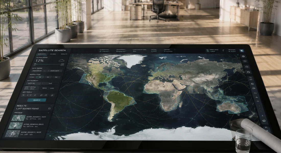
Bildersuche und Vorschau
Ihre Online-Plattform ermöglicht es Nutzern, Archivbilder zu durchsuchen, indem sie ein gewünschtes Gebiet auf einer Webkarte einzeichnen und nach Datumsbereich, Auflösung, Wolkenbedeckungsgrad und Sensortyp filtern. Vorschaubilder zeigen die Abdeckung und die ungefähre Bildqualität vor dem Kauf.
Dadurch entfällt die Frustration, Bildmaterial blind zu bestellen und erst nach Budgetausgaben festzustellen, dass es wolkenverhangen oder geometrisch verzerrt ist. Die Möglichkeit, die Abdeckung vor der endgültigen Bestellung visuell zu überprüfen, spart Zeit und Geld.
Verarbeitungskapazitäten
Die Bildverarbeitungsdienste von Apollo Mapping wandeln Rohbilder in Formate um, die GIS-Software direkt verarbeiten kann. Die Orthorektifizierung nutzt digitale Höhenmodelle, um Geländeverschiebungen zu korrigieren und so präzise Entfernungs- und Flächenmessungen zu gewährleisten. Dies ist insbesondere in gebirgigem Gelände wichtig, da unkorrigierte Bilder räumliche Beziehungen verzerren.
Pansharpening kombiniert hochauflösende Graustufenbilder mit niedrigauflösenden Farbdaten und erzeugt so scharfe, farbenfrohe Bilder, die visuelle Attraktivität und räumliche Detailgenauigkeit optimal ausbalancieren. Die atmosphärische Korrektur entfernt Dunst und Streueffekte und verbessert dadurch die Konsistenz von Aufnahmen, die unter verschiedenen Wetterbedingungen entstanden sind.
Durch das Mosaikverfahren werden mehrere Satellitenbilder zu einer nahtlosen regionalen Abdeckung zusammengefügt, wobei überlappende Bereiche so miteinander verschmelzen, dass sichtbare Übergänge vermieden werden. Bei Projekten, die Gebiete umfassen, die größer als ein einzelnes Satellitenbild sind – wie beispielsweise bei der Kartierung von Infrastrukturkorridoren oder regionalen Landnutzungsstudien –, bieten Mosaike eine durchgängige Abdeckung ohne manuelles Zusammenfügen der Bilder.
Kundenspezifische Analysedienstleistungen
Die Merkmalsextraktion identifiziert und digitalisiert spezifische Objekte wie Gebäude, Straßen, Gewässer und Vegetationstypen. Die Veränderungserkennung vergleicht Bildmaterial von verschiedenen Zeitpunkten und hebt Bereiche hervor, in denen sich die Landnutzung verändert hat. Dadurch wird der mühsame manuelle Vergleich automatisiert, der sonst eine visuelle Inspektion nebeneinander erfordern würde.
Vegetationsindizes wie der NDVI (Normalized Difference Vegetation Index) quantifizieren Pflanzengesundheit und Biomasse anhand multispektraler Bilddaten. Landwirtschaftliche Anwender nutzen diese, um gestresste Pflanzen zu identifizieren, die Maßnahmen benötigen, während forstwirtschaftliche Anwendungen die Gesundheit von Holzbeständen und den Regenerationserfolg erfassen.
Die Erstellung digitaler Höhenmodelle (DEMs) erzeugt dreidimensionale Geländedarstellungen aus Stereosatellitenbildern – Bildpaaren, die aus verschiedenen Winkeln aufgenommen wurden. Diese DEMs unterstützen die Modellierung von Wassereinzugsgebieten, die Sichtbarkeitsanalyse und die Volumenberechnung für Erdbauprojekte.
Preisstruktur und Kostenüberlegungen
Die Preisgestaltung für Satellitenbilder gehört nach wie vor zu den intransparentesten Aspekten der Branche. Anders als bei Software-Abonnements mit veröffentlichten Preisstufen variieren die Kosten für Bildmaterial erheblich, abhängig von Auflösung, Abdeckungsbereich, Verarbeitungsaufwand, Lizenzbedingungen und davon, ob Archivierungs- oder Neudaten benötigt werden.
Kostenvariablen
Die Auflösung ist der wichtigste Preisfaktor. Submetergenaue Bilder von Premium-Satelliten kosten pro Quadratkilometer deutlich mehr als Daten mit einer Auflösung von 2–5 Metern. Bei Produkten mit der höchsten Auflösung kann der Unterschied das Zehnfache oder mehr betragen.
- Die Abdeckungsfläche ist wichtig, aber nicht immer linear. Satellitenaufnahmen haben Mindestbestellflächen – oft 25 bis 100 Quadratkilometer –, selbst wenn Sie nur einen kleinen Ausschnitt benötigen. Die Bestellung mehrerer angrenzender Aufnahmen für eine regionale Abdeckung kann Mengenrabatte auslösen.
- Der Verarbeitungsgrad beeinflusst die Kosten. Rohbilder direkt vom Satelliten sind günstiger als orthorektifizierte, atmosphärisch korrigierte und pansharpene Produkte, die für die GIS-Analyse geeignet sind. Der höhere Aufwand an Arbeitskraft und Rechenleistung für die fortgeschrittene Verarbeitung rechtfertigt diesen Aufpreis.
- Die Lizenzbedingungen schaffen eine weitere Preisdimension. Einzelplatzlizenzen ohne Übertragbarkeit sind günstiger als Unternehmenslizenzen, die die uneingeschränkte interne Weitergabe erlauben. Für die öffentliche Verbreitung – beispielsweise die Veröffentlichung von Bildmaterial auf öffentlichen Websites oder in Publikationen – fallen zusätzliche Gebühren an.
- Archivbilder und auftragsbezogene Aufnahmen weisen einen grundlegenden Kostenunterschied auf. Archivbilder, die bereits im Katalog eines Satellitenbetreibers vorhanden sind, kosten nur einen Bruchteil der Kosten einer Neuaufnahme. Allerdings können Archivbilder Wolkenbedeckung, Aufnahmen aus der falschen Jahreszeit oder veraltete Bedingungen aufweisen. Neuaufnahmen garantieren hingegen genau das, was Sie benötigen – allerdings zu einem höheren Preis.
Was Apollo Mapping hinzufügt
Das Wertversprechen von Apollo Mapping besteht nicht immer nur darin, günstigere Bilddaten anzubieten – manchmal entsprechen ihre Preise sogar den Preisen direkter Satellitenbetreiber. Ihr Aufschlag deckt Fachkompetenz, Komfort und Risikominimierung ab.
Sie navigieren durch komplexe Kataloge von Satellitenbetreibern und Lizenzvereinbarungen und ersparen ihren Kunden so wochenlange Recherche und Verhandlung. Sie beraten zu kostengünstigen Alternativen, wenn die ursprünglichen Anforderungen das Budget übersteigen – und schlagen preiswertere Sensoren, Archivierungsoptionen oder reduzierte Verarbeitungsstufen vor, die die Projektanforderungen zu niedrigeren Preisen erfüllen.
Bei Projekten, die Bildmaterial aus mehreren Satellitenquellen erfordern – sei es die Kombination von hochauflösenden optischen Daten mit Radardaten oder die Zusammenführung von historischen und aktuellen Aufnahmen – bündelt Apollo Mapping die Beschaffung über einen einzigen Anbieter, anstatt separate Verträge mit mehreren Betreibern zu verwalten.
Leitfaden zur Budgetplanung
Für allgemeine Planungszwecke sollten Sie die offizielle Website von Apollo Mapping auf aktuelle Preise überprüfen, da diese je nach Satellitenbetreiber und Wechselkurs schwanken. Branchenberichten zufolge liegen die Kosten für archivierte Submeter-Bilder typischerweise zwischen wenigen und mehreren Dutzend Dollar pro Quadratkilometer, während neue Aufträge für Premium-Sensoren Hunderte von Dollar pro Quadratkilometer kosten können.
Die Kosten für die Bildverarbeitung erhöhen die Basiskosten. Eine einfache Orthorektifizierung kann die Bildkosten nur geringfügig erhöhen, während komplexe multitemporale Analysen oder Merkmalsextraktion die Gesamtprojektkosten verdoppeln oder verdreifachen können.
Die entscheidende Frage ist nicht, ob Apollo Mapping mehr kostet als kostenlose Alternativen – das tut es –, sondern ob der Mehraufwand einen Nutzen bringt, der dem Projektbedarf entspricht. Bei einem Infrastrukturprojekt im Wert von einer Million Dollar, bei dem präzises Bildmaterial kostspielige Planungsfehler verhindert, ist die Investition von mehreren Tausend Dollar in geeignete Satellitendaten wirtschaftlich sinnvoll. Für explorative Forschungsarbeiten, bei denen ungefähre Informationen ausreichen, sollten kostenlose Alternativen in Betracht gezogen werden.
Satellitendatenquellen Apollo-Kartierungszugriffe
Der Wert von Apollo Mapping beruht unter anderem auf den Beziehungen zu Dutzenden von Satellitenbetreibern weltweit. Anstatt sich an eine einzige Satellitenkonstellation zu binden, wählen sie den Sensor aus, der am besten zu den Anforderungen des jeweiligen Projekts passt.
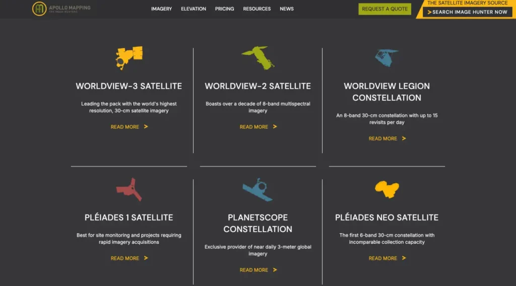
Hochauflösende optische Sensoren
Hochwertige kommerzielle Satellitenkonstellationen wie WorldView, GeoEye und Pleiades bieten eine Auflösung im Submeterbereich sowohl im panchromatischen als auch im multispektralen Modus. Diese Satelliten überfliegen viele Gebiete häufig – täglich oder sogar noch häufiger – und ermöglichen so eine schnelle Reaktion auf zeitkritische Anforderungen.
Satelliten mit mittlerer Auflösung wie SPOT und SuperView Neo bieten eine Auflösung von 1,5 bis 5 Metern zu geringeren Kosten und eignen sich für Anwendungen, bei denen Details im Submeterbereich nicht erforderlich sind. Diese Sensoren bieten oft größere Erfassungsbreiten und decken so größere Bereiche pro Szene ab.
Synthetisches Aperturradar
Radarsatelliten wie Sentinel-1, RADARSAT und TerraSAR-X durchdringen Wolken und Dunkelheit und erfassen Daten unabhängig von Wetter und Tageszeit. Dadurch ist Radar unentbehrlich für tropische Regionen mit anhaltender Wolkendecke oder für Anwendungen, die eine Überwachung bei Nacht erfordern.
Radar eignet sich hervorragend zur Erkennung von Oberflächenfeuchtigkeit, zur Überwachung von Bodensenkungen und zur Identifizierung von Strukturveränderungen, die für optische Sensoren unsichtbar sind. Apollo Mapping berät Sie unter anderem, wann Radar optische Bildgebung in spezifischen Anwendungsfällen ergänzen oder ersetzen sollte.
Historische und freigegebene Archive
Die Erkennung langfristiger Veränderungen erfordert historische Vergleichswerte. Apollo Mapping bietet Zugang zu freigegebenen Satellitenbildern des Geheimdienstes, die bis in die 1960er-Jahre zurückreichen – wertvoll für die Untersuchung jahrzehntelanger Stadterweiterung, Küstenlinienentwicklung oder Umweltzerstörung.
Historische Luftbildarchive reichen noch viel weiter zurück und bieten Einblicke in Landschaften vor der modernen Bebauung. Diese Archive unterstützen die historische Ökologieforschung, die Identifizierung archäologischer Stätten und Rechtsstreitigkeiten, die Beweise für frühere Landverhältnisse erfordern.
Spezialsensoren
Hyperspektrale Satelliten erfassen Dutzende oder Hunderte schmaler Spektralbänder und ermöglichen so die Identifizierung von Mineralien, die Unterscheidung von Pflanzenarten und die Beurteilung der Wasserqualität, die weit über die Möglichkeiten herkömmlicher multispektraler Sensoren hinausgehen. Diese spezialisierten Sensoren sind zwar teurer, bieten aber einzigartige Möglichkeiten für die geologische Erkundung und die Präzisionslandwirtschaft.
Satelliten mit sehr hoher zeitlicher Auflösung verzichten auf räumliche Auflösung, um durch häufige Überflüge dasselbe Gebiet mehrmals täglich zu erfassen. Sie eignen sich zur Überwachung dynamischer Phänomene wie Schiffsverkehr, Baufortschritte oder Katastrophenschutz, bei denen nahezu Echtzeit-Aktualisierungen wichtiger sind als feine räumliche Details.
| Sensorkategorie | Typische Auflösung | Wichtigste Vorteile | Am besten geeignet für |
|---|---|---|---|
| Optische Ultrahochauflösung | 30 cm–50 cm | Maximale Detailgenauigkeit, präzise Messungen | Infrastrukturkartierung, detaillierte Anlageninventur |
| Hochauflösend optisch | 50 cm–2 m | Gute Detailgenauigkeit, niedrigere Kosten, breite Verfügbarkeit | Allgemeine Kartierung, Stadtplanung, landwirtschaftliche Überwachung |
| Optische Mittelauflösung | 2 m–10 m | Große Gebietsabdeckung, häufige Nachbesuche | Regionalanalyse, Korridorkartierung, Forstwirtschaft |
| Synthetisches Aperturradar | 1 m–30 m | Wetterunabhängige, Tag-/Nacht-Oberflächenfeuchtigkeitsmessung | Tropische Regionen, Überwachung von Bodensenkungen, Hochwasserkartierung |
| Hyperspektral | 5 m–30 m | Hunderte von Spektralbändern, Materialidentifizierung | Mineralexploration, Präzisionslandwirtschaft, Wasserqualität |
| Hohe zeitliche Auflösung | 3 m–10 m | Mehrere tägliche Besuche | Katastrophenüberwachung, Baufortschritt, Schiffsverfolgung |
Vergleich des Apollo-Kartierungssystems mit Alternativen
Apollo Mapping agiert in einem wettbewerbsintensiven Umfeld mit mehreren alternativen Ansätzen zur Erfassung von Satellitenbildern.
Kostenlose Satellitenbildplattformen
Das Earthdata-Portal der NASA bietet kostenlosen Zugriff auf Daten von Landsat (15–30 m Auflösung), ASTER (15–90 m) und MODIS (250 m–1 km) aus mehreren Jahrzehnten. Das Copernicus-Programm der ESA stellt Sentinel-Bilder bereit – Sentinel-2 liefert optische Daten mit 10 m Auflösung und einer Wiederholungsrate von 5 Tagen, während Sentinel-1 Radarbilder liefert.
Diese kostenlosen Quellen eignen sich hervorragend für großflächige Überwachung, langfristige Trendanalysen und Anwendungen, bei denen eine Auflösung von 10–30 Metern ausreicht. Umweltüberwachung, Klimaforschung und großflächige Landbedeckungskartierung benötigen oft keine kommerziellen Bilddaten.
Kostenlose Satellitenbilder haben jedoch ihre Grenzen. Die Auflösung ist auf 10 Meter begrenzt – unzureichend, um einzelne Gebäude, schmale, lineare Strukturen oder kleine Grundstücke zu identifizieren. Zu seltene Überflüge können dazu führen, dass wichtige Ereignisse zwischen den Überflügen verpasst werden. Die Verarbeitung von Rohdaten in analysetaugliche Formate erfordert technisches Fachwissen und Rechenleistung.
Direkte Beziehungen zu Satellitenbetreibern
Organisationen mit einem dauerhaften Bedarf an Bildmaterial schließen mitunter direkte Verträge mit Satellitenbetreibern wie Maxar, Airbus oder Planet ab. Direkte Geschäftsbeziehungen können die Kosten pro Szene bei der Bestellung großer Mengen reduzieren und unter Umständen eine prioritäre Auftragsvergabe oder einen dedizierten Zugang zu Satellitenkonstellationen ermöglichen.
Direktverträge eignen sich am besten für große Organisationen mit eigenen Fernerkundungsteams, die die Sensorspezifikationen verstehen, Rohdaten verarbeiten und komplexe Lizenzvereinbarungen verwalten können. Kleinere Organisationen oder solche mit nur gelegentlichem Bildbedarf finden den Aufwand, mehrere Beziehungen zu Satellitenbetreibern aufzubauen und zu pflegen, unpraktisch.
Cloudbasierte Bildverarbeitungsplattformen
Google Earth Engine, Microsoft Planetary Computer und Amazon Web Services bieten Cloud-basierten Zugriff auf riesige Archive von Satellitenbildern mit Verarbeitungswerkzeugen, die die lokale Datenverwaltung überflüssig machen. Diese Plattformen eignen sich hervorragend für Datenwissenschaftler, die Erfahrung im Programmieren zur Analyse von Bildern im kontinentalen Maßstab haben.
Cloud-Plattformen bieten oft kostenloses Bildmaterial, berechnen jedoch Gebühren für den Zugriff auf kommerzielle hochauflösende Daten, Rechenressourcen und den Datenexport. Sie erfordern Programmierkenntnisse – Python oder JavaScript – sowie ein Verständnis von Fernerkundungsalgorithmen. Organisationen, die aufbereitete Bildprodukte benötigen, anstatt eigene Analysen durchzuführen, stellen möglicherweise fest, dass diese Plattformen einen steileren Lernprozess erfordern als nötig.
Drohnen- und Luftbildfotografie
Für kleine Gebiete, in denen es auf ultrahohe Auflösung – Details im Zentimeterbereich – ankommt, bieten Drohnen einen größeren Nutzen als Satelliten. Drohnen erfassen Bilder genau dann und dort, wo sie benötigt werden, wobei die Auflösung hauptsächlich durch die Flughöhe und die Kameraqualität begrenzt ist.
Drohnen unterliegen jedoch regulatorischen Beschränkungen, Reichweitenbegrenzungen und Wetterempfindlichkeit. Die Erfassung großer Gebiete ist zeitaufwendig. Projekte, die sich über Hunderte von Quadratkilometern erstrecken, sprechen deutlich für Satelliten gegenüber Drohnen, während Projekte, die sowohl einen umfassenden Kontext als auch hochauflösende Details erfordern, Satellitenkarten mit gezielten Drohnenaufnahmen kombinieren können.
Wann Apollo-Kartierung sinnvoll ist
Apollo Mapping schließt die Lücke für Organisationen, die kommerzielle hochauflösende Bilder benötigen, ohne eigene Fernerkundungskapazitäten aufzubauen. Besonders wertvoll ist Apollo Mapping, wenn die Projektanforderungen die Möglichkeiten kostenloser Bilder übersteigen, wenn mehrere Satellitenquellen verglichen oder kombiniert werden müssen, wenn schnelle Bearbeitungszeiten wichtig sind oder wenn Expertise in der Bildverarbeitung einen Mehrwert bietet.
Sie sind weniger notwendig, wenn kostenlose Bilddaten den Projektanforderungen entsprechen, wenn Organisationen bereits direkte Beziehungen zu Satellitenbetreibern und eigene Verarbeitungskapazitäten haben oder wenn Budgetbeschränkungen kommerzielle Bilddaten gänzlich ausschließen.
Anwendungsbeispiele aus der Praxis
Den Wert von Apollo Mapping kann man anhand konkreter Beispiele aus verschiedenen Branchen besser verstehen.
Katastrophenschutz: Hochwasserkartierung
Bei Hochwasser benötigen Katastrophenschutzbehörden umgehend Bildmaterial, das das Ausmaß der Überschwemmung zeigt, um Rettungsmaßnahmen zu koordinieren und Infrastrukturschäden zu beurteilen. Kostenlose Satelliten überfliegen das betroffene Gebiet unter Umständen tagelang nicht, und Wolken verdecken bei Stürmen häufig die optischen Sensoren.
Apollo Mapping nutzt Satelliten mit synthetischem Aperturradar, die Wolken durchdringen und innerhalb weniger Stunden Bildmaterial liefern. Die Auswertungsteams ermitteln die Überschwemmungsgebiete und vergleichen die Bilder nach der Überschwemmung mit den Aufnahmen vor der Katastrophe. So werden die überfluteten Flächen quantifiziert und abgeschnittene Ortschaften identifiziert. Die schnelle Bearbeitung – manchmal sogar noch am selben Tag – unterstützt unmittelbar Entscheidungen zur Lebensrettung.
Infrastrukturplanung: Auswahl der Pipeline-Route
Energieunternehmen, die Pipelinetrassen planen, benötigen Stereosatellitenbilder zur Erstellung digitaler Höhenmodelle für die Hangneigungsanalyse, Bildmaterial aus verschiedenen Jahreszeiten zur Identifizierung von Feuchtgebieten und Gewässern sowie historisches Bildmaterial zum Verständnis von Landnutzungsmustern.
Apollo Mapping erstellt multitemporale Bilddatensätze, koordiniert Stereobildpaaraufnahmen zur Erstellung digitaler Geländemodelle (DEM) und liefert aufbereitete Datensätze, die für Korridoranalyse-Software optimiert sind. Dank ihrer Expertise im Lizenzbereich können die Bilddaten im Rahmen von Genehmigungsverfahren mit Aufsichtsbehörden geteilt werden, ohne gegen Nutzungsbeschränkungen zu verstoßen.
Landwirtschaftliche Überwachung: Beurteilung des Pflanzenzustands
Große Agrarbetriebe überwachen Tausende von Feldern in mehreren Bundesländern oder Ländern. Die frühzeitige Erkennung von gestressten Pflanzen – sei es durch Dürre, Schädlinge oder Nährstoffmangel – verhindert Ernteausfälle.
Apollo Mapping liefert multitemporale multispektrale Bilddaten über die gesamte Vegetationsperiode hinweg. Diese werden verarbeitet, um Vegetationsindizes zu generieren, die Pflanzenstress aufzeigen, bevor dieser mit bloßem Auge sichtbar ist. Die Zeitreihenanalyse verfolgt die Pflanzenentwicklung und vergleicht den aktuellen Zustand mit historischen Normwerten, um Anomalien zu identifizieren, die eine Felduntersuchung erfordern.
Umweltauflagen: Überwachung der Minensanierung
Für den Abbau ist eine schrittweise Rekultivierung erforderlich – die Wiederherstellung der beeinträchtigten Flächen im Zuge des Abbaus. Die Aufsichtsbehörden verlangen Dokumentationen, die die Ansiedlung von Vegetation, die Erosionsbekämpfung und den Schutz der Wasserqualität belegen.
Apollo Mapping liefert jährlich hochauflösende Bilder von rekultivierten Flächen, führt Veränderungsanalysen durch, um neu beeinträchtigte und erfolgreich wiederbegrünte Bereiche hervorzuheben, und erstellt Berechnungen des Vegetationsbedeckungsgrades zur Unterstützung von Konformitätsberichten. Die dokumentierte Herkunft und die ordnungsgemäße Lizenzierung gewährleisten die rechtliche Verwertbarkeit der Bilder in behördlichen Verfahren.
Akademische Forschung: Analyse der Zersiedelung
Forscher, die städtische Wachstumsmuster untersuchen, benötigen konsistentes Bildmaterial über Jahrzehnte hinweg – eine Herausforderung, da sich die Satellitensensoren im Laufe der Zeit verändern und jeweils unterschiedliche Auflösungen und spektrale Eigenschaften aufweisen.
Apollo Mapping nutzt historisches Bildmaterial verschiedener Satellitengenerationen, wendet radiometrische Normalisierung an, um die Vergleichbarkeit unterschiedlicher Sensoren zu gewährleisten, und georeferenziert alle Bilder in einheitliche Koordinatensysteme. Dies ermöglicht Zeitreihenanalysen zur Verfolgung der Stadterweiterung, zur Quantifizierung des Verlusts von Agrarflächen oder natürlichen Lebensräumen sowie zur Modellierung von Faktoren, die Entwicklungsmuster beeinflussen.
Einschränkungen und Überlegungen
Apollo Mapping löst viele Herausforderungen im Bereich Satellitenbildgebung, aber kein Dienst ist für jede Situation perfekt.
Kostenbarrieren
Hochauflösende kommerzielle Satellitenbilder sind im Vergleich zu kostenlosen Alternativen weiterhin teuer. Projekte mit begrenzten Budgets stellen möglicherweise fest, dass kommerzielle Bilder unverhältnismäßig viele Ressourcen beanspruchen und somit wenig für die eigentliche Analyse übrig bleibt.
Die Kosten-Nutzen-Rechnung hängt vollständig von der Projektwirtschaftlichkeit ab. Bei Infrastrukturprojekten, bei denen die Kosten für Bildmaterial nur einen geringen Anteil des Gesamtbudgets ausmachen, ist die Investition in geeignete Daten sinnvoll. Für unfinanzierte akademische Forschung oder gemeinnützige Naturschutzprojekte muss oft kostenloses Bildmaterial trotz dessen Einschränkungen ausreichen.
Technische Komplexität
Apollo Mapping reduziert zwar die Komplexität im Vergleich zur direkten Verwaltung von Satellitenbeziehungen, dennoch erfordert die Arbeit mit Satellitenbildern weiterhin Kenntnisse im Bereich Geodaten. Kunden müssen Projektionen, Koordinatensysteme, Dateiformate und den Import von Bildern in GIS- oder Fernerkundungssoftware verstehen.
Organisationen ohne bestehende GIS-Kenntnisse müssen sich erst einarbeiten. Apollo Mapping liefert zwar hervorragend aufbereitetes Bildmaterial, doch die Gewinnung von Erkenntnissen erfordert analytische Fähigkeiten und geeignete Software. Manche Kunden stellen fest, dass sie neben der Bildmaterialbereitstellung auch Beratungsleistungen benötigen – beispielsweise Unterstützung bei der GIS-Software, Mitarbeiterschulungen oder fortlaufende Analysepartnerschaften.
Datenvolumen und Speicherplatz
Hochauflösende Satellitenbilder erzeugen riesige Dateien – Gigabytes oder Terabytes für regionale Abdeckung. Organisationen benötigen daher ausreichende Netzwerkbandbreite zum Herunterladen, Speicherinfrastruktur zur Archivierung und Rechenressourcen zur Verarbeitung.
Cloud-Speicherung und -Verarbeitung bieten zwar Lösungen, verursachen aber laufende Kosten. Kleine Organisationen, die an Dateien im Megabyte-Bereich gewöhnt sind, unterschätzen möglicherweise den Infrastrukturbedarf von Satellitendaten.
Wetter- und Zeitbeschränkungen
Optische Satelliten können nicht durch Wolken hindurch Bilder aufnehmen. Die Bestellung neuer Bilddaten in bewölkten Gebieten kann mehrere Anläufe erfordern und die Lieferzeiten verlängern. Saisonale Einschränkungen – Schneebedeckung, Laubstatus der Vegetation, Wachstumsstadien in der Landwirtschaft – spielen eine Rolle und erfordern Bildaufnahmen in bestimmten Zeitfenstern.
Radarsatelliten überwinden zwar die Einschränkungen durch Wolken, liefern aber Bilder, deren Interpretation spezielle Kenntnisse erfordert. Radar eignet sich hervorragend für bestimmte Anwendungen, kann aber die intuitive visuelle Klarheit optischer Bilder in vielen Fällen nicht ersetzen.
Erwartungen an die Lösung
Marketingmaterialien mit atemberaubenden Satellitenbildern im Submeterbereich wecken Erwartungen, die möglicherweise nicht den praktischen Bedürfnissen oder Budgets entsprechen. Viele Anwendungen erfordern berechtigterweise eine hohe Auflösung, doch manche Kunden wünschen sich die maximale Auflösung, weil sie beeindruckend aussieht, anstatt weil ihre Anwendung sie erfordert.
Der beratende Ansatz von Apollo Mapping hilft, diese Erwartungen zu steuern und die jeweils passende Auflösung für spezifische Aufgaben zu empfehlen. Der Druck, visuell beeindruckende Bilder zu liefern, führt jedoch mitunter zu Auflösungen, die über die eigentlichen Analyseanforderungen hinausgehen und die Kosten unnötig in die Höhe treiben.
Die Wettbewerbsposition der Image Hunters im Jahr 2026
Die Satellitenbildbranche entwickelt sich weiterhin rasant. Zu verstehen, welche Rolle Apollo Mapping im Jahr 2026 spielen wird, hilft dabei, seine zukünftige Relevanz vorherzusagen.
Zunehmende Satellitenverfügbarkeit
Jährlich werden Dutzende neuer kommerzieller Satelliten gestartet, wodurch die Verfügbarkeit von Bildmaterial drastisch erhöht und der Wettbewerb angekurbelt wird, was die Kosten senkt. Satellitenkonstellationen wie Planet betreiben Hunderte von Satelliten und erfassen täglich die gesamte Erde mit einer Auflösung von 3 bis 5 Metern.
Diese Kommerzialisierung bedroht die Geschäftsmodelle traditioneller Bilddatenhändler. Warum Zwischenhändler bezahlen, wenn Satellitenbetreiber den direkten Online-Kauf und die automatisierte Lieferung anbieten? Apollo Mapping setzt daher auf Mehrwertdienste – nicht nur auf den Verkauf von Bildmaterial, sondern auch auf Expertise, individuelle Bildverarbeitung und anwendungsspezifische Lösungen.
KI und automatisierte Analyse
Künstliche Intelligenz automatisiert zunehmend Aufgaben, die zuvor menschliche Analysten erforderten – Objekterkennung, Landbedeckungsklassifizierung, Identifizierung von Veränderungen. Fortschrittliche Kartierungs- und Analysetechnologien revolutionieren die Interpretation und Nutzung räumlicher Daten in verschiedensten Bereichen.
Apollo Mapping integriert KI-gestützte Analysen in sein Dienstleistungsangebot und nutzt maschinelles Lernen, um Merkmale zu extrahieren, Bildmaterial zu klassifizieren und Anomalien schneller und zuverlässiger als durch manuelle Interpretation zu erkennen. Dadurch positioniert sich das Unternehmen als Analyseanbieter und nicht nur als Bildlieferant.
Demokratisierung der Geodaten-Technologie
Cloud-Plattformen und benutzerfreundliche GIS-Software senken die Hürden bei der Arbeit mit Satellitenbildern. Organisationen, die zuvor auf externe Experten angewiesen waren, können nun grundlegende Aufgaben mit geringem Schulungsaufwand intern erledigen.
Diese Demokratisierung birgt sowohl Risiken als auch Chancen für Apollo Mapping. Die Risiken ergeben sich daraus, dass Kunden einfache Aufgaben selbst erledigen. Die Chancen liegen darin, dass deutlich mehr Organisationen den Wert von Satellitenbildern erkennen und schließlich fortgeschrittene Funktionen benötigen, die über Do-it-yourself-Lösungen hinausgehen.
Spezialisierung und vertikale Integration
Die Zukunft von Apollo Mapping liegt wahrscheinlich in einer stärkeren Spezialisierung auf bestimmte Sektoren – vielleicht wird das Unternehmen eher zur ersten Anlaufstelle für Bergbauüberwachung, Agrarinformationen oder Katastrophenhilfe, anstatt alle Märkte gleichermaßen zu bedienen.
Die vertikale Integration – die Kombination von Bildmaterial mit Fachwissen, firmeneigenen Algorithmen und kontinuierlichen Überwachungsdiensten – schafft tragfähige Wertversprechen, die der reine Bildweiterverkauf angesichts zunehmender Automatisierung und direkter Satellitenverkäufe nicht aufrechterhalten kann.
Arbeiten mit Apollo Mapping: Prozess und Erwartungen
Organisationen, die Apollo Mapping in Betracht ziehen, profitieren davon, den typischen Vorgehensprozess zu verstehen.
Erstberatung
Die Zusammenarbeit beginnt typischerweise mit Sondierungsgesprächen – dabei werden die geografischen Interessensgebiete definiert, die Projektziele verstanden, die technischen Anforderungen geklärt und Budgets und Zeitpläne festgelegt.
Diese Beratung klärt, ob vorhandenes Archivbildmaterial den Anforderungen genügt oder neue Aufgaben erforderlich sind, welche Sensoren und Verarbeitungsstufen für die Anwendung geeignet sind und ob zusätzliche Analysedienstleistungen einen Mehrwert bieten. Die Beratung selbst schafft Mehrwert, indem sie Kunden über Bildmaterialoptionen informiert, die sie möglicherweise noch nicht in Betracht gezogen haben.
Bildersuche und -auswahl
Für Archivbilder durchsucht Apollo Mapping verfügbare Kataloge und präsentiert Optionen mit Vorschaubildern, Metadaten-Zusammenfassungen und Preisen. Kunden prüfen die Optionen und wägen Kosten, Bildqualität, Bewölkung, Aufnahmedaten und andere Faktoren ab.
Diese Überprüfungsphase hilft Kunden, die Vor- und Nachteile zu verstehen: Perfekte Aufnahmen unter optimalen Bedingungen und zu optimalen Terminen sind teurer als akzeptable Aufnahmen mit kleineren Einschränkungen. Wer lernt, sich mit ausreichend guten Aufnahmen zufriedenzugeben, anstatt auf Perfektion zu bestehen, spart erhebliche Kosten.
Datenerfassung und -verarbeitung
Sobald Bildmaterial ausgewählt oder ein Auftrag erteilt wurde, übernimmt Apollo Mapping die Logistik der Datenerfassung – von der Auftragserteilung an Satellitenbetreiber über die Überwachung des Erfassungsstatus und das Herunterladen und Speichern der Rohdaten bis hin zur Anwendung der angeforderten Verarbeitungsprozesse.
Die Bearbeitungszeiten variieren von Stunden für einfache Orthorektifizierungen bis hin zu Wochen für komplexe Mosaike aus mehreren Szenen oder kundenspezifische Analysen. Expressbearbeitung ist gegen Aufpreis möglich, wenn der Projektplan dies erfordert.
Lieferung und Support
Die Bilddaten werden üblicherweise über eine sichere Dateiübertragung bereitgestellt und in gängigen Geodatenformaten wie GeoTIFF, JPEG2000 oder anderen Spezifikationen, die mit der GIS-Software des Kunden kompatibel sind, organisiert. Umfassende Metadaten dokumentieren Sensorspezifikationen, Aufnahmeparameter, Verarbeitungsschritte und Koordinatensysteme.
Der Kundendienst nach der Auslieferung hilft Kunden bei der Behebung von Importproblemen, dem Verständnis von Dateistrukturen und der Interpretation von Bildmerkmalen. Zwar wird keine unbegrenzte kostenlose Beratung angeboten, aber ein angemessener technischer Support stellt sicher, dass Kunden die erworbenen Produkte auch tatsächlich nutzen können.
Laufende Beziehungen
Viele Kunden kehren immer wieder zurück – sei es zur Überwachung von Projekten mit regelmäßigen Bildaktualisierungen, zur Ausweitung erfolgreicher Pilotprojekte auf größere Gebiete oder zur Anwendung bewährter Arbeitsabläufe in neuen Regionen. Diese langfristigen Beziehungen vereinfachen zukünftige Akquisitionen, da Apollo Mapping die Präferenzen und Anforderungen der Kunden genau kennt.
Großkunden können Vorzugspreise, Prioritätsvergabe für Aufgaben oder individuelle Servicevereinbarungen aushandeln, um bei dringenden Bedürfnissen eine schnelle Reaktion zu gewährleisten.
Häufig gestellte Fragen
Apollo Mapping bietet neben kostenlosen Satellitenbildern drei wesentliche Vorteile. Erstens Zugang zu hochauflösenden kommerziellen Satelliten, die nicht öffentlich verfügbar sind – mit einer Auflösung im Submeterbereich im Vergleich zu den 10–30 Metern, die kostenlose Quellen wie Landsat und Sentinel bieten. Zweitens Expertise in der Auswahl aus Dutzenden von Satellitenoptionen, Beratung hinsichtlich geeigneter Sensoren für spezifische Anwendungen und Abwicklung komplexer Lizenzangelegenheiten. Drittens Verarbeitungsdienste, die Rohdaten in analysereife Formate umwandeln und so viel Zeit sparen. Dies erfordert spezielle Software und Fachkenntnisse, die vielen Organisationen fehlen.
Die Preise variieren stark je nach Auflösung, Abdeckungsbereich, Verarbeitungsaufwand und ob Archiv- oder neues Bildmaterial benötigt wird. Aktuelle Preise finden Sie auf der offiziellen Website von Apollo Mapping, da diese je nach Kosten der Satellitenbetreiber und Marktlage schwanken. Generell sind Archivbilder günstiger als neue Aufnahmen, und die Auflösung ist ein entscheidender Preisfaktor – Bilder mit einer Auflösung unter einem Meter sind pro Quadratkilometer deutlich teurer als Daten mit 2–5 Metern. Verarbeitungs- und Analysedienstleistungen erhöhen die Grundkosten für das Bildmaterial. Apollo Mapping erstellt Ihnen gerne ein Angebot, nachdem die spezifischen Projektanforderungen geklärt sind.
Nahezu jeder Ort kann abgebildet werden, doch es gibt praktische Einschränkungen. Einige Länder beschränken die kommerzielle Erfassung oder Verbreitung von Satellitenbildern aus Gründen der nationalen Sicherheit. Anhaltende Wolken in tropischen Regionen können mehrere Aufnahmeversuche oder den Einsatz von Radarsensoren erforderlich machen. Abgelegene Polargebiete werden seltener von Satelliten abgedeckt als mittlere Breiten. Apollo Mapping verfügt über die Expertise, diese Einschränkungen zu überwinden, Alternativen vorzuschlagen, wenn keine idealen Bilder verfügbar sind, und realistische Erwartungen hinsichtlich der Machbarkeit und des Zeitrahmens der Datenerfassung zu formulieren.
Archivbilder – bereits aufgenommene Szenen in den Katalogen der Satellitenbetreiber – werden in der Regel innerhalb weniger Tage geliefert, bei einfachen Aufträgen manchmal sogar noch am selben Tag. Die Auftragsvergabe für neue Bilder hängt von der Satellitenüberflugrate, den Wetterbedingungen und der Priorität der Auftragswarteschlange ab. Standardaufträge können innerhalb weniger Wochen bearbeitet werden; Expressaufträge ermöglichen die Lieferung innerhalb weniger Tage gegen Aufpreis. Das Wetter beeinflusst insbesondere optische Satelliten – Wolkenbedeckung erfordert eine Umplanung. Radarsatelliten bieten besser planbare Lieferzeiten, da sie durch Wolken hindurch Bilder aufnehmen. Apollo Mapping legt in den ersten Beratungsgesprächen realistische Liefererwartungen fest.
Google Earth bietet zwar kostenloses globales Satellitenbildmaterial, das sich für allgemeine Referenz- und Visualisierungszwecke eignet, weist aber erhebliche Einschränkungen für professionelle Anwendungen auf. Die Bilder setzen sich aus Aufnahmen verschiedener Zeitpunkte und Quellen zusammen, wodurch die Erkennung von Veränderungen unmöglich wird. Die Auflösung variiert unvorhersehbar je nach Standort. Nutzer können weder auf die Rohbilddateien für quantitative Analysen zugreifen, noch spezifische Spektralbänder extrahieren oder Verarbeitungsparameter steuern. Die Lizenzbestimmungen schränken kommerzielle Anwendungen ein. Apollo Mapping hingegen bietet datumsbezogene Einzelsensorbilder in gängigen Geodatenformaten, die von GIS-Software quantitativ analysiert werden können. Zudem bietet Apollo Mapping Lizenzen für die kommerzielle Nutzung und Auflösungen, die in Google Earth nicht verfügbar sind.
Grundlegende GIS-Softwarekenntnisse helfen, den Nutzen von Satellitenbildern zu maximieren. Gängige Plattformen sind ArcGIS, QGIS, ERDAS IMAGINE und ENVI. Apollo Mapping liefert Bildmaterial in Standardformaten, die diese Anwendungen direkt importieren können. Organisationen ohne GIS-Kapazitäten können zusätzliche Verarbeitungsschritte anfordern – Apollo Mapping extrahiert spezifische Informationen und liefert die Ergebnisse als einfache Karten, Berichte oder Datentabellen anstelle von Rohbilddateien. Für komplexe Analysen nutzen viele Kunden die Analysedienstleistungen von Apollo Mapping, anstatt die Interpretation intern durchzuführen, insbesondere bei Anwendungen, die Fernerkundungsexpertise erfordern, wie z. B. Hyperspektralanalyse oder Radarinterpretation.
Apollo Mapping betreut Kunden unterschiedlichster Größenordnungen – von einzelnen Forschern, die einzelne Szenen für akademische Projekte erwerben, bis hin zu Regierungsbehörden, die regionale Bilddaten benötigen. Kleinere Projekte lohnen sich, wenn hochauflösendes Bildmaterial ein gutes Preis-Leistungs-Verhältnis bietet. Beispielsweise könnte ein kleines Umweltberatungsunternehmen Bildmaterial für eine spezifische Standortbewertung erwerben, bei der präzise Daten kostspielige Feldarbeiten oder Planungsänderungen verhindern. Organisationen mit sehr begrenzten Budgets greifen hingegen oft auf kostenlose Bildquellen zurück und akzeptieren dabei Einschränkungen hinsichtlich Auflösung und Aktualität. Die Beratung von Apollo Mapping hilft dabei, zu entscheiden, ob kommerzielles Bildmaterial für bestimmte Anwendungen wirtschaftlich sinnvoll ist.
Fazit: Ist Apollo Mapping das Richtige für Ihr Projekt?
Apollo Mapping – die Bildjäger – besetzt eine spezielle Nische im Ökosystem der Satellitenbildanalyse. Sie sind weder die günstigste noch die einzige Option, stellen aber für bestimmte Anwendungsfälle die optimale Wahl dar.
Ihr Wertversprechen basiert auf drei Säulen: Zugang zu Premium-Kommerzsatelliten, die eine Auflösung und Fähigkeiten bieten, die über kostenlose Alternativen hinausgehen; Expertise im Umgang mit komplexen Sensorspezifikationen, Lizenzierungs- und Verarbeitungsanforderungen; und Zeitersparnis für Organisationen, die Satellitenbilder benötigen, aber keine eigenen Fernerkundungsprogramme aufbauen wollen.
Apollo Mapping ist besonders sinnvoll, wenn Projekte eine Auflösung im Submeterbereich erfordern, wenn es auf schnelle Bearbeitungszeiten ankommt, wenn mehrere Satellitenquellen verglichen oder kombiniert werden müssen, wenn Verarbeitungsexpertise einen Mehrwert bietet oder wenn eine ordnungsgemäße Lizenzdokumentation für die Einhaltung gesetzlicher Vorschriften oder die rechtliche Absicherung von entscheidender Bedeutung ist.
Sie sind weniger notwendig, wenn kostenlose Bilddaten den Anforderungen genügen, wenn Organisationen direkte Beziehungen zu Satellitenbetreibern und eigene Kapazitäten haben oder wenn das Budget die Kosten für kommerzielle Bilddaten einfach nicht zulässt.
Die Satellitenbildbranche entwickelt sich rasant weiter. Die zunehmende Verfügbarkeit von Satelliten, die Automatisierung der Analyse durch künstliche Intelligenz und die Demokratisierung der Geodaten-Technologie setzen die traditionellen Geschäftsmodelle des Bildvertriebs unter Druck. Apollo Mappings anhaltende Relevanz hängt davon ab, weiterhin Mehrwert über den reinen Verkauf von Standardbildern hinaus zu bieten – mit Fokus auf Expertise, kundenspezifische Analysen und anwendungsspezifische Lösungen.
Für Organisationen, die überlegen, ob sie Apollo Mapping beauftragen sollen, ist der Entscheidungsprozess unkompliziert. Definieren Sie die Projektanforderungen klar – Auflösung, Spektralbänder, Flächenabdeckung, Aktualität, Budget. Prüfen Sie ehrlich, ob kostenlose Alternativen diese Anforderungen erfüllen. Falls Lücken bestehen, fordern Sie eine Beratung bei Apollo Mapping an, um Optionen zu besprechen und Angebote einzuholen. Vergleichen Sie die Kosten mit der Wirtschaftlichkeit des Projekts – verhindern präzise Bilder Fehler, sparen Zeit im Feld oder ermöglichen Funktionen, die die Investition rechtfertigen?