Posts by admin
Exploring the Different Types of Remote Sensing Sensors and Their Applications

Remote sensing sensors are instruments that are used to collect data about the Earth’s surface and atmosphere remotely. These sensors can be placed on aircrafts, satellites, drones, or other platforms and can capture information about the physical properties of the planet, such as temperature, reflectance, and emissions. In this article, we will explore different types…
Read MoreThe Advantages of Using AI for Object Detection in Aerial Imagery
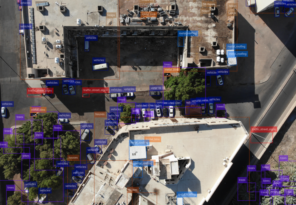
Aerial imagery has become an increasingly valuable tool for a variety of industries, from agriculture to infrastructure. However, manually analyzing aerial imagery can be a time-consuming and resource-intensive task. This is where AI object detection comes in. By using machine learning algorithms to automatically identify and classify objects in aerial imagery, AI object detection can…
Read MoreThe Benefits of Using FlyPix AI for Disaster Management and Response
Natural disasters like hurricanes, wildfires, and earthquakes can strike at any time, causing widespread damage and disruption to communities. In such situations, rapid and effective disaster response is crucial to mitigate the impact on people and infrastructure. This is where Flypix.ai can play a vital role. In this blog post, we will explore the benefits…
Read MoreRevolutionizing Infrastructure Planning and Management with AI-Powered Object Detection for Aerial Imagery
The use of AI-powered object detection for aerial imagery is transforming the way we plan, design, and manage infrastructure. With the ability to analyze high-quality images in an automated way, AI-powered object detection can support a wide range of infrastructure-related tasks, including road construction, building inspections, and urban planning. In this blog post, we will…
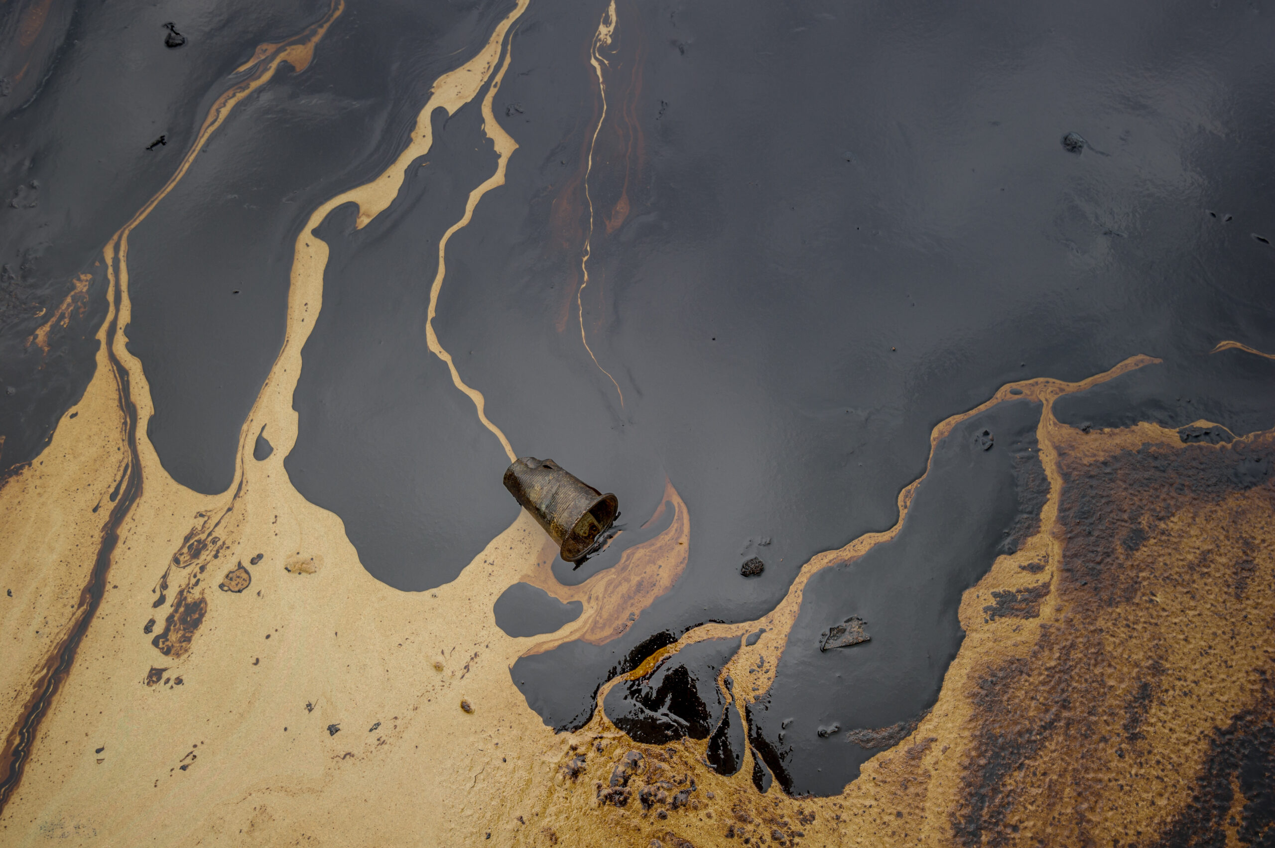
Read MoreRevolutionising the Oil and Gas Industry with Object Detection on Aerial Images

In today’s fast-paced world, technology is rapidly changing the way we do things and the oil and gas industry is no exception. The use of object detection on aerial images is one of the latest technological advancements that has the potential to transform this industry. Object detection is a computer vision technique that uses machine…
Read MoreHow Satellite Imagery Object Detection can support Wildlife Conservation

Object detection in satellite imagery can be a powerful tool for wildlife and forest conservation. By using advanced algorithms and machine learning techniques, researchers and conservationists can quickly and accurately survey large areas of land, identify different species of animals and plants, and monitor changes over time. Applications One way that object detection in satellite…
Read MorePrecision Agriculture: How is UAV-based Object Detection Revolutionising the Agriculture Industry
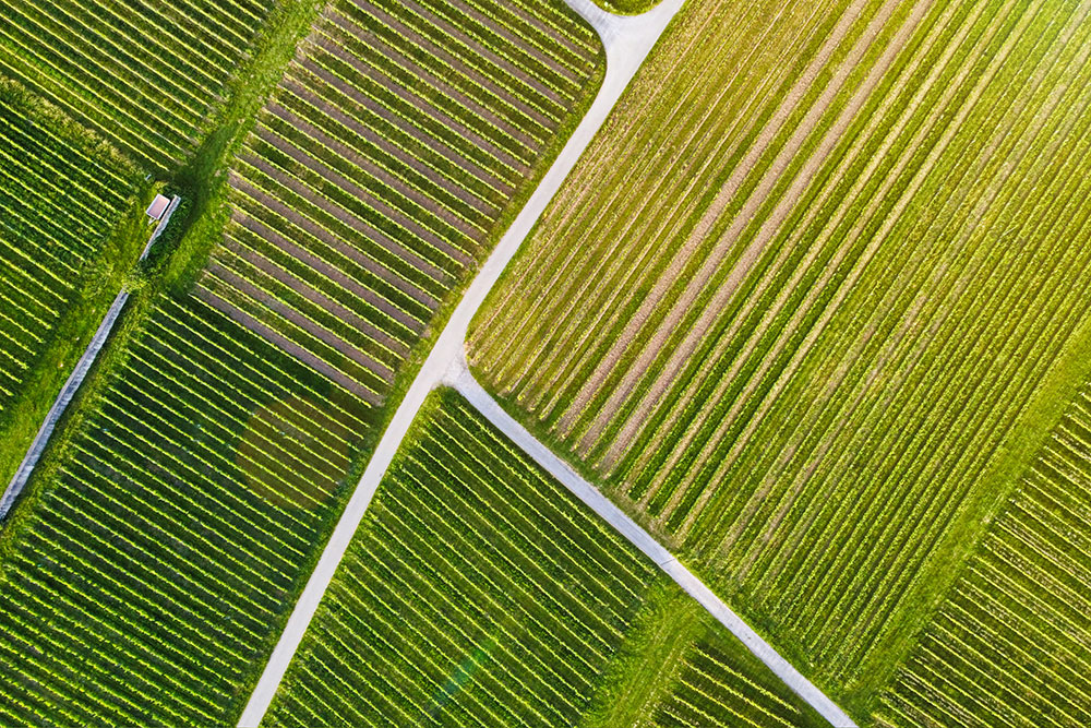
UAV-based Object Detection in Precision Agriculture
Read More